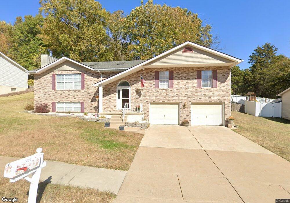
2191 Doe Run Dr Arnold, MO 63010
Estimated Value: $323,000 - $376,000
Studio
--
Bath
1,860
Sq Ft
$189/Sq Ft
Est. Value
About This Home
This home is located at 2191 Doe Run Dr, Arnold, MO 63010 and is currently estimated at $351,740, approximately $189 per square foot. 2191 Doe Run Dr is a home located in Jefferson County with nearby schools including Clyde Hamrick Elementary School, Ridgewood Middle School, and Fox Senior High School.
Ownership History
Date
Name
Owned For
Owner Type
Purchase Details
Closed on
Jul 28, 2000
Sold by
Palmer Steven P and Palmer Jo Billie
Bought by
Biermann Edward F and Biermann Robin L
Current Estimated Value
Home Financials for this Owner
Home Financials are based on the most recent Mortgage that was taken out on this home.
Original Mortgage
$65,000
Interest Rate
8.15%
Purchase Details
Closed on
May 10, 1999
Sold by
Dutcher Lawrence and Dutcher Catherine
Bought by
Palmer Steven P and Palmer Billie Jo
Home Financials for this Owner
Home Financials are based on the most recent Mortgage that was taken out on this home.
Original Mortgage
$122,050
Interest Rate
7.04%
Create a Home Valuation Report for This Property
The Home Valuation Report is an in-depth analysis detailing your home's value as well as a comparison with similar homes in the area
Home Values in the Area
Average Home Value in this Area
Purchase History
| Date | Buyer | Sale Price | Title Company |
|---|---|---|---|
| Biermann Edward F | $147,400 | -- | |
| Palmer Steven P | -- | -- |
Source: Public Records
Mortgage History
| Date | Status | Borrower | Loan Amount |
|---|---|---|---|
| Closed | Biermann Edward F | $65,000 | |
| Previous Owner | Palmer Steven P | $122,050 |
Source: Public Records
Tax History
| Year | Tax Paid | Tax Assessment Tax Assessment Total Assessment is a certain percentage of the fair market value that is determined by local assessors to be the total taxable value of land and additions on the property. | Land | Improvement |
|---|---|---|---|---|
| 2025 | $2,819 | $44,000 | $2,900 | $41,100 |
| 2024 | $2,819 | $40,300 | $2,900 | $37,400 |
| 2023 | $2,819 | $40,300 | $2,900 | $37,400 |
| 2022 | $2,873 | $40,300 | $2,900 | $37,400 |
| 2021 | $2,875 | $40,300 | $2,900 | $37,400 |
| 2020 | $2,691 | $35,800 | $2,500 | $33,300 |
| 2019 | $2,700 | $35,800 | $2,500 | $33,300 |
| 2018 | $2,683 | $35,800 | $2,500 | $33,300 |
| 2017 | $2,723 | $35,800 | $2,500 | $33,300 |
| 2016 | $2,313 | $32,600 | $2,300 | $30,300 |
| 2015 | $2,319 | $32,600 | $2,300 | $30,300 |
| 2013 | -- | $32,600 | $2,300 | $30,300 |
Source: Public Records
Map
Nearby Homes
- 1924 Jennifer Lynn Ln
- 1763 Lisa Dr
- 1756 Old Lemay Ferry Rd
- 2121 Blossom Ln
- 1627 Trinity Cir
- 3242 Rosedale Dr
- 1859 Engle Dr
- 2061 Ridgeway Dr
- 2558 Frederitzi Ln
- 0000 Botanical Dr
- 2112 Santiago Dr
- 1806 Melody Ln
- 2836 Harmony Ridge Dr
- 324 Bramtonn Place
- 1981 Saint Johns Crossing
- 2107 Henley Woods Dr
- 1713 Rhythm Ln
- 1636 Polly Dr
- 3339 Vine Clad Hill Dr
- 3352 Vine Clad Hill Dr
- 2195 Doe Run Dr
- 2187 Doe Run Dr
- 2194 Doe Run Dr
- 2186 Doe Run Dr
- 2183 Doe Run Dr
- 2004 Buck Dr
- 3146 Tuscan Valley Estates Ct
- 2182 Doe Run Dr
- 1917 Old Lemay Ferry Rd
- 1917 Old Lemay Ferry Rd
- 2179 Doe Run Dr
- 2008 Buck Dr
- 2178 Doe Run Dr
- 1922 Big Bill Rd
- 1934 Big Bill Rd
- 2151 Pearl Dr
- 1900 Big Bill Rd
- 2012 Buck Dr
- 2175 Doe Run Dr
- 2104 Doe Run Dr
Your Personal Tour Guide
Ask me questions while you tour the home.