Estimated Value: $200,000 - $252,000
2
Beds
1
Bath
1,892
Sq Ft
$120/Sq Ft
Est. Value
About This Home
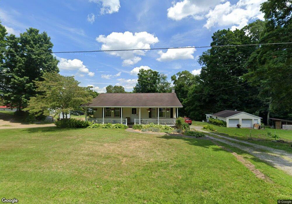
This home is located at 2191 Moffett Rd, Lucas, OH 44843 and is currently estimated at $226,246, approximately $119 per square foot. 2191 Moffett Rd is a home with nearby schools including Lucas Elementary School, Lucas Heritage Middle School, and Lucas High School.
Ownership History
Date
Name
Owned For
Owner Type
Purchase Details
Closed on
Feb 15, 2024
Sold by
Draime Michael
Bought by
Draime Maegan
Current Estimated Value
Home Financials for this Owner
Home Financials are based on the most recent Mortgage that was taken out on this home.
Original Mortgage
$136,000
Outstanding Balance
$132,814
Interest Rate
6.66%
Mortgage Type
New Conventional
Estimated Equity
$93,432
Purchase Details
Closed on
Jul 5, 2019
Sold by
Vanmeter Jeffery A and Vanmeter Denise L
Bought by
Draime Michael
Home Financials for this Owner
Home Financials are based on the most recent Mortgage that was taken out on this home.
Original Mortgage
$129,000
Interest Rate
4%
Mortgage Type
VA
Purchase Details
Closed on
Aug 2, 2016
Sold by
Harvey Jodie A
Bought by
Vanmeter Jeffrey A and Van Meter Denise L
Create a Home Valuation Report for This Property
The Home Valuation Report is an in-depth analysis detailing your home's value as well as a comparison with similar homes in the area
Purchase History
| Date | Buyer | Sale Price | Title Company |
|---|---|---|---|
| Draime Maegan | -- | Atlas Title | |
| Draime Maegan | -- | Atlas Title | |
| Draime Michael | $129,000 | Chicago Title | |
| Vanmeter Jeffrey A | -- | Attorney |
Source: Public Records
Mortgage History
| Date | Status | Borrower | Loan Amount |
|---|---|---|---|
| Open | Draime Maegan | $136,000 | |
| Closed | Draime Maegan | $136,000 | |
| Previous Owner | Draime Michael | $129,000 |
Source: Public Records
Tax History
| Year | Tax Paid | Tax Assessment Tax Assessment Total Assessment is a certain percentage of the fair market value that is determined by local assessors to be the total taxable value of land and additions on the property. | Land | Improvement |
|---|---|---|---|---|
| 2025 | $2,204 | $53,890 | $10,850 | $43,040 |
| 2024 | $2,204 | $53,890 | $10,850 | $43,040 |
| 2023 | $2,261 | $53,900 | $10,860 | $43,040 |
| 2022 | $1,991 | $42,410 | $9,090 | $33,320 |
| 2021 | $1,995 | $42,410 | $9,090 | $33,320 |
| 2020 | $2,028 | $42,410 | $9,090 | $33,320 |
| 2019 | $1,598 | $31,410 | $7,700 | $23,710 |
| 2018 | $1,187 | $31,410 | $7,700 | $23,710 |
| 2017 | $1,195 | $31,410 | $7,700 | $23,710 |
| 2016 | $1,172 | $31,230 | $6,840 | $24,390 |
| 2015 | $1,172 | $31,230 | $6,840 | $24,390 |
| 2014 | $1,177 | $31,230 | $6,840 | $24,390 |
| 2012 | $1,154 | $31,230 | $6,840 | $24,390 |
Source: Public Records
Map
Nearby Homes
- 2778 Lucas Perrysville Rd
- 1 E Main St
- 28 N Union St
- 2130 State Route 39
- 2804 Rd
- 0 Mount Zion Rd Unit 226009674
- 0 Mount Zion Rd Unit 9072801
- 4281 Lucas Perrysville Rd
- 3405 Hastings Newville Rd
- 0 State Route 39 & I-71 Northeast Quadrant
- 2011 Ohio 39
- 0 State Route 39 & I-71 Southeast Quadrant
- 1715 Mansfield Lucas Rd
- 744 E Hanley Rd
- 3386 Trumpower Rd
- 0 McBride Road Parcel # 1 Unit 9066028
- 400 Garver Rd
- 0 Mcelroy Rd
- 474 Biscayne Dr
- 59 Ridge Rd S
Your Personal Tour Guide
Ask me questions while you tour the home.