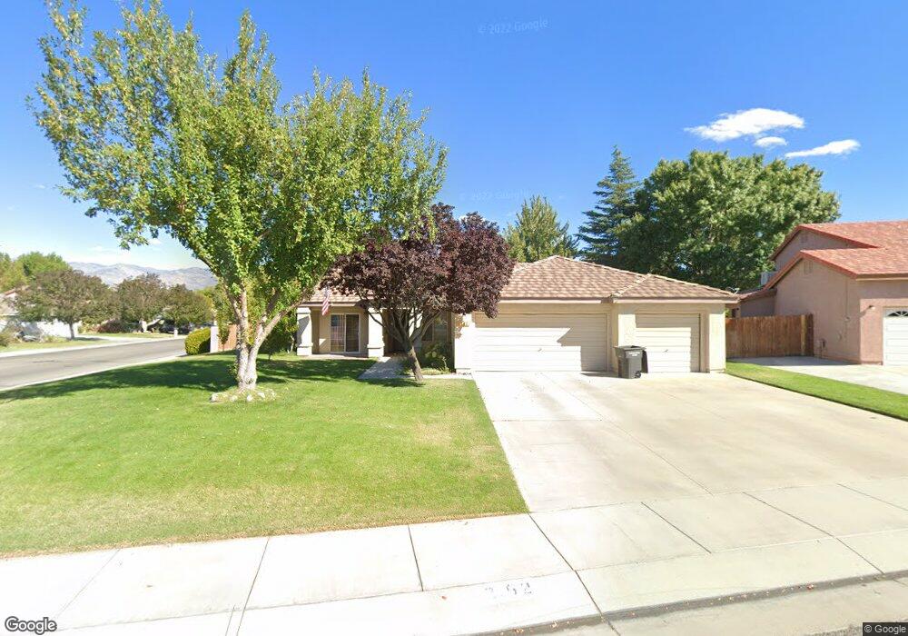
2192 Kiowa Cir Bishop, CA 93514
Estimated Value: $529,000 - $631,000
4
Beds
2
Baths
1,527
Sq Ft
$382/Sq Ft
Est. Value
About This Home
This home is located at 2192 Kiowa Cir, Bishop, CA 93514 and is currently estimated at $582,892, approximately $381 per square foot. 2192 Kiowa Cir is a home located in Inyo County with nearby schools including Bishop Elementary School, Elm Street Elementary School, and Home Street Middle School.
Ownership History
Date
Name
Owned For
Owner Type
Purchase Details
Closed on
Oct 5, 2017
Sold by
Inafuku Lester and Inafuku Dawn
Bought by
Kinney Charles W and Kenney Doris N
Current Estimated Value
Purchase Details
Closed on
Aug 17, 2015
Sold by
Inafuku Lester T and Inafuku Dawn D
Bought by
Lester & Dawn Inafuku 2015 Revocable Tru
Purchase Details
Closed on
May 20, 2009
Sold by
Drm Inc
Bought by
Inafuku Lester T and Inafuku Dawn D
Home Financials for this Owner
Home Financials are based on the most recent Mortgage that was taken out on this home.
Original Mortgage
$215,000
Interest Rate
4.76%
Mortgage Type
Purchase Money Mortgage
Purchase Details
Closed on
Feb 17, 2008
Sold by
Mccoy Ronald M and Mccoy Denise L
Bought by
Drm Inc
Create a Home Valuation Report for This Property
The Home Valuation Report is an in-depth analysis detailing your home's value as well as a comparison with similar homes in the area
Home Values in the Area
Average Home Value in this Area
Purchase History
| Date | Buyer | Sale Price | Title Company |
|---|---|---|---|
| Kinney Charles W | $405,000 | Inyo Mono Title Company | |
| Lester & Dawn Inafuku 2015 Revocable Tru | -- | None Available | |
| Inafuku Lester T | $360,000 | Inyon Mono Title Company | |
| Drm Inc | $387,000 | Inyo Mono Title Company |
Source: Public Records
Mortgage History
| Date | Status | Borrower | Loan Amount |
|---|---|---|---|
| Previous Owner | Inafuku Lester T | $215,000 |
Source: Public Records
Tax History Compared to Growth
Tax History
| Year | Tax Paid | Tax Assessment Tax Assessment Total Assessment is a certain percentage of the fair market value that is determined by local assessors to be the total taxable value of land and additions on the property. | Land | Improvement |
|---|---|---|---|---|
| 2025 | $4,809 | $460,816 | $170,671 | $290,145 |
| 2024 | $4,809 | $451,781 | $167,325 | $284,456 |
| 2023 | $4,701 | $442,924 | $164,045 | $278,879 |
| 2022 | $4,608 | $434,240 | $160,829 | $273,411 |
| 2021 | $4,608 | $425,726 | $157,676 | $268,050 |
| 2020 | $4,458 | $421,362 | $156,060 | $265,302 |
| 2019 | $2,229 | $413,100 | $153,000 | $260,100 |
| 2018 | $4,361 | $405,000 | $150,000 | $255,000 |
| 2017 | $3,698 | $350,000 | $140,000 | $210,000 |
| 2016 | $3,475 | $326,400 | $130,000 | $196,400 |
| 2015 | $3,391 | $320,000 | $130,000 | $190,000 |
| 2014 | $3,389 | $320,000 | $130,000 | $190,000 |
Source: Public Records
Map
Nearby Homes
- 2168 Kiowa Cir
- 1805 Shoshone Dr
- 1510 Glenwood Ln Unit 47
- 2234 Brigadoon Ave
- 2227 Darby Ave
- 1495 Argyle Ln
- 1495 Argyle Ln Unit 86
- 2310 Fiora Ave
- 1424 Rocking West Dr
- 2322 Galloway Ave
- 2371 Edinburgh Ave
- 1369 Glenwood Ln
- 1369 Glenwood Ln Unit 48
- 896 Home St
- 543 Sierra St
- 198 Mac Iver St Unit 2
- 771 N Main St Unit 39
- 3115 W Line St
- 3115 W Line St Unit 1
- 223 Wildrose Ln
- 2192 Kiowa Cir Unit 1
- 2186 Kiowa Cir
- 2197 Cheyenne Dr
- 2205 Cheyenne Dr Unit Lot
- 2205 Cheyenne Dr
- 2181 Kiowa Cir
- 2180 Kiowa Cir
- 2175 Shoshone Dr
- 2103 Shoshone Dr
- 2211 Cheyenne Dr Unit 4
- 2211 Cheyenne Dr
- 2281 Shoshone Dr Unit 11
- 2281 Shoshone Dr
- 2067 Shoshone Dr
- 2217 Cheyenne Dr
- 2174 Kiowa Cir
- 2175 Kiowa Cir
- 2287 Shoshone Dr Unit 12
- 2287 Shoshone Dr
- 2223 Cheyenne Dr
