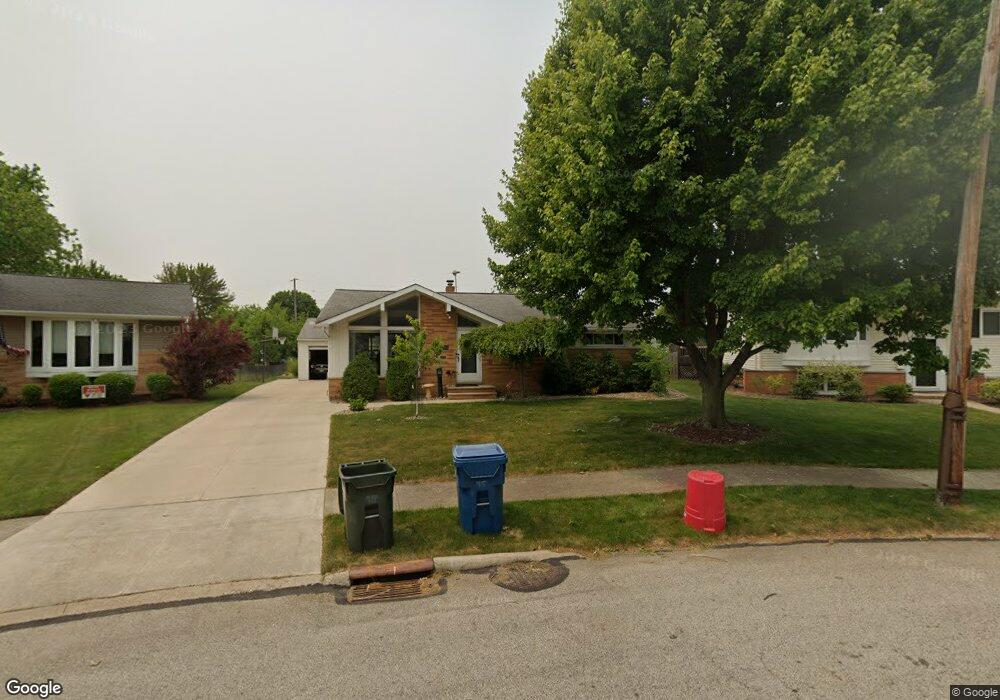
21941 Marian Cir Cleveland, OH 44126
Estimated Value: $257,000 - $291,000
3
Beds
2
Baths
1,238
Sq Ft
$221/Sq Ft
Est. Value
About This Home
This home is located at 21941 Marian Cir, Cleveland, OH 44126 and is currently estimated at $273,838, approximately $221 per square foot. 21941 Marian Cir is a home located in Cuyahoga County with nearby schools including Gilles-Sweet Elementary School, Lewis F Mayer Middle School, and Fairview High School.
Ownership History
Date
Name
Owned For
Owner Type
Purchase Details
Closed on
Jun 11, 2001
Sold by
Lamouri Abbas Vileikis Nelly
Bought by
Rogalski John E and Steigerwald Patricia A
Current Estimated Value
Home Financials for this Owner
Home Financials are based on the most recent Mortgage that was taken out on this home.
Original Mortgage
$128,250
Outstanding Balance
$8,048
Interest Rate
7.18%
Estimated Equity
$265,790
Purchase Details
Closed on
Jul 25, 1995
Sold by
Jansons Laimons
Bought by
Lamouri Abbas and Vileikis Nelly
Home Financials for this Owner
Home Financials are based on the most recent Mortgage that was taken out on this home.
Original Mortgage
$103,016
Interest Rate
7.5%
Mortgage Type
FHA
Purchase Details
Closed on
Jan 1, 1975
Bought by
Jansons Laimons and Jansons Astrida R
Create a Home Valuation Report for This Property
The Home Valuation Report is an in-depth analysis detailing your home's value as well as a comparison with similar homes in the area
Home Values in the Area
Average Home Value in this Area
Purchase History
| Date | Buyer | Sale Price | Title Company |
|---|---|---|---|
| Rogalski John E | $135,000 | Enterprise Title Agency Inc | |
| Lamouri Abbas | $104,000 | -- | |
| Jansons Laimons | -- | -- |
Source: Public Records
Mortgage History
| Date | Status | Borrower | Loan Amount |
|---|---|---|---|
| Open | Rogalski John E | $128,250 | |
| Closed | Lamouri Abbas | $103,016 |
Source: Public Records
Tax History Compared to Growth
Tax History
| Year | Tax Paid | Tax Assessment Tax Assessment Total Assessment is a certain percentage of the fair market value that is determined by local assessors to be the total taxable value of land and additions on the property. | Land | Improvement |
|---|---|---|---|---|
| 2024 | $5,642 | $81,865 | $19,355 | $62,510 |
| 2023 | $5,389 | $66,990 | $17,010 | $49,980 |
| 2022 | $5,255 | $66,990 | $17,010 | $49,980 |
| 2021 | $5,367 | $66,990 | $17,010 | $49,980 |
| 2020 | $4,939 | $54,040 | $13,720 | $40,320 |
| 2019 | $4,391 | $154,400 | $39,200 | $115,200 |
| 2018 | $4,397 | $54,040 | $13,720 | $40,320 |
| 2017 | $4,147 | $47,120 | $11,310 | $35,810 |
| 2016 | $4,119 | $47,120 | $11,310 | $35,810 |
| 2015 | $3,960 | $47,120 | $11,310 | $35,810 |
| 2014 | $3,960 | $45,750 | $10,990 | $34,760 |
Source: Public Records
Map
Nearby Homes
- 5300 Sherwood Dr
- 21760 Sherwood Dr
- 21877 Seabury Ave
- 22276 Sycamore Dr
- 22534 Bard Ave
- 22439 Haber Dr
- 22503 Sandy Ln
- 22250 Mastick Rd
- 21104 Mastick Rd
- 21888 Eaton Rd
- 22831 Esther Ave
- 20930 Mastick Rd
- 4480 W 224th St
- 22640 Lenox Dr
- 4654 W 221st St
- 4464 W 224th St
- 4627 W 223rd St
- 22636 Mastick Rd
- 4570 W 228th St
- 22934 Mastick Rd Unit 102
- 21931 Marian Cir
- 21947 Marian Cir
- 21951 Marian Cir
- 5355 W 220th St
- 5317 W 220th St
- 21921 Marian Cir
- 5383 W 220th St
- 5361 W 220th St
- 21900 Marian Cir
- 5307 W 220th St
- 21911 Marian Cir
- 21880 Marian Cir
- 21941 Briarwood Dr
- 21961 Briarwood Dr
- 5293 W 220th St
- 5405 W 220th St
- 21901 Marian Cir
- 21901 Briarwood Dr
- 5281 W 220th St
- 21860 Marian Cir