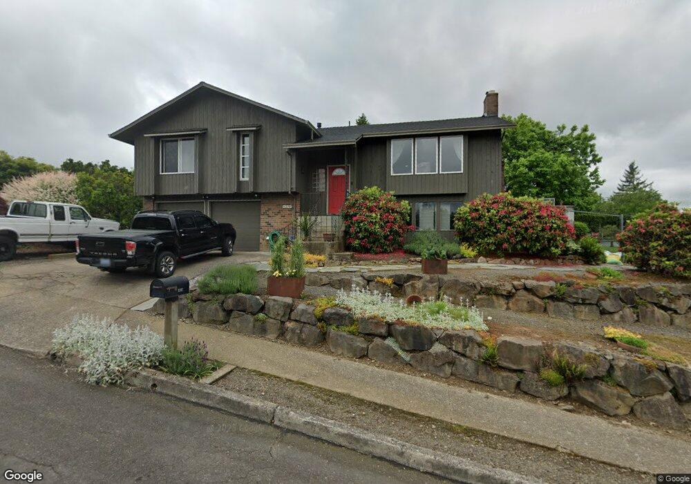
2197 SW Tegart Ave Gresham, OR 97080
Southwest Gresham NeighborhoodEstimated Value: $543,360 - $578,000
3
Beds
3
Baths
1,482
Sq Ft
$381/Sq Ft
Est. Value
About This Home
This home is located at 2197 SW Tegart Ave, Gresham, OR 97080 and is currently estimated at $564,090, approximately $380 per square foot. 2197 SW Tegart Ave is a home located in Multnomah County with nearby schools including Butler Creek Elementary School, Centennial Middle School, and Centennial High School.
Ownership History
Date
Name
Owned For
Owner Type
Purchase Details
Closed on
Aug 6, 1996
Sold by
Lehman Charles Joseph
Bought by
Steen Russell C and Steen Julie L
Current Estimated Value
Home Financials for this Owner
Home Financials are based on the most recent Mortgage that was taken out on this home.
Original Mortgage
$128,100
Outstanding Balance
$9,336
Interest Rate
8.33%
Mortgage Type
Purchase Money Mortgage
Estimated Equity
$554,754
Create a Home Valuation Report for This Property
The Home Valuation Report is an in-depth analysis detailing your home's value as well as a comparison with similar homes in the area
Home Values in the Area
Average Home Value in this Area
Purchase History
| Date | Buyer | Sale Price | Title Company |
|---|---|---|---|
| Steen Russell C | $168,200 | Ticor Title Insurance |
Source: Public Records
Mortgage History
| Date | Status | Borrower | Loan Amount |
|---|---|---|---|
| Open | Steen Russell C | $128,100 |
Source: Public Records
Tax History
| Year | Tax Paid | Tax Assessment Tax Assessment Total Assessment is a certain percentage of the fair market value that is determined by local assessors to be the total taxable value of land and additions on the property. | Land | Improvement |
|---|---|---|---|---|
| 2025 | $6,550 | $345,880 | -- | -- |
| 2024 | $6,274 | $335,810 | -- | -- |
| 2023 | $5,648 | $326,030 | $0 | $0 |
| 2022 | $5,440 | $316,540 | $0 | $0 |
| 2021 | $5,460 | $307,330 | $0 | $0 |
| 2020 | $5,027 | $298,380 | $0 | $0 |
| 2019 | $4,905 | $289,690 | $0 | $0 |
| 2018 | $4,704 | $281,260 | $0 | $0 |
| 2017 | $4,547 | $273,070 | $0 | $0 |
| 2016 | $4,414 | $265,120 | $0 | $0 |
Source: Public Records
Map
Nearby Homes
- 2092 SW Thomas Place
- 3198 SW 16th Cir
- 1963 SW Myers Place
- 2607 SW Pleasant View Dr
- 3857 SW Brittany Dr
- 2791 SW Myers Dr
- 2263 SW Phyllis Place
- 1744 SW Battaglia Ave
- 2652 SW Phyllis Dr
- 2277 SW Nancy Place
- 4123 SW 26th Ct
- 4010 SW 13th Ct
- 3813 SW Mckinley St
- 4077 SW Mckinley St Unit 37
- 4059 SW Mckinley St Unit 40
- 4055 SW Mckinley St Unit 39
- 4071 SW Mckinley St Unit 36
- 4000 SW 30th Dr
- 3427 SW Hartley Ave
- 3010 SW Phyllis Dr
- 2157 SW Tegart Ave
- 3251 SW 22nd Ct
- 3285 SW 22nd Ct
- 3181 SW 22nd St
- 2180 SW Redfern Ave
- 2204 SW Redfern Ave
- 2166 SW Tegart Ave
- 2137 SW Tegart Ave
- 2142 SW Redfern Place
- 3198 SW 22nd St
- 2128 SW Redfern Place
- 3143 SW 22nd St
- 2218 SW Redfern Ave
- 2148 SW Tegart Ave
- 3309 SW 22nd Ct
- 3170 SW 22nd St
- 2091 SW Tegart Ave
- 2156 SW Redfern Place
- 2231 SW Redfern Ave
- 2110 SW Tegart Ave
Your Personal Tour Guide
Ask me questions while you tour the home.