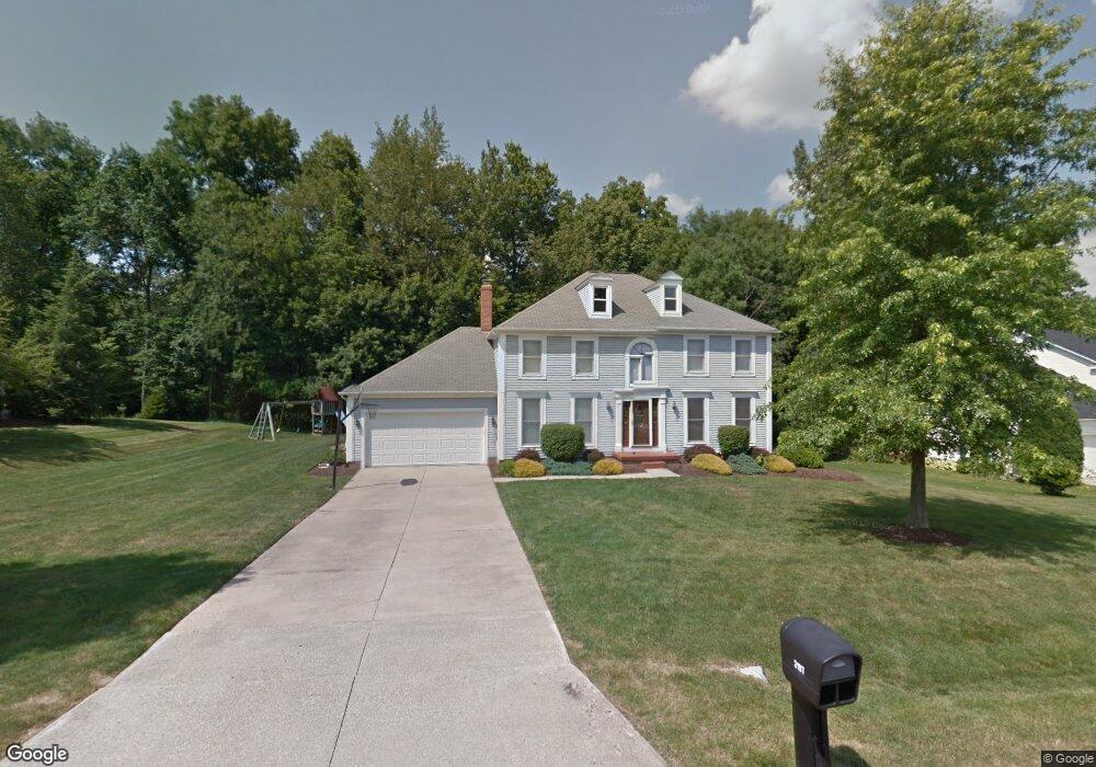
2197 Weston Dr Hudson, OH 44236
Estimated Value: $491,000 - $565,000
4
Beds
3
Baths
2,938
Sq Ft
$181/Sq Ft
Est. Value
About This Home
This home is located at 2197 Weston Dr, Hudson, OH 44236 and is currently estimated at $530,395, approximately $180 per square foot. 2197 Weston Dr is a home located in Summit County with nearby schools including Ellsworth Hill Elementary School, East Woods Intermediate School, and Hudson Middle School.
Ownership History
Date
Name
Owned For
Owner Type
Purchase Details
Closed on
Apr 2, 2011
Sold by
Siciliano Paul M and Siciliano Jodi B
Bought by
Siciliano Paul M and Siciliano Jodi B
Current Estimated Value
Purchase Details
Closed on
Aug 6, 2000
Sold by
Shoemaker Donald L and Shoemaker Deborah E
Bought by
Siciliano Paul M and Siciliano Jodi B
Home Financials for this Owner
Home Financials are based on the most recent Mortgage that was taken out on this home.
Original Mortgage
$183,900
Interest Rate
6.99%
Purchase Details
Closed on
Jan 28, 1997
Sold by
Newman Clarence
Bought by
Shoemaker Donald and Shoemaker Deborah
Home Financials for this Owner
Home Financials are based on the most recent Mortgage that was taken out on this home.
Original Mortgage
$158,000
Interest Rate
7.66%
Mortgage Type
New Conventional
Create a Home Valuation Report for This Property
The Home Valuation Report is an in-depth analysis detailing your home's value as well as a comparison with similar homes in the area
Home Values in the Area
Average Home Value in this Area
Purchase History
| Date | Buyer | Sale Price | Title Company |
|---|---|---|---|
| Siciliano Paul M | -- | Attorney | |
| Siciliano Paul M | $229,900 | Midland Commerce Group | |
| Shoemaker Donald | $238,000 | -- |
Source: Public Records
Mortgage History
| Date | Status | Borrower | Loan Amount |
|---|---|---|---|
| Previous Owner | Siciliano Paul M | $183,900 | |
| Previous Owner | Shoemaker Donald | $158,000 | |
| Closed | Siciliano Paul M | $22,990 |
Source: Public Records
Tax History Compared to Growth
Tax History
| Year | Tax Paid | Tax Assessment Tax Assessment Total Assessment is a certain percentage of the fair market value that is determined by local assessors to be the total taxable value of land and additions on the property. | Land | Improvement |
|---|---|---|---|---|
| 2025 | $8,119 | $159,359 | $34,017 | $125,342 |
| 2024 | $8,119 | $159,359 | $34,017 | $125,342 |
| 2023 | $8,119 | $159,359 | $34,017 | $125,342 |
| 2022 | $6,204 | $108,409 | $23,142 | $85,267 |
| 2021 | $6,214 | $108,409 | $23,142 | $85,267 |
| 2020 | $6,105 | $108,410 | $23,140 | $85,270 |
| 2019 | $6,388 | $105,080 | $18,520 | $86,560 |
| 2018 | $6,365 | $105,080 | $18,520 | $86,560 |
| 2017 | $5,837 | $105,080 | $18,520 | $86,560 |
| 2016 | $5,879 | $93,590 | $18,520 | $75,070 |
| 2015 | $5,837 | $93,590 | $18,520 | $75,070 |
| 2014 | $5,854 | $93,590 | $18,520 | $75,070 |
| 2013 | $6,018 | $94,010 | $18,520 | $75,490 |
Source: Public Records
Map
Nearby Homes
- 5465 Park Vista Ct
- 5473 Young Rd
- V/L Norton Rd
- 5431 Diana Lynn Dr
- 1884 Village Ct Unit X66
- 2749 Norton Rd
- 1759 E Sapphire Dr
- 5139 Rockport Cove
- 4901 Pebblehurst Dr
- 1620 Sapphire Dr
- 2327 Crockett Cir
- 5241 Brockton Dr
- 4731 Haughton Ct
- 2380 Port Williams Dr Unit 2380
- 4917 Independence Cir Unit B
- 2444 Port Charles Dr
- 1705 Barlow Rd
- 0 Stow Rd Unit 5102979
- 5791 Sunset Dr
- 1664 Cypress Ct
- 2209 Weston Dr
- 2185 Weston Dr
- 5420 Brooklands Dr
- 2186 Weston Dr
- 2177 Weston Dr
- 2219 Weston Dr
- 5419 Brooklands Dr
- 5410 Brooklands Dr
- 5444 Stow Rd
- 2167 Weston Dr
- 2193 Bristol Ct
- 5411 Brooklands Dr
- 5400 Brooklands Dr
- 5468 Stow Rd
- 2200 Bristol Ct
- 5401 Brooklands Dr
- 2157 Weston Dr
- 2181 Bristol Ct
- 5390 Brooklands Dr
- 5391 Brooklands Dr