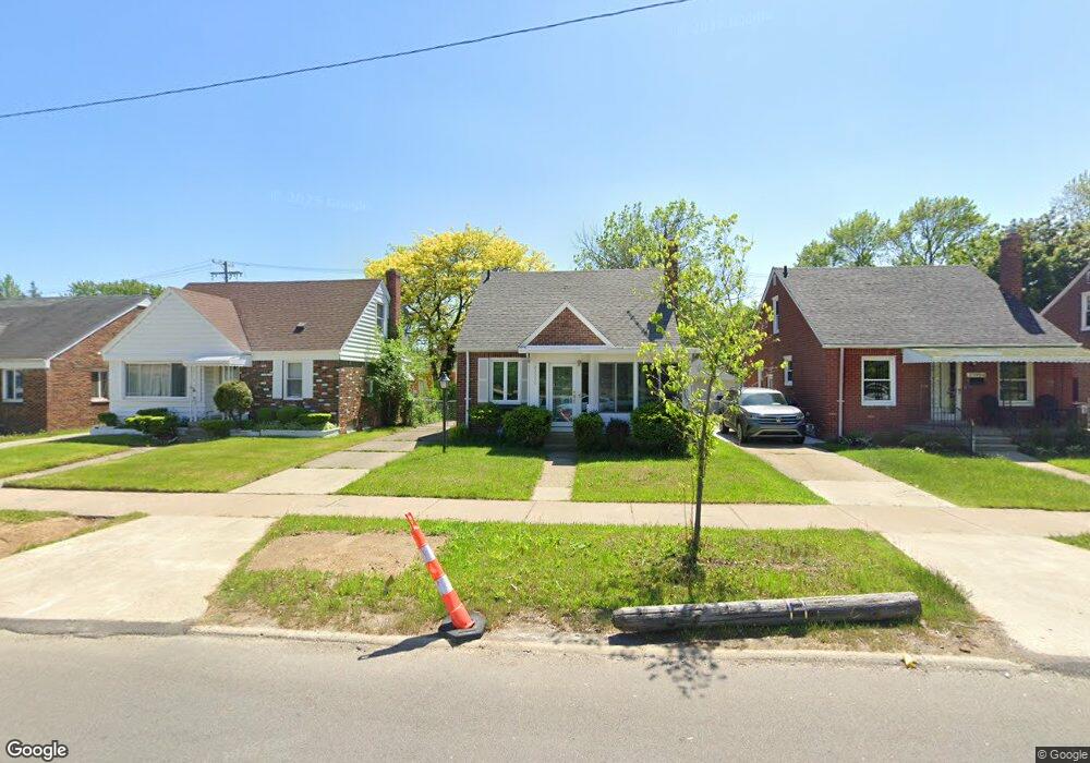
21994 Moross Rd Grosse Pointe, MI 48236
Cornerstone Village NeighborhoodEstimated Value: $85,888 - $124,000
Studio
1
Bath
960
Sq Ft
$112/Sq Ft
Est. Value
About This Home
This home is located at 21994 Moross Rd, Grosse Pointe, MI 48236 and is currently estimated at $107,472, approximately $111 per square foot. 21994 Moross Rd is a home located in Wayne County with nearby schools including Marquette Elementary-Middle School, Edward 'Duke' Ellington Conservatory of Music and Art, and Charles L. Spain Elementary-Middle School.
Ownership History
Date
Name
Owned For
Owner Type
Purchase Details
Closed on
Oct 2, 2014
Sold by
Wayne County Treasurer
Bought by
The Rayla Group
Current Estimated Value
Purchase Details
Closed on
May 6, 2009
Sold by
Navarra Feisal A
Bought by
American General Financial Services De I
Create a Home Valuation Report for This Property
The Home Valuation Report is an in-depth analysis detailing your home's value as well as a comparison with similar homes in the area
Home Values in the Area
Average Home Value in this Area
Purchase History
| Date | Buyer | Sale Price | Title Company |
|---|---|---|---|
| The Rayla Group | $25,000 | None Available | |
| American General Financial Services De I | $36,000 | None Available |
Source: Public Records
Tax History
| Year | Tax Paid | Tax Assessment Tax Assessment Total Assessment is a certain percentage of the fair market value that is determined by local assessors to be the total taxable value of land and additions on the property. | Land | Improvement |
|---|---|---|---|---|
| 2025 | $1,157 | $33,900 | $0 | $0 |
| 2024 | $1,139 | $29,200 | $0 | $0 |
| 2023 | $1,106 | $21,700 | $0 | $0 |
| 2022 | $1,176 | $18,200 | $0 | $0 |
| 2021 | $1,145 | $14,300 | $0 | $0 |
| 2020 | $1,145 | $12,900 | $0 | $0 |
| 2019 | $1,128 | $10,900 | $0 | $0 |
| 2018 | $995 | $9,800 | $0 | $0 |
| 2017 | $190 | $10,000 | $0 | $0 |
| 2016 | $1,352 | $14,700 | $0 | $0 |
| 2015 | $1,470 | $14,700 | $0 | $0 |
| 2013 | $2,096 | $20,964 | $0 | $0 |
| 2010 | -- | $30,735 | $972 | $29,763 |
Source: Public Records
Map
Nearby Homes
- 21970 Moross Rd
- 21820 Moross Rd
- 21806 Moross Rd
- 21800 Moross Rd
- 5228 Hillcrest St
- 21756 Moross Rd
- 5231 Lannoo St
- 21718 Moross Rd
- 5514 Ashley St
- 19299 Raymond St
- 19196 Berden St
- 18904 Mallina St
- 19134 Mallina St
- 5951 Radnor St
- 6144 Radnor St
- 5754 Farmbrook St
- 21602 Newcastle Rd
- 5047 Anatole St
- 5570 Farmbrook St
- 5745 Farmbrook St
- 22000 Moross Rd
- 21986 Moross Rd
- 22010 Moross Rd
- 21978 Moross Rd
- 19021 Chandler Park Dr
- 22020 Moross Rd
- 22020 Moross Rd
- 5636 Hillcrest St
- 5636 Hillcrest St
- 19011 Chandler Park Dr
- 21960 Moross Rd
- 5646 Hillcrest St
- 19001 Chandler Park Dr
- 5656 Hillcrest St
- 21954 Moross Rd
- 5662 Hillcrest St
- 21946 Moross Rd
- 5670 Hillcrest St
- 21938 Moross Rd
- 5678 Hillcrest St
Your Personal Tour Guide
Ask me questions while you tour the home.