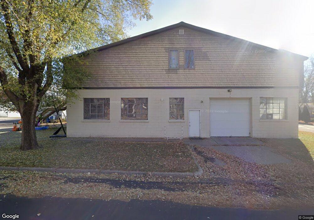
22 7th Ave N Sauk Rapids, MN 56379
Estimated Value: $239,000 - $286,000
3
Beds
3
Baths
2,784
Sq Ft
$93/Sq Ft
Est. Value
About This Home
This home is located at 22 7th Ave N, Sauk Rapids, MN 56379 and is currently estimated at $259,343, approximately $93 per square foot. 22 7th Ave N is a home located in Benton County with nearby schools including Mississippi Heights Elementary School, Sauk Rapids-Rice Middle School, and Sauk Rapids-Rice Senior High School.
Ownership History
Date
Name
Owned For
Owner Type
Purchase Details
Closed on
Apr 3, 2007
Sold by
Gronseth Scott W and Gronseth Rhonda R
Bought by
My Beautiful Wife Llc
Current Estimated Value
Home Financials for this Owner
Home Financials are based on the most recent Mortgage that was taken out on this home.
Original Mortgage
$152,000
Interest Rate
6.25%
Mortgage Type
Future Advance Clause Open End Mortgage
Purchase Details
Closed on
Dec 29, 2006
Sold by
Adams William Jacob
Bought by
Gronesth Scott W and Gronesth Rhonda R
Create a Home Valuation Report for This Property
The Home Valuation Report is an in-depth analysis detailing your home's value as well as a comparison with similar homes in the area
Home Values in the Area
Average Home Value in this Area
Purchase History
| Date | Buyer | Sale Price | Title Company |
|---|---|---|---|
| My Beautiful Wife Llc | -- | -- | |
| Gronseth Scott W | $175,000 | -- | |
| Gronesth Scott W | $175,000 | -- |
Source: Public Records
Mortgage History
| Date | Status | Borrower | Loan Amount |
|---|---|---|---|
| Closed | My Beautiful Wife Llc | $152,000 |
Source: Public Records
Tax History
| Year | Tax Paid | Tax Assessment Tax Assessment Total Assessment is a certain percentage of the fair market value that is determined by local assessors to be the total taxable value of land and additions on the property. | Land | Improvement |
|---|---|---|---|---|
| 2025 | $3,410 | $248,900 | $59,500 | $189,400 |
| 2024 | $3,124 | $234,500 | $58,400 | $176,100 |
| 2023 | $2,888 | $191,100 | $58,400 | $132,700 |
| 2022 | $2,160 | $183,400 | $51,300 | $132,100 |
| 2021 | $2,082 | $144,800 | $51,300 | $93,500 |
| 2018 | $2,548 | $147,700 | $51,300 | $96,400 |
| 2017 | $2,548 | $152,700 | $51,300 | $101,400 |
| 2016 | $2,686 | $152,500 | $51,300 | $101,200 |
| 2015 | $3,784 | $163,000 | $51,300 | $111,700 |
| 2014 | -- | $165,700 | $51,300 | $114,400 |
| 2013 | -- | $163,000 | $51,300 | $111,700 |
Source: Public Records
Map
Nearby Homes
- 113 6th Ave N
- 117 6th Ave N
- 400 7th Ave N
- 616 2nd Ave N
- 720 3rd Ave N
- 37 Portage Trail
- 507 5th St S
- 608 Summit Ave S
- 880 Golden Spike Rd NE
- 720 12th St N
- 707 2nd Ave S
- 1227 8th Ave N
- 970 Golden Spike Rd NE
- 1961 6th Ave N
- TBD Golden Spike Rd
- 423 13th Ave S
- 805 2nd Ave S
- 2518 Ocarina Dr
- 936 5th St S
- 2022 Hillcrest Dr
Your Personal Tour Guide
Ask me questions while you tour the home.