S
Seller's Agent in 2025
Sandy Pierce
Keller Williams Realty Eugene and Springfield
(541) 431-6480
1 in this area
6 Total Sales
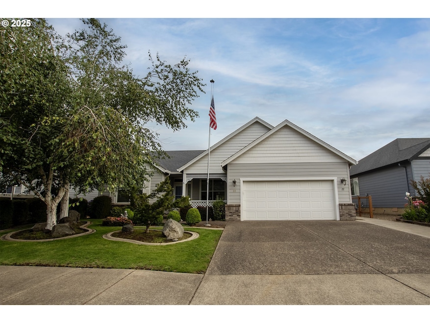
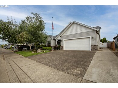
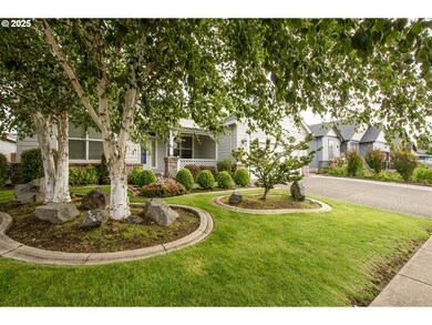
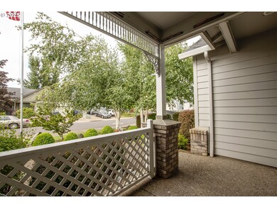
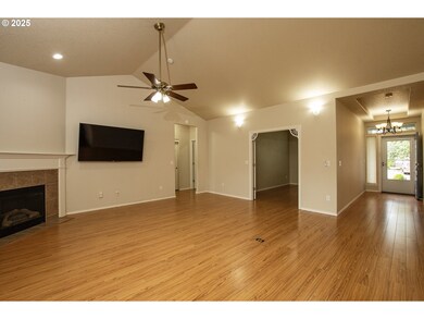
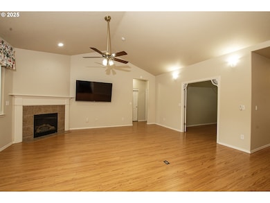
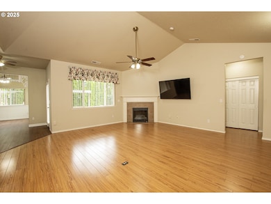
Discover everything this charming property has to offer with its nicely landscaped yard! This one level ranch style home offers an open floor plan with high ceilings and plenty of natural light, large living area with gas fireplace, 3 bedrooms, 2 baths and an office. Kitchen includes granite, island, pantry and refrigerator. The primary en suite with walk-in shower, soaking tub and walk-in closet is on one end of the home while the other bedrooms and bath are on the opposite end. The indoor laundry room is right off the garage. The private backyard is great for gardening or entertaining and the garden shed is included. The front and back yard have programmable sprinklers and the garage is wired for a generator. Large television is included. Come see this spacious home today! Listing agent is related to seller. The house has been professionally cleaned.
Last Agent to Sell the Property
Keller Williams Realty Eugene and Springfield Brokerage Phone: 541-915-8948 License #201221620 Listed on: 07/25/2025

| Date | Type | Sale Price | Title Company |
|---|---|---|---|
| Warranty Deed | $470,000 | Fidelity National Title | |
| Interfamily Deed Transfer | -- | None Available | |
| Special Warranty Deed | $203,000 | Multiple | |
| Trustee Deed | $164,900 | Nextitle | |
| Interfamily Deed Transfer | -- | First American | |
| Warranty Deed | $269,740 | First American Title |
| Date | Status | Loan Amount | Loan Type |
|---|---|---|---|
| Open | $195,000 | New Conventional | |
| Previous Owner | $100,000 | New Conventional | |
| Previous Owner | $261,647 | Purchase Money Mortgage |
| Date | Event | Price | List to Sale | Price per Sq Ft |
|---|---|---|---|---|
| 09/23/2025 09/23/25 | Sold | $470,000 | -1.1% | $239 / Sq Ft |
| 08/07/2025 08/07/25 | Pending | -- | -- | -- |
| 07/25/2025 07/25/25 | For Sale | $475,000 | -- | $241 / Sq Ft |
| Year | Tax Paid | Tax Assessment Tax Assessment Total Assessment is a certain percentage of the fair market value that is determined by local assessors to be the total taxable value of land and additions on the property. | Land | Improvement |
|---|---|---|---|---|
| 2025 | $4,368 | $266,125 | -- | -- |
| 2024 | $3,267 | $258,374 | -- | -- |
| 2023 | $3,267 | $250,849 | $0 | $0 |
| 2022 | $3,519 | $243,543 | $0 | $0 |
| 2021 | $3,399 | $236,450 | $0 | $0 |
| 2020 | $3,352 | $229,564 | $0 | $0 |
| 2019 | $3,278 | $222,878 | $0 | $0 |
| 2018 | $3,129 | $203,372 | $0 | $0 |
| 2017 | $3,035 | $203,372 | $0 | $0 |
| 2016 | $3,108 | $197,449 | $0 | $0 |
| 2015 | $2,996 | $191,698 | $0 | $0 |
| 2014 | $2,971 | $186,115 | $0 | $0 |
S
Seller's Agent in 2025
Sandy Pierce
Keller Williams Realty Eugene and Springfield
(541) 431-6480
1 in this area
6 Total Sales
M
Buyer's Agent in 2025
Mitchell Morgan
Works Real Estate
(541) 833-5809
1 in this area
12 Total Sales
Source: Regional Multiple Listing Service (RMLS)
MLS Number: 733534986
APN: 1776408
Disclaimer: Certain information contained herein is derived from information provided by parties other than Homes.com. All information provided is deemed reliable, but is not guaranteed to be accurate and should be independently verified.
![]() The content relating to real estate for sale on this web site comes in part from the IDX program of the RMLS™ of Portland, Oregon. Real estate listings held by brokerage firms other than Ten-X are marked with the RMLS™ logo, and detailed information about these properties includes the names of the listing brokers. Listing content is copyright © 2025 RMLS™, Portland, Oregon. Some properties which appear for sale on this web site may subsequently have sold or may no longer be available. All information provided is deemed reliable but is not guaranteed and should be independently verified.
The content relating to real estate for sale on this web site comes in part from the IDX program of the RMLS™ of Portland, Oregon. Real estate listings held by brokerage firms other than Ten-X are marked with the RMLS™ logo, and detailed information about these properties includes the names of the listing brokers. Listing content is copyright © 2025 RMLS™, Portland, Oregon. Some properties which appear for sale on this web site may subsequently have sold or may no longer be available. All information provided is deemed reliable but is not guaranteed and should be independently verified.