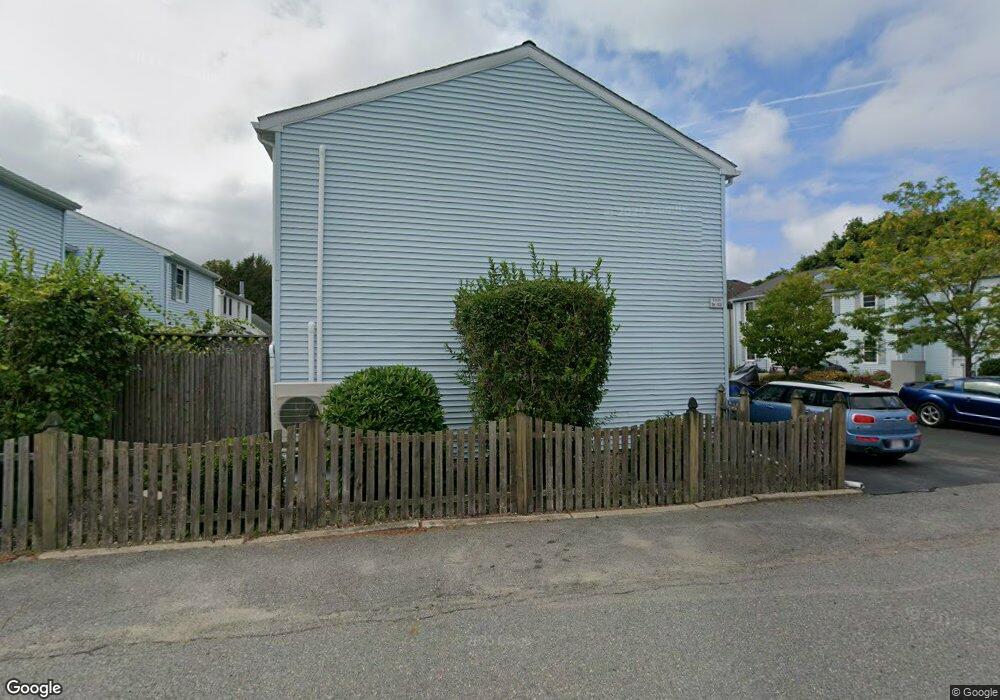
22 Arthur St Unit 11 Gloucester, MA 01930
Central Gloucester NeighborhoodEstimated Value: $328,000 - $489,000
3
Beds
2
Baths
1,106
Sq Ft
$354/Sq Ft
Est. Value
About This Home
This home is located at 22 Arthur St Unit 11, Gloucester, MA 01930 and is currently estimated at $391,575, approximately $354 per square foot. 22 Arthur St Unit 11 is a home located in Essex County with nearby schools including Beeman Memorial, Ralph B O'maley Middle School, and Gloucester High School.
Ownership History
Date
Name
Owned For
Owner Type
Purchase Details
Closed on
Mar 17, 2008
Sold by
Brisbois Jason J
Bought by
Cracchiolo Cesare A
Current Estimated Value
Home Financials for this Owner
Home Financials are based on the most recent Mortgage that was taken out on this home.
Original Mortgage
$160,000
Outstanding Balance
$99,570
Interest Rate
5.72%
Mortgage Type
Purchase Money Mortgage
Estimated Equity
$292,005
Create a Home Valuation Report for This Property
The Home Valuation Report is an in-depth analysis detailing your home's value as well as a comparison with similar homes in the area
Home Values in the Area
Average Home Value in this Area
Purchase History
| Date | Buyer | Sale Price | Title Company |
|---|---|---|---|
| Cracchiolo Cesare A | $160,000 | -- |
Source: Public Records
Mortgage History
| Date | Status | Borrower | Loan Amount |
|---|---|---|---|
| Open | Cracchiolo Cesare A | $160,000 | |
| Previous Owner | Cracchiolo Cesare A | $125,400 |
Source: Public Records
Tax History
| Year | Tax Paid | Tax Assessment Tax Assessment Total Assessment is a certain percentage of the fair market value that is determined by local assessors to be the total taxable value of land and additions on the property. | Land | Improvement |
|---|---|---|---|---|
| 2025 | $2,886 | $296,900 | $0 | $296,900 |
| 2024 | $2,708 | $278,300 | $0 | $278,300 |
| 2023 | $2,598 | $245,300 | $0 | $245,300 |
| 2022 | $2,672 | $227,800 | $0 | $227,800 |
| 2021 | $2,666 | $214,300 | $0 | $214,300 |
| 2020 | $2,642 | $214,300 | $0 | $214,300 |
| 2019 | $2,520 | $198,600 | $0 | $198,600 |
| 2018 | $2,379 | $184,000 | $0 | $184,000 |
| 2017 | $2,151 | $163,100 | $0 | $163,100 |
| 2016 | $2,044 | $150,200 | $0 | $150,200 |
| 2015 | $2,102 | $154,000 | $0 | $154,000 |
Source: Public Records
Map
Nearby Homes
- 40 Sargent St
- 98 Maplewood Ave
- 8 Mystic Ave
- 13 Mystic Ave
- 33 Maplewood Ave Unit 310
- 33 Maplewood Ave Unit 16
- 113 Pleasant St
- 19 Trask St Unit 2
- 6 Monroe Ct
- 15 Mount Vernon St
- 20 Beacon St
- 20 Beacon St Unit 2
- 20 Beacon St Unit 1
- 15 Harvard St
- 160 Prospect St Unit 3
- 33 Middle St
- 191 Main St Unit 3
- 191 Main St Unit 2A
- 55 Mansfield St Unit A
- 55 Mansfield St Unit B
- 22 Arthur St Unit 16
- 22 Arthur St Unit 15
- 22 Arthur St Unit 14
- 22 Arthur St Unit 13
- 22 Arthur St Unit 12
- 22 Arthur St Unit 10
- 22 Arthur St Unit 9
- 22 Arthur St Unit 8
- 22 Arthur St Unit 7
- 22 Arthur St Unit 6
- 22 Arthur St Unit 5
- 22 Arthur St Unit 4
- 22 Arthur St Unit 3
- 22 Arthur St Unit 2
- 22 Arthur St Unit 1
- 22 Arthur St Unit 7,22
- 2 22 Arthur St Unit 2
- 15 Cleveland Place
- 18 Arthur St Unit 3
- 20 Arthur St Unit U1
Your Personal Tour Guide
Ask me questions while you tour the home.