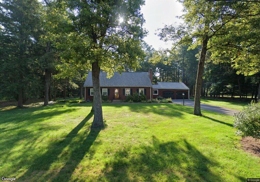
22 Beaverbrook Rd West Simsbury, CT 06092
Estimated Value: $529,000 - $578,000
4
Beds
2
Baths
2,008
Sq Ft
$280/Sq Ft
Est. Value
About This Home
This home is located at 22 Beaverbrook Rd, West Simsbury, CT 06092 and is currently estimated at $562,115, approximately $279 per square foot. 22 Beaverbrook Rd is a home located in Hartford County with nearby schools including Tootin' Hills School, Henry James Memorial School, and Simsbury High School.
Ownership History
Date
Name
Owned For
Owner Type
Purchase Details
Closed on
Apr 23, 2007
Sold by
Tulley Paola M
Bought by
Giardino Ronald D and Giardino Lorraine A
Current Estimated Value
Home Financials for this Owner
Home Financials are based on the most recent Mortgage that was taken out on this home.
Original Mortgage
$69,000
Interest Rate
6.19%
Purchase Details
Closed on
Dec 29, 1997
Sold by
Lefante Lucio and Lefante Jane
Bought by
Tully Paola and Tully Darrin
Purchase Details
Closed on
Nov 12, 1993
Sold by
Daubert John and Daubert Anna Mae
Bought by
Lefante Lucio and Lefante Jane
Create a Home Valuation Report for This Property
The Home Valuation Report is an in-depth analysis detailing your home's value as well as a comparison with similar homes in the area
Home Values in the Area
Average Home Value in this Area
Purchase History
| Date | Buyer | Sale Price | Title Company |
|---|---|---|---|
| Giardino Ronald D | $381,000 | -- | |
| Tully Paola | $208,900 | -- | |
| Lefante Lucio | $170,000 | -- |
Source: Public Records
Mortgage History
| Date | Status | Borrower | Loan Amount |
|---|---|---|---|
| Open | Lefante Lucio | $66,500 | |
| Closed | Lefante Lucio | $100,000 | |
| Closed | Lefante Lucio | $69,000 |
Source: Public Records
Tax History Compared to Growth
Tax History
| Year | Tax Paid | Tax Assessment Tax Assessment Total Assessment is a certain percentage of the fair market value that is determined by local assessors to be the total taxable value of land and additions on the property. | Land | Improvement |
|---|---|---|---|---|
| 2025 | $8,953 | $262,080 | $82,530 | $179,550 |
| 2024 | $8,730 | $262,080 | $82,530 | $179,550 |
| 2023 | $8,339 | $262,080 | $82,530 | $179,550 |
| 2022 | $7,856 | $203,360 | $89,550 | $113,810 |
| 2021 | $7,856 | $203,360 | $89,550 | $113,810 |
| 2020 | $7,543 | $203,360 | $89,550 | $113,810 |
| 2019 | $7,589 | $203,360 | $89,550 | $113,810 |
| 2018 | $7,644 | $203,360 | $89,550 | $113,810 |
| 2017 | $7,345 | $189,500 | $89,560 | $99,940 |
| 2016 | $7,034 | $189,500 | $89,560 | $99,940 |
| 2015 | $7,034 | $189,500 | $89,560 | $99,940 |
| 2014 | $7,038 | $189,500 | $89,560 | $99,940 |
Source: Public Records
Map
Nearby Homes
- 269 W Mountain Rd
- 395 Bushy Hill Rd
- 301 Bushy Hill Rd
- 302 Bushy Hill Rd
- 10 Sachems Trail
- 8 Quorn Hunt Rd
- 121 Gracey Rd
- 8 Crane Place
- 370A W Mountain Rd
- 23 Red Fox Run
- 15 Red Fox Run
- 1 Alcima Dr
- 3 Minister Brook Dr
- 6 Highwood Rd
- 14 Nod Brook Dr
- 26 Red Stone Dr
- 41 Applegate Ln
- 3 Applegate Ln Unit 3
- 31 Applegate Ln Unit 31
- 49 Applegate Ln Unit 49
- 26 Beaverbrook Rd
- 5 Daden Ln
- 16 Beaverbrook Rd
- 21 Beaverbrook Rd
- 3 Daden Ln
- 25 Beaverbrook Rd
- 4 Sharlin Dr
- 17 Beaverbrook Rd
- 12 Beaverbrook Rd
- 30 Beaverbrook Rd
- 13 Beaverbrook Rd
- 29 Beaverbrook Rd
- 13 Huckleberry Ln
- 6 Daden Ln
- 7 Sharlin Dr
- 6 Sharlin Dr
- 4 Daden Ln
- 11 Huckleberry Ln
- 7 Daden Ln
- 15 Huckleberry Ln