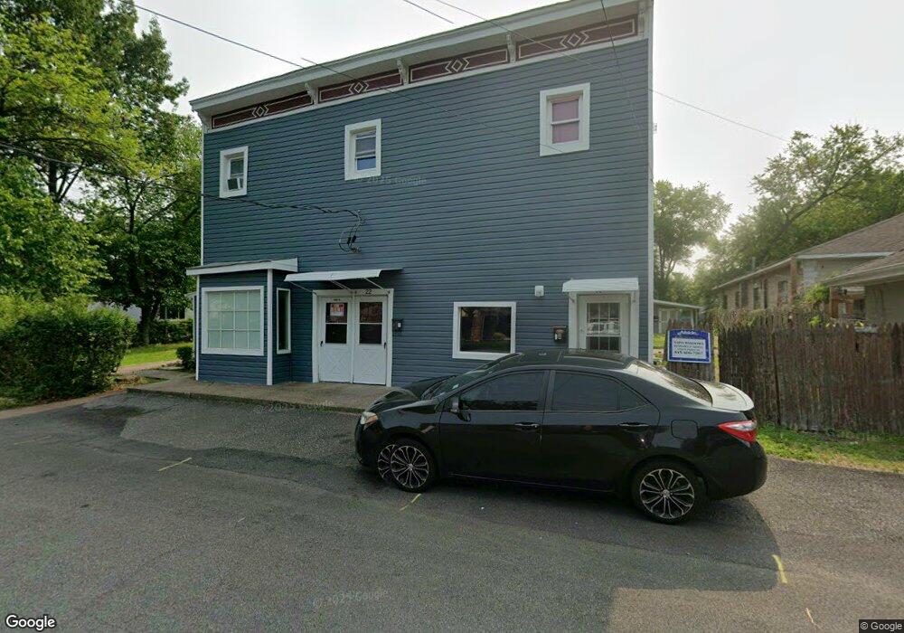
22 Burnside Ave Congers, NY 10920
Estimated Value: $749,348 - $812,000
Studio
--
Bath
3,740
Sq Ft
$209/Sq Ft
Est. Value
About This Home
This home is located at 22 Burnside Ave, Congers, NY 10920 and is currently estimated at $780,674, approximately $208 per square foot. 22 Burnside Ave is a home located in Rockland County with nearby schools including Lakewood Elementary School, Felix Festa Middle School, and Clarkstown North Senior High School.
Ownership History
Date
Name
Owned For
Owner Type
Purchase Details
Closed on
Jan 19, 2017
Sold by
Cifuni Thomas and Cifuni Frances
Bought by
Psmc Ralty Inc
Current Estimated Value
Home Financials for this Owner
Home Financials are based on the most recent Mortgage that was taken out on this home.
Original Mortgage
$275,000
Outstanding Balance
$227,780
Interest Rate
4.3%
Mortgage Type
Commercial
Estimated Equity
$552,894
Purchase Details
Closed on
Feb 26, 2009
Sold by
Cifuni Dian
Bought by
Cifuni Richard J
Purchase Details
Closed on
Dec 9, 2003
Sold by
Cifuni James D
Bought by
Cifuni Dian
Create a Home Valuation Report for This Property
The Home Valuation Report is an in-depth analysis detailing your home's value as well as a comparison with similar homes in the area
Home Values in the Area
Average Home Value in this Area
Purchase History
| Date | Buyer | Sale Price | Title Company |
|---|---|---|---|
| Psmc Ralty Inc | $420,000 | None Available | |
| Cifuni Richard J | $118,125 | National Granite Title Insur | |
| Cifuni Dian | $75,000 | -- |
Source: Public Records
Mortgage History
| Date | Status | Borrower | Loan Amount |
|---|---|---|---|
| Open | Psmc Ralty Inc | $275,000 |
Source: Public Records
Tax History
| Year | Tax Paid | Tax Assessment Tax Assessment Total Assessment is a certain percentage of the fair market value that is determined by local assessors to be the total taxable value of land and additions on the property. | Land | Improvement |
|---|---|---|---|---|
| 2024 | $15,192 | $85,300 | $27,300 | $58,000 |
| 2023 | $15,192 | $85,300 | $27,300 | $58,000 |
| 2022 | $12,668 | $85,300 | $27,300 | $58,000 |
| 2021 | $12,668 | $85,300 | $27,300 | $58,000 |
| 2020 | $14,505 | $85,300 | $27,300 | $58,000 |
| 2019 | $14,425 | $85,300 | $27,300 | $58,000 |
| 2018 | $14,425 | $85,300 | $27,300 | $58,000 |
| 2017 | $14,214 | $85,300 | $27,300 | $58,000 |
| 2016 | $13,161 | $78,100 | $27,300 | $50,800 |
| 2015 | -- | $78,100 | $27,300 | $50,800 |
| 2014 | -- | $78,100 | $27,300 | $50,800 |
Source: Public Records
Map
Nearby Homes
- 19 Sheridan Ave
- 16 Lamborn Ave
- 34 Waldberg Ave
- 22 Parkside Dr
- 22 New York Ave
- 44 Old Lake Rd Unit 44
- 25 Massachusetts Ave
- 47 Lakeland Ave
- 144 Sleepy Hollow Ln
- 11 Chester Ave
- 10 Wesley Ct
- 193 Kings Hwy
- 18 Ridge Rd
- 16 Roman Terrace
- 227 S Harrison Ave
- 83 Gilchrest Rd
- 186 S Route 303
- 11 Pine Tree Ct
- 281-283 Old Haverstraw Rd
- 20 Corners Rd
- 22 Burnside Ave Unit B
- 22 Burnside Ave Unit C
- 10 Burnside Ave Unit B
- 10 Burnside Ave Unit A
- 10 Burnside Ave Unit F
- 10 Burnside Ave Unit E
- 10 Burnside Ave Unit D
- 15 Sheridan Ave Unit 1
- 15 Sheridan Ave
- 11 Sheridan Ave
- 32 Burnside Ave
- 10 Burnside Apt E
- 5 Sheridan Ave
- 42 Lake Rd
- 44 Lake Rd
- 16 Sheridan Ave
- 36 Burnside Ave
- 44-46 Lake Rd
- 23 Sheridan Ave
- 18 Sheridan Ave
Your Personal Tour Guide
Ask me questions while you tour the home.