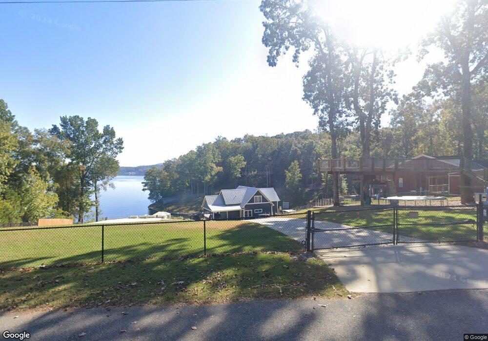
22 Circle 1 Shelby, AL 35143
South Shelby NeighborhoodEstimated Value: $414,000 - $501,000
--
Bed
1
Bath
2,394
Sq Ft
$198/Sq Ft
Est. Value
About This Home
This home is located at 22 Circle 1, Shelby, AL 35143 and is currently estimated at $472,895, approximately $197 per square foot. 22 Circle 1 is a home located in Shelby County with nearby schools including Shelby Elementary School, Columbiana Middle School, and Shelby County High School.
Ownership History
Date
Name
Owned For
Owner Type
Purchase Details
Closed on
Jul 19, 2010
Sold by
Armstrong Donald Scott
Bought by
Horton Allen
Current Estimated Value
Home Financials for this Owner
Home Financials are based on the most recent Mortgage that was taken out on this home.
Original Mortgage
$36,000
Outstanding Balance
$24,006
Interest Rate
4.79%
Mortgage Type
Future Advance Clause Open End Mortgage
Estimated Equity
$448,889
Purchase Details
Closed on
Oct 23, 2000
Sold by
Dale Murphy Audie
Bought by
Armstrong Donald Scott
Home Financials for this Owner
Home Financials are based on the most recent Mortgage that was taken out on this home.
Original Mortgage
$28,000
Interest Rate
7.91%
Purchase Details
Closed on
Oct 18, 2000
Sold by
Murphy Cynthia K
Bought by
Murphy Audie Dale
Home Financials for this Owner
Home Financials are based on the most recent Mortgage that was taken out on this home.
Original Mortgage
$28,000
Interest Rate
7.91%
Create a Home Valuation Report for This Property
The Home Valuation Report is an in-depth analysis detailing your home's value as well as a comparison with similar homes in the area
Home Values in the Area
Average Home Value in this Area
Purchase History
| Date | Buyer | Sale Price | Title Company |
|---|---|---|---|
| Horton Allen | $45,000 | None Available | |
| Armstrong Donald Scott | $27,000 | Stewart Title Insurance Co | |
| Murphy Audie Dale | $500 | Shelby County Abstract & Tit |
Source: Public Records
Mortgage History
| Date | Status | Borrower | Loan Amount |
|---|---|---|---|
| Open | Horton Allen | $36,000 | |
| Previous Owner | Armstrong Donald Scott | $28,000 |
Source: Public Records
Tax History Compared to Growth
Tax History
| Year | Tax Paid | Tax Assessment Tax Assessment Total Assessment is a certain percentage of the fair market value that is determined by local assessors to be the total taxable value of land and additions on the property. | Land | Improvement |
|---|---|---|---|---|
| 2024 | $1,661 | $37,760 | $0 | $0 |
| 2023 | $1,542 | $35,040 | $0 | $0 |
| 2022 | $1,382 | $31,420 | $0 | $0 |
| 2021 | $1,253 | $28,480 | $0 | $0 |
| 2020 | $1,206 | $27,400 | $0 | $0 |
| 2019 | $1,184 | $26,920 | $0 | $0 |
| 2017 | $951 | $21,620 | $0 | $0 |
| 2015 | $916 | $20,820 | $0 | $0 |
| 2014 | $894 | $20,320 | $0 | $0 |
Source: Public Records
Map
Nearby Homes
- 511 Wallace Dr
- 3753 County Road 42 Unit 1
- 156 Wallace Dr
- 19819 River Dr
- 914 Paradise Point Dr Unit 14
- 47 Conn Cir
- 89 Hall Cir
- 59 General Jackson Memorial Dr Unit 59
- 451 Paradise Point Dr
- 53 Summers Bend Unit 1
- 0 Vick Ln Unit 21416150
- 0 General Jackson Memorial Dr Unit 21425920
- 436 Perkins Landing Cove
- 427 Perkins Landing Cove
- 108 Perkins Pointe
- 17016 Highway 42
- 239 Our Rd
- 1035 Lake Dr
- 770 Gallops Ln
- 3015 Talladega Springs Rd
- 34 Circle One
- 524 N River Dr
- 464 N River Dr
- 44 Circle 1
- 50 Circle 1
- 5 Circle 1
- 915 N River Dr
- 0 N River Dr Unit 6 1353471
- 0 N River Dr Unit 728224
- 0 N River Dr Unit 766612
- 0 N River Dr Unit 779441
- 0 N River Dr Unit 9 1335640
- 0 N River Dr Unit 12 891234
- 0 N River Dr Unit 12 386832
- 0 N River Dr Unit 12 508836
- 0 N River Dr Unit 12 585613
- 0 N River Dr Unit 624832
- 0 N River Dr Unit 12 721716
- 0 N River Dr
- 48 Circle 1