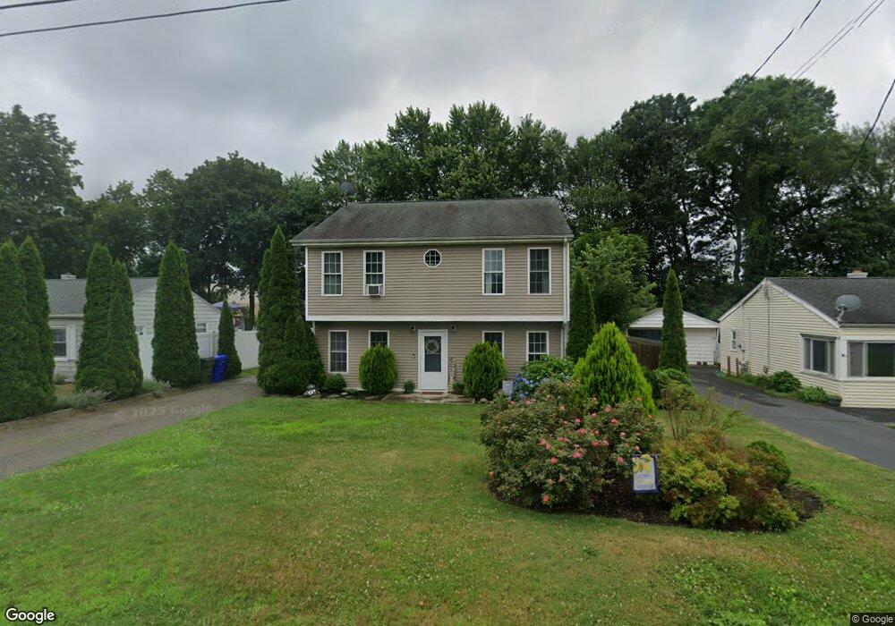
22 Circle Dr Wallingford, CT 06492
Estimated Value: $300,000 - $385,000
2
Beds
1
Bath
1,680
Sq Ft
$208/Sq Ft
Est. Value
About This Home
This home is located at 22 Circle Dr, Wallingford, CT 06492 and is currently estimated at $349,012, approximately $207 per square foot. 22 Circle Dr is a home located in New Haven County with nearby schools including Highland Elementary School, Mary G. Fritz Elementary School, and James H. Moran Middle School.
Ownership History
Date
Name
Owned For
Owner Type
Purchase Details
Closed on
Nov 30, 2021
Sold by
Werdann Brian K
Bought by
Desanti Lisa M
Current Estimated Value
Purchase Details
Closed on
Oct 13, 2006
Sold by
Demarzo Lenora
Bought by
Desanti Lisa M and Werdann Brian K
Home Financials for this Owner
Home Financials are based on the most recent Mortgage that was taken out on this home.
Original Mortgage
$190,000
Interest Rate
6.47%
Purchase Details
Closed on
Jan 13, 2005
Sold by
Est Conrad Mary E and Small Janis M
Bought by
Demarzo Lenora
Home Financials for this Owner
Home Financials are based on the most recent Mortgage that was taken out on this home.
Original Mortgage
$150,000
Interest Rate
5.81%
Create a Home Valuation Report for This Property
The Home Valuation Report is an in-depth analysis detailing your home's value as well as a comparison with similar homes in the area
Home Values in the Area
Average Home Value in this Area
Purchase History
| Date | Buyer | Sale Price | Title Company |
|---|---|---|---|
| Desanti Lisa M | -- | None Available | |
| Desanti Lisa M | -- | None Available | |
| Desanti Lisa M | $190,000 | -- | |
| Desanti Lisa M | $190,000 | -- | |
| Demarzo Lenora | $150,000 | -- | |
| Demarzo Lenora | $150,000 | -- |
Source: Public Records
Mortgage History
| Date | Status | Borrower | Loan Amount |
|---|---|---|---|
| Previous Owner | Demarzo Lenora | $190,000 | |
| Previous Owner | Demarzo Lenora | $150,000 |
Source: Public Records
Tax History
| Year | Tax Paid | Tax Assessment Tax Assessment Total Assessment is a certain percentage of the fair market value that is determined by local assessors to be the total taxable value of land and additions on the property. | Land | Improvement |
|---|---|---|---|---|
| 2025 | $5,355 | $222,000 | $78,200 | $143,800 |
| 2024 | $4,807 | $156,800 | $56,700 | $100,100 |
| 2023 | $4,601 | $156,800 | $56,700 | $100,100 |
| 2022 | $4,553 | $156,800 | $56,700 | $100,100 |
| 2021 | $5,513 | $156,800 | $56,700 | $100,100 |
| 2020 | $4,647 | $159,200 | $57,500 | $101,700 |
| 2019 | $4,647 | $159,200 | $57,500 | $101,700 |
| 2018 | $5,841 | $159,200 | $57,500 | $101,700 |
| 2017 | $4,545 | $159,200 | $57,500 | $101,700 |
| 2016 | $4,440 | $159,200 | $57,500 | $101,700 |
| 2015 | $4,131 | $150,400 | $57,600 | $92,800 |
| 2014 | $4,044 | $150,400 | $57,600 | $92,800 |
Source: Public Records
Map
Nearby Homes
- 6 North Ln
- 3 Pamela Dr
- 84 Staffordshire Commons Dr
- 72 Staffordshire Commons Dr
- 396 Main St Unit 2
- 15 Hanover St
- 13 Bailey Ave
- 380 Main St Unit 3
- 380 Main St Unit 7
- 380 Main St Unit 4
- 380 Main St Unit 16
- 380 Main St Unit 13
- 380 Main St Unit 14
- 1012 Old Colony Rd Unit LOT 81
- 67 Royal Oak Cir
- 219 S Broad St Unit S108
- 190 Elmwood Dr
- 64 Victoria Dr
- 34 Stanley St
- 34 Meetinghouse Ridge
Your Personal Tour Guide
Ask me questions while you tour the home.