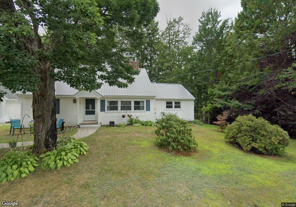
22 E Branch Rd Intervale, NH 03845
Estimated Value: $483,580 - $555,000
3
Beds
4
Baths
1,886
Sq Ft
$281/Sq Ft
Est. Value
About This Home
This home is located at 22 E Branch Rd, Intervale, NH 03845 and is currently estimated at $529,395, approximately $280 per square foot. 22 E Branch Rd is a home with nearby schools including Josiah Bartlett Elementary School and The Lilliputian School.
Ownership History
Date
Name
Owned For
Owner Type
Purchase Details
Closed on
Oct 28, 2016
Sold by
Antonioli Mary E
Bought by
Davis Joshua S and Davis Samantha R
Current Estimated Value
Home Financials for this Owner
Home Financials are based on the most recent Mortgage that was taken out on this home.
Original Mortgage
$193,030
Outstanding Balance
$155,359
Interest Rate
3.5%
Mortgage Type
Purchase Money Mortgage
Estimated Equity
$374,036
Create a Home Valuation Report for This Property
The Home Valuation Report is an in-depth analysis detailing your home's value as well as a comparison with similar homes in the area
Home Values in the Area
Average Home Value in this Area
Purchase History
| Date | Buyer | Sale Price | Title Company |
|---|---|---|---|
| Davis Joshua S | $199,000 | -- |
Source: Public Records
Mortgage History
| Date | Status | Borrower | Loan Amount |
|---|---|---|---|
| Open | Davis Joshua S | $193,030 |
Source: Public Records
Tax History
| Year | Tax Paid | Tax Assessment Tax Assessment Total Assessment is a certain percentage of the fair market value that is determined by local assessors to be the total taxable value of land and additions on the property. | Land | Improvement |
|---|---|---|---|---|
| 2024 | $2,391 | $428,500 | $130,600 | $297,900 |
| 2023 | $2,211 | $428,500 | $130,600 | $297,900 |
| 2022 | $2,130 | $428,500 | $130,600 | $297,900 |
| 2021 | $1,877 | $197,000 | $55,900 | $141,100 |
| 2020 | $1,903 | $197,000 | $55,900 | $141,100 |
| 2019 | $1,840 | $197,000 | $55,900 | $141,100 |
| 2018 | $1,799 | $197,000 | $55,900 | $141,100 |
| 2016 | $1,916 | $201,700 | $48,200 | $153,500 |
| 2015 | $1,924 | $201,700 | $48,200 | $153,500 |
| 2014 | $1,975 | $201,700 | $48,200 | $153,500 |
| 2010 | $1,707 | $186,600 | $42,600 | $144,000 |
Source: Public Records
Map
Nearby Homes
- 378 New Hampshire 16a Unit 4
- 00 Moat Mountain Circle Rd Unit 15
- 20 Highwoods Dr
- 21 Hidden Glade Dr
- 17 Hidden Glade Dr Unit 1
- 3 Beechwoods Dr
- 17 Highwoods Dr Unit 16 and 17
- 5 Holiday Ridge Rd
- 16 Burdett Rd
- 127 New Hampshire 16a
- 135 Nh Rte 16 and 302 Hwy
- 20 Hochland Dr
- G60 Eagle Ridge Rd
- 28 Washington Ave
- 00 Dundee Rd Unit R00
- D37 Eagle Ridge Rd Unit D37
- 63 W Side Woods Rd
- 00 Thorn Hill Rd Unit LOE
- 13 Walter Way Unit 4
- 46 Crestwood Dr
- 26 East Branch
- 26 E Branch Rd
- 26 E Branch Rd
- 19 E Branch Rd
- 80 E Branch Rd
- 28 E Branch Rd
- 336 New Hampshire 16a Unit 19
- 13 East Branch
- 13 E Branch Rd
- 29 E Branch Rd
- 11 E Branch Rd
- 9 E Branch (Pud) Unit 9
- 46 Town Hall Rd
- 27 Nuthatch Ln
- 10 Nuthatch Ln
- 16 Farm at New England Inn Rd
- 41 E Branch Rd
- 337 Nh Route 16a
- 372 Nh Route 16a
- 372 New Hampshire 16a
Your Personal Tour Guide
Ask me questions while you tour the home.