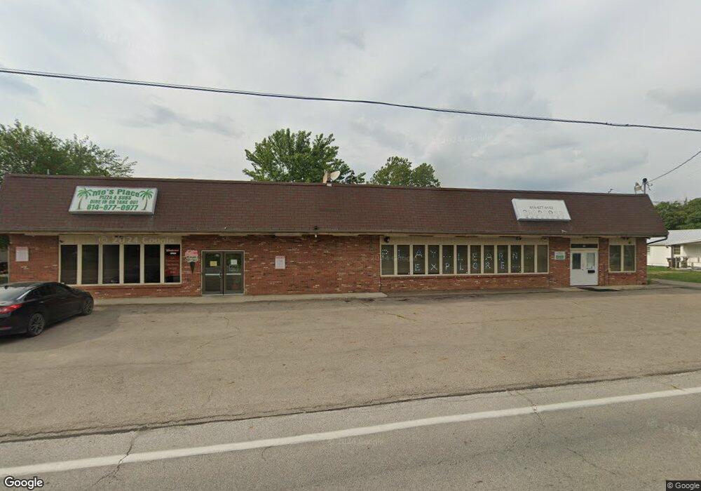
22 E Scioto St Orient, OH 43146
Studio
--
Bath
2,300
Sq Ft
10,454
Sq Ft Lot
About This Home
This home is located at 22 E Scioto St, Orient, OH 43146. 22 E Scioto St is a home located in Pickaway County.
Ownership History
Date
Name
Owned For
Owner Type
Purchase Details
Closed on
May 6, 2019
Sold by
Bunting Danny R
Bought by
Hill Keavin R Trustee
Home Financials for this Owner
Home Financials are based on the most recent Mortgage that was taken out on this home.
Interest Rate
4.14%
Purchase Details
Closed on
Apr 30, 2015
Sold by
Bunting Danny R and Bunting Hope E
Bought by
Hill Keavin R and The Trust Of Keavin R Hill
Home Financials for this Owner
Home Financials are based on the most recent Mortgage that was taken out on this home.
Original Mortgage
$120,000
Interest Rate
3.68%
Mortgage Type
Seller Take Back
Purchase Details
Closed on
Oct 1, 1987
Purchase Details
Closed on
May 1, 1985
Create a Home Valuation Report for This Property
The Home Valuation Report is an in-depth analysis detailing your home's value as well as a comparison with similar homes in the area
Home Values in the Area
Average Home Value in this Area
Purchase History
| Date | Buyer | Sale Price | Title Company |
|---|---|---|---|
| Hill Keavin R Trustee | $150,000 | -- | |
| Hill Keavin R | $150,000 | Attorney | |
| -- | $80,000 | -- | |
| -- | $33,000 | -- |
Source: Public Records
Mortgage History
| Date | Status | Borrower | Loan Amount |
|---|---|---|---|
| Closed | Hill Keavin R Trustee | -- | |
| Previous Owner | Hill Keavin R | $120,000 |
Source: Public Records
Tax History
| Year | Tax Paid | Tax Assessment Tax Assessment Total Assessment is a certain percentage of the fair market value that is determined by local assessors to be the total taxable value of land and additions on the property. | Land | Improvement |
|---|---|---|---|---|
| 2024 | $0 | $51,540 | $5,250 | $46,290 |
| 2023 | $2,370 | $51,540 | $5,250 | $46,290 |
| 2022 | $2,425 | $49,270 | $4,460 | $44,810 |
| 2021 | $2,388 | $49,270 | $4,460 | $44,810 |
| 2020 | $2,488 | $49,270 | $4,460 | $44,810 |
| 2019 | $952 | $37,640 | $4,460 | $33,180 |
| 2018 | $1,795 | $37,640 | $4,460 | $33,180 |
| 2017 | $1,857 | $37,640 | $4,460 | $33,180 |
| 2016 | $1,946 | $39,470 | $4,430 | $35,040 |
| 2015 | $969 | $39,470 | $4,430 | $35,040 |
| 2014 | $1,934 | $39,470 | $4,430 | $35,040 |
| 2013 | $2,071 | $41,730 | $4,430 | $37,300 |
Source: Public Records
Map
Nearby Homes
- 502 Conley Dr
- 500 Walker Pointe Dr
- 505 Conley Dr
- 484 Creekside Dr
- 487 Creekside Dr
- 24 Erin Hills Rd
- 426 Bethpage Blvd
- 507 Walker Pointe Dr
- 55 Genoa Cir
- 66 Genoa Cir
- 315 Genoa Rd
- 38 Waterman Ave
- 277 Olympic Loop
- 282 Olympic Loop
- 284 Olympic Loop
- 305 Cherry Hills Rd
- 304 Cherry Hills Rd
- 305 Olympic Loop
- 320 Cherry Hills Rd
- 341 Merion Dr
