Estimated Value: $575,000 - $758,000
3
Beds
2
Baths
1,267
Sq Ft
$539/Sq Ft
Est. Value
About This Home
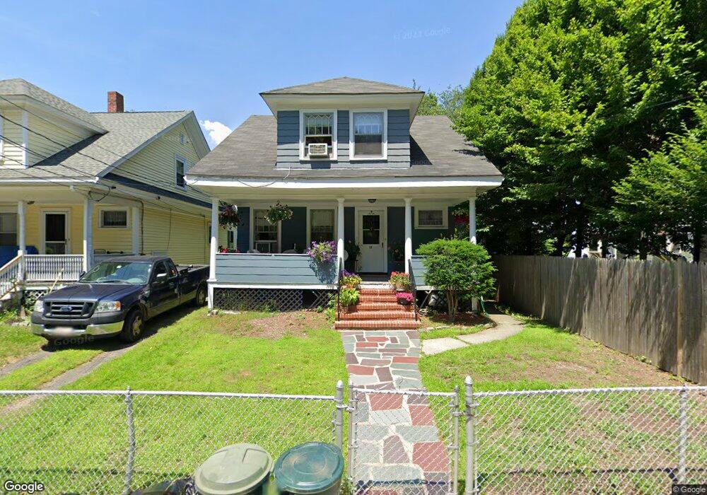
This home is located at 22 Elm St, Dorchester, MA 02122 and is currently estimated at $682,970, approximately $539 per square foot. 22 Elm St is a home located in Suffolk County with nearby schools including Neighborhood House Charter School and Helen Y. Davis Leadership Academy Charter Public School.
Ownership History
Date
Name
Owned For
Owner Type
Purchase Details
Closed on
Feb 5, 2025
Sold by
Sugrue Niall J and Sugrue Mary C
Bought by
Niall & Mary Sugrue Ret and Sugrue
Current Estimated Value
Purchase Details
Closed on
Jul 3, 1989
Sold by
Keeley John M
Bought by
Sugrue Niall J
Create a Home Valuation Report for This Property
The Home Valuation Report is an in-depth analysis detailing your home's value as well as a comparison with similar homes in the area
Home Values in the Area
Average Home Value in this Area
Purchase History
| Date | Buyer | Sale Price | Title Company |
|---|---|---|---|
| Niall & Mary Sugrue Ret | -- | None Available | |
| Niall & Mary Sugrue Ret | -- | None Available | |
| Sugrue Niall J | $144,000 | -- |
Source: Public Records
Mortgage History
| Date | Status | Borrower | Loan Amount |
|---|---|---|---|
| Previous Owner | Sugrue Niall J | $16,600 | |
| Previous Owner | Sugrue Niall J | $99,000 | |
| Previous Owner | Sugrue Niall J | $16,600 |
Source: Public Records
Tax History Compared to Growth
Tax History
| Year | Tax Paid | Tax Assessment Tax Assessment Total Assessment is a certain percentage of the fair market value that is determined by local assessors to be the total taxable value of land and additions on the property. | Land | Improvement |
|---|---|---|---|---|
| 2025 | $5,910 | $510,400 | $254,200 | $256,200 |
| 2024 | $5,510 | $505,500 | $218,500 | $287,000 |
| 2023 | $5,429 | $505,500 | $218,500 | $287,000 |
| 2022 | $5,094 | $468,200 | $202,400 | $265,800 |
| 2021 | $4,803 | $450,100 | $194,600 | $255,500 |
| 2020 | $4,381 | $414,900 | $185,000 | $229,900 |
| 2019 | $4,126 | $391,500 | $149,400 | $242,100 |
| 2018 | $3,765 | $359,300 | $149,400 | $209,900 |
| 2017 | $3,693 | $348,700 | $149,400 | $199,300 |
| 2016 | $3,653 | $332,100 | $149,400 | $182,700 |
| 2015 | $2,974 | $245,600 | $106,300 | $139,300 |
| 2014 | $2,914 | $231,600 | $106,300 | $125,300 |
Source: Public Records
Map
Nearby Homes
- 32 Beach St Unit 1
- 9 Park St Unit 8
- 15 Duncan St
- 382 Adams St Unit 384-1
- 34 Houghton St
- 381 Adams St Unit 2
- 381 Adams St Unit 1
- 381 Adams St Unit 3
- 32 Gibson St Unit 3
- 6 Agawam St
- 4 Payne St Unit 5
- 60 Houghton St Unit 62
- 20 Parkman St Unit 2
- 108 King St Unit 3
- 104 King St Unit 2
- 96 King St Unit 1
- 20 Leslie St
- 40 Linden St Unit C
- 34 Dix St Unit 3
- 43 Robinson St Unit 3
- 20 Elm St
- 16 Elm St Unit 18
- 13 Everett St Unit 15
- 13 Everett St Unit 15
- 13 Everett St Unit 15
- 13 Everett St Unit 15
- 13 Everett St Unit 15
- 9 Everett St
- 9 Everett St Unit 4
- 14 Elm St Unit 2
- 12 Elm St Unit 1
- 12-14 Elm St Unit 12
- 12 Elm St Unit 2
- 11 Everett St
- 7 Everett St
- 28 Park St
- 28 Park St Unit 1
- 27 Elm St Unit 2
- 27 Elm St Unit 1
- 27 Elm St Unit 3