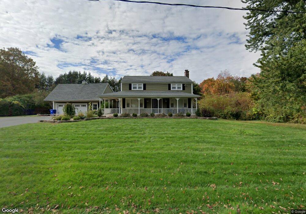
22 Hatheway Rd Ellington, CT 06029
Estimated Value: $424,696 - $548,000
4
Beds
2
Baths
1,666
Sq Ft
$281/Sq Ft
Est. Value
About This Home
This home is located at 22 Hatheway Rd, Ellington, CT 06029 and is currently estimated at $467,674, approximately $280 per square foot. 22 Hatheway Rd is a home located in Tolland County with nearby schools including Ellington High School.
Ownership History
Date
Name
Owned For
Owner Type
Purchase Details
Closed on
Sep 16, 2013
Sold by
Bogoslofski Richard N and Bogoslofski Stacey N
Bought by
Bontempo Daniel J and Bontempo Katherine A
Current Estimated Value
Home Financials for this Owner
Home Financials are based on the most recent Mortgage that was taken out on this home.
Original Mortgage
$252,000
Outstanding Balance
$188,274
Interest Rate
4.43%
Estimated Equity
$279,400
Purchase Details
Closed on
Mar 12, 2010
Sold by
Phelps Linda
Bought by
Bogoslofski Richard and Bogoslofski Stacey
Home Financials for this Owner
Home Financials are based on the most recent Mortgage that was taken out on this home.
Original Mortgage
$269,037
Interest Rate
5.5%
Mortgage Type
FHA
Create a Home Valuation Report for This Property
The Home Valuation Report is an in-depth analysis detailing your home's value as well as a comparison with similar homes in the area
Home Values in the Area
Average Home Value in this Area
Purchase History
| Date | Buyer | Sale Price | Title Company |
|---|---|---|---|
| Bontempo Daniel J | $280,000 | -- | |
| Bogoslofski Richard | $276,000 | -- |
Source: Public Records
Mortgage History
| Date | Status | Borrower | Loan Amount |
|---|---|---|---|
| Open | Bontempo Daniel J | $252,000 | |
| Previous Owner | Bogoslofski Richard | $269,037 | |
| Previous Owner | Bogoslofski Richard | $125,000 | |
| Previous Owner | Bogoslofski Richard | $125,000 | |
| Previous Owner | Bogoslofski Richard | $80,000 |
Source: Public Records
Tax History Compared to Growth
Tax History
| Year | Tax Paid | Tax Assessment Tax Assessment Total Assessment is a certain percentage of the fair market value that is determined by local assessors to be the total taxable value of land and additions on the property. | Land | Improvement |
|---|---|---|---|---|
| 2025 | $6,414 | $172,890 | $57,900 | $114,990 |
| 2024 | $6,224 | $172,890 | $57,900 | $114,990 |
| 2023 | $5,930 | $172,890 | $57,900 | $114,990 |
| 2022 | $5,619 | $172,890 | $57,900 | $114,990 |
| 2021 | $5,463 | $172,890 | $57,900 | $114,990 |
| 2020 | $5,508 | $168,970 | $57,460 | $111,510 |
| 2019 | $5,508 | $168,970 | $57,460 | $111,510 |
| 2016 | $5,154 | $168,970 | $57,460 | $111,510 |
| 2015 | $5,154 | $175,260 | $57,460 | $117,800 |
| 2014 | $5,030 | $175,260 | $57,460 | $117,800 |
Source: Public Records
Map
Nearby Homes
- 20 Hatheway Rd
- 21 Hatheway Rd
- 21 Hatheway Rd
- 30 Hatheway Rd
- 18 Hatheway Rd
- 2 Rockland Dr
- 58 Muddy Brook Rd
- 82 Muddy Brook Rd
- 16 Hatheway Rd
- 32 Hatheway Rd
- 1 Rockland Dr
- 4 Rockland Dr
- 6 Rockland Dr
- 86 Muddy Brook Rd
- 79 Muddy Brook Rd
- 1 Patriot Cir
- 56 Muddy Brook Rd
- 11 Hatheway Rd
- 54 Muddy Brook Rd
- 81 Muddy Brook Rd