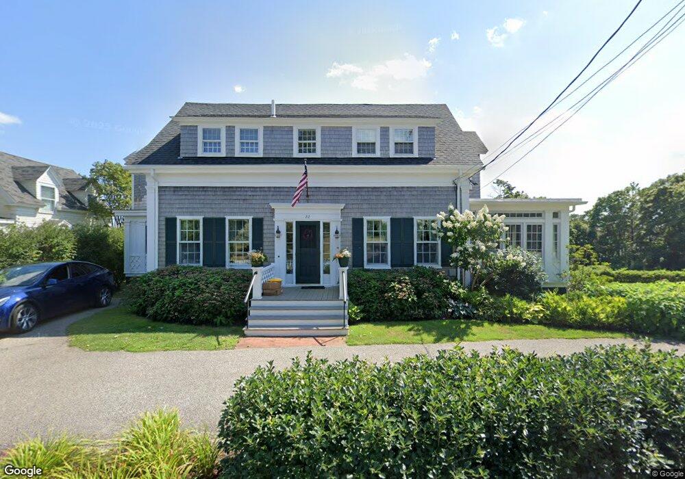
22 Lester B Orcutt Blvd Biddeford, ME 04005
Fortunes Rocks NeighborhoodEstimated Value: $1,244,000 - $2,010,000
4
Beds
4
Baths
3,144
Sq Ft
$552/Sq Ft
Est. Value
About This Home
This home is located at 22 Lester B Orcutt Blvd, Biddeford, ME 04005 and is currently estimated at $1,735,594, approximately $552 per square foot. 22 Lester B Orcutt Blvd is a home with nearby schools including John F Kennedy Memorial School, Biddeford Primary School, and Biddeford Intermediate School.
Ownership History
Date
Name
Owned For
Owner Type
Purchase Details
Closed on
Feb 26, 2024
Sold by
Millet David F
Bought by
Orcutt 22 Nt and Millet
Current Estimated Value
Create a Home Valuation Report for This Property
The Home Valuation Report is an in-depth analysis detailing your home's value as well as a comparison with similar homes in the area
Home Values in the Area
Average Home Value in this Area
Purchase History
| Date | Buyer | Sale Price | Title Company |
|---|---|---|---|
| Orcutt 22 Nt | -- | None Available | |
| Orcutt 22 Nt | -- | None Available | |
| Orcutt 22 Nt | -- | None Available | |
| Orcutt 22 Nt | -- | None Available |
Source: Public Records
Tax History Compared to Growth
Tax History
| Year | Tax Paid | Tax Assessment Tax Assessment Total Assessment is a certain percentage of the fair market value that is determined by local assessors to be the total taxable value of land and additions on the property. | Land | Improvement |
|---|---|---|---|---|
| 2024 | $20,724 | $1,457,400 | $1,058,800 | $398,600 |
| 2023 | $19,062 | $1,452,900 | $1,054,300 | $398,600 |
| 2022 | $16,988 | $1,035,200 | $667,400 | $367,800 |
| 2021 | $16,163 | $886,600 | $566,200 | $320,400 |
| 2020 | $17,010 | $848,400 | $536,400 | $312,000 |
| 2019 | $16,951 | $848,400 | $536,400 | $312,000 |
| 2018 | $16,713 | $848,400 | $536,400 | $312,000 |
| 2017 | $3,912 | $848,400 | $536,400 | $312,000 |
| 2016 | $16,849 | $848,400 | $536,400 | $312,000 |
| 2015 | $16,518 | $848,400 | $536,400 | $312,000 |
| 2014 | $16,111 | $848,400 | $536,400 | $312,000 |
| 2013 | -- | $886,700 | $555,900 | $330,800 |
Source: Public Records
Map
Nearby Homes
- 111 Mile Stretch Rd
- 3 Fortunes Rocks Rd
- 6 Days Landing
- 88-90 Old Pool Rd
- 66 Old Pool Rd
- 2 Maddox Pond Rd
- Lot 1 Longboard Ln
- Lot 2 Longboard Ln
- 1 Willow Ridge
- Lot 3 Longboard Ln
- 26 Reserved Ln
- Lot 4 Longboard Ln
- Lot 7 Longboard Ln
- Lot 6 Longboard Ln
- 700 Pool St
- 96 Fortunes Rocks Rd
- 23 North Ave
- 9 Riverside Ave
- 12 Lower Beach Rd
- 27 Sunrise Ave
- 9 Lester B Orcutt Blvd Unit 7
- 9 Lester B Orcutt Blvd Unit 1
- 7 Lester B Orcutt Blvd
- 9 Lester B Orcutt Blvd Unit 4
- 9 Lester B Orcutt Blvd Unit 2
- 9 Lester B Orcutt Blvd Unit 8
- 9 Lester B Orcutt Blvd Unit 9
- 24 Lester B Orcutt Blvd
- 21 Lester B Orcutt Blvd
- 6 Sandy Ln
- 23 Lester B Orcutt Blvd
- 26 Lester B Orcutt Blvd
- 20 Lester B Orcutt Blvd Unit 3
- 20 Lester B Orcutt Blvd Unit 1
- 20 Lester B Orcutt Blvd Unit 4
- 20 Lester B Orcutt Blvd Unit 5
- 28 Lester B Orcutt Blvd
- 1 Bayview Ave
- 27 Lester B Orcutt Blvd