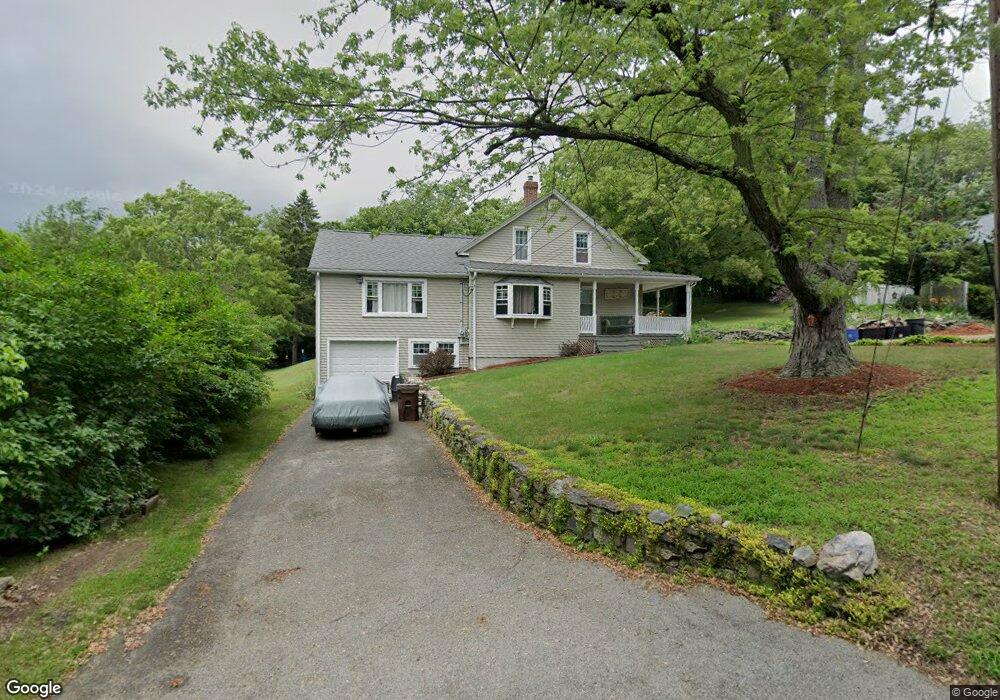
22 Maple St Auburn, MA 01501
West Auburn NeighborhoodEstimated Value: $339,000 - $541,000
4
Beds
4
Baths
1,676
Sq Ft
$274/Sq Ft
Est. Value
About This Home
This home is located at 22 Maple St, Auburn, MA 01501 and is currently estimated at $459,710, approximately $274 per square foot. 22 Maple St is a home located in Worcester County with nearby schools including Auburn Senior High School and Shrewsbury Montessori School - Auburn Campus.
Ownership History
Date
Name
Owned For
Owner Type
Purchase Details
Closed on
May 21, 2007
Sold by
Smith Bryan A and Smith Lori L
Bought by
Smith Lori L
Current Estimated Value
Purchase Details
Closed on
Jan 25, 1988
Sold by
Kackley Mark J
Bought by
Smith Bryan A
Home Financials for this Owner
Home Financials are based on the most recent Mortgage that was taken out on this home.
Original Mortgage
$124,000
Interest Rate
10.64%
Mortgage Type
Purchase Money Mortgage
Create a Home Valuation Report for This Property
The Home Valuation Report is an in-depth analysis detailing your home's value as well as a comparison with similar homes in the area
Home Values in the Area
Average Home Value in this Area
Purchase History
| Date | Buyer | Sale Price | Title Company |
|---|---|---|---|
| Smith Lori L | -- | -- | |
| Smith Bryan A | $155,000 | -- |
Source: Public Records
Mortgage History
| Date | Status | Borrower | Loan Amount |
|---|---|---|---|
| Previous Owner | Smith Bryan A | $111,000 | |
| Previous Owner | Smith Bryan A | $25,000 | |
| Previous Owner | Smith Bryan A | $116,000 | |
| Previous Owner | Smith Bryan A | $124,000 |
Source: Public Records
Tax History
| Year | Tax Paid | Tax Assessment Tax Assessment Total Assessment is a certain percentage of the fair market value that is determined by local assessors to be the total taxable value of land and additions on the property. | Land | Improvement |
|---|---|---|---|---|
| 2025 | $60 | $421,700 | $119,200 | $302,500 |
| 2024 | $5,772 | $386,600 | $114,600 | $272,000 |
| 2023 | $5,455 | $343,500 | $98,800 | $244,700 |
| 2022 | $4,996 | $297,000 | $93,300 | $203,700 |
| 2021 | $4,749 | $261,800 | $82,600 | $179,200 |
| 2020 | $4,587 | $255,100 | $82,600 | $172,500 |
| 2019 | $4,132 | $224,300 | $76,000 | $148,300 |
| 2018 | $3,926 | $212,900 | $71,100 | $141,800 |
| 2017 | $3,756 | $204,800 | $64,500 | $140,300 |
| 2016 | $3,611 | $199,600 | $66,600 | $133,000 |
| 2015 | $3,312 | $191,900 | $66,600 | $125,300 |
| 2014 | $3,233 | $187,000 | $63,600 | $123,400 |
Source: Public Records
Map
Nearby Homes
- 4 Athens St
- 0 Athens St
- 808 Washington St
- 104 Appleton Rd
- 49 Prospect St
- 35 Waterman Rd
- 19 Thayer Pond Dr Unit 3
- 17 Thayer Pond Dr Unit 2
- 24 Thayer Pond Dr Unit 17
- 634 Oxford St S
- 32 Thayer Pond Dr Unit 17
- 34 Thayer Pond Dr Unit 8
- 4 Thayer Pond Dr Unit 20
- 6 Thayer Pond Dr Unit 11
- 1 Crowl Hill Rd
- 155 Southbridge Rd
- 751 Washington St Unit 43A
- 6 Laurelwood Dr
- 166 Leicester St
- 45 Leicester St
- 14 Maple St
- 18 Maple St
- 26 Maple St Unit 3
- 26 Maple St Unit 2
- 26 Maple St Unit 1
- 000 Southbridge St
- 8 Maple St
- 38 Maple St
- 0 0 Unit 71537377
- 40 Maple St
- 813 Southbridge St
- 825 Washington St
- 0 Maple St
- 20 Tinkerhill Rd
- 838 Southbridge St
- 838 Southbridge St Unit 1
- 785 Southbridge St
- 785 Southbridge St Unit 2
- 785 Southbridge St Unit 1
- 25 Tinkerhill Rd
Your Personal Tour Guide
Ask me questions while you tour the home.