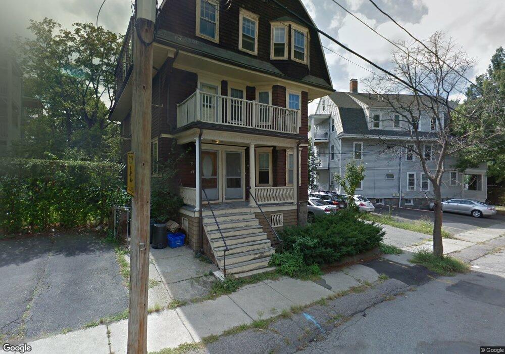
22 Marion Rd Unit 24 Belmont, MA 02478
Cushing Square NeighborhoodEstimated Value: $1,219,023 - $1,579,000
6
Beds
3
Baths
3,726
Sq Ft
$379/Sq Ft
Est. Value
About This Home
This home is located at 22 Marion Rd Unit 24, Belmont, MA 02478 and is currently estimated at $1,412,256, approximately $379 per square foot. 22 Marion Rd Unit 24 is a home located in Middlesex County with nearby schools including Roger Wellington Elementary School, Winthrop L Chenery Middle School, and Belmont High School.
Ownership History
Date
Name
Owned For
Owner Type
Purchase Details
Closed on
Mar 25, 2014
Sold by
Otash James A
Bought by
Tobey Nt and Otash James A
Current Estimated Value
Purchase Details
Closed on
Dec 12, 1990
Sold by
Mccusker Walter M
Bought by
Otash James A
Home Financials for this Owner
Home Financials are based on the most recent Mortgage that was taken out on this home.
Original Mortgage
$185,000
Interest Rate
10.07%
Mortgage Type
Purchase Money Mortgage
Create a Home Valuation Report for This Property
The Home Valuation Report is an in-depth analysis detailing your home's value as well as a comparison with similar homes in the area
Home Values in the Area
Average Home Value in this Area
Purchase History
| Date | Buyer | Sale Price | Title Company |
|---|---|---|---|
| Tobey Nt | -- | -- | |
| Otash James A | $285,000 | -- |
Source: Public Records
Mortgage History
| Date | Status | Borrower | Loan Amount |
|---|---|---|---|
| Previous Owner | Otash James A | $183,000 | |
| Previous Owner | Otash James A | $185,000 |
Source: Public Records
Tax History Compared to Growth
Tax History
| Year | Tax Paid | Tax Assessment Tax Assessment Total Assessment is a certain percentage of the fair market value that is determined by local assessors to be the total taxable value of land and additions on the property. | Land | Improvement |
|---|---|---|---|---|
| 2025 | $15,354 | $1,348,000 | $692,000 | $656,000 |
| 2024 | $15,618 | $1,479,000 | $949,000 | $530,000 |
| 2023 | $15,444 | $1,374,000 | $895,000 | $479,000 |
| 2022 | $13,986 | $1,266,000 | $819,000 | $447,000 |
| 2021 | $13,986 | $1,212,000 | $811,000 | $401,000 |
| 2020 | $12,441 | $1,131,000 | $654,000 | $477,000 |
| 2019 | $11,518 | $987,000 | $501,000 | $486,000 |
| 2018 | $11,093 | $913,000 | $434,000 | $479,000 |
| 2017 | $10,520 | $829,000 | $358,000 | $471,000 |
| 2016 | $10,362 | $825,000 | $358,000 | $467,000 |
| 2015 | $8,901 | $690,000 | $319,000 | $371,000 |
Source: Public Records
Map
Nearby Homes
- 30 Unity Ave Unit 30
- 10 Marlboro St Unit 1
- 163 Belmont St
- 16 Ericsson St
- 87 Templeton Pkwy Unit 3
- 73 Foster Rd Unit 2
- 56-58 Edgecliff Rd
- 133 Hillside Rd Unit 2
- 133 Hillside Rd
- 133 Hillside Rd Unit 1
- 147 Langdon Ave Unit 149
- 27 Dalton Rd Unit 27
- 276 Belmont St Unit 1
- 25 Francis St Unit 2
- 25 Francis St Unit 1
- 95 Cushing St
- 161 Cushing St
- 43 Irma Ave Unit 43
- 66 Holworthy St
- 81 Winsor Ave
- 22 Marion Rd Unit 3
- 22 Marion Rd Unit 2
- 27 Grove St
- 27 Grove St Unit 2
- 27 Grove St Unit 27
- 18 Marion Rd Unit 20
- 26 Marion Rd Unit 28
- 26 Marion Rd Unit 28
- 26 Marion Rd Unit 28
- 28 Marion Rd Unit 3
- 26 Marion Rd Unit 2
- 26 Marion Rd Unit 3
- 28 Marion Rd Unit 1
- 26 Marion Rd Unit 1
- 14 Marion Rd Unit 3
- 14 Marion Rd Unit 2
- 14 Marion Rd Unit 1
- 26-28 Marion Rd Unit 3
- 25 Grove Unit 2
- 10 Marion Rd