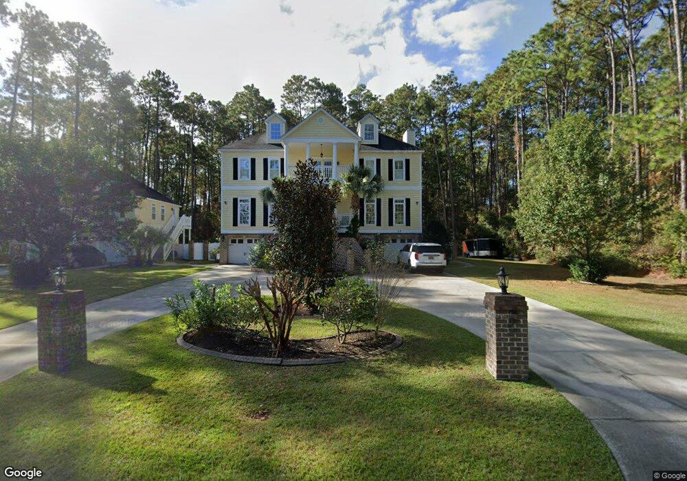
22 Mill Park Rd Pawleys Island, SC 29585
Estimated Value: $739,000 - $1,076,537
--
Bed
4
Baths
3,780
Sq Ft
$234/Sq Ft
Est. Value
About This Home
This home is located at 22 Mill Park Rd, Pawleys Island, SC 29585 and is currently estimated at $884,134, approximately $233 per square foot. 22 Mill Park Rd is a home located in Georgetown County with nearby schools including Waccamaw Elementary School, Waccamaw Intermediate School, and Waccamaw Middle School.
Ownership History
Date
Name
Owned For
Owner Type
Purchase Details
Closed on
May 24, 2005
Sold by
Brinson Robert J
Bought by
Kinmartin Brian P and Kinmartin Melissa
Current Estimated Value
Home Financials for this Owner
Home Financials are based on the most recent Mortgage that was taken out on this home.
Original Mortgage
$103,500
Interest Rate
5.69%
Mortgage Type
Future Advance Clause Open End Mortgage
Create a Home Valuation Report for This Property
The Home Valuation Report is an in-depth analysis detailing your home's value as well as a comparison with similar homes in the area
Home Values in the Area
Average Home Value in this Area
Purchase History
| Date | Buyer | Sale Price | Title Company |
|---|---|---|---|
| Kinmartin Brian P | $117,000 | -- |
Source: Public Records
Mortgage History
| Date | Status | Borrower | Loan Amount |
|---|---|---|---|
| Closed | Kinmartin Brian P | $103,500 |
Source: Public Records
Tax History Compared to Growth
Tax History
| Year | Tax Paid | Tax Assessment Tax Assessment Total Assessment is a certain percentage of the fair market value that is determined by local assessors to be the total taxable value of land and additions on the property. | Land | Improvement |
|---|---|---|---|---|
| 2024 | $3,388 | $26,350 | $3,400 | $22,950 |
| 2023 | $3,388 | $26,350 | $3,400 | $22,950 |
| 2022 | $3,111 | $26,350 | $3,400 | $22,950 |
| 2021 | $3,011 | $26,356 | $3,400 | $22,956 |
| 2020 | $3,003 | $26,356 | $3,400 | $22,956 |
| 2019 | $2,905 | $25,724 | $3,200 | $22,524 |
| 2018 | $2,967 | $257,240 | $0 | $0 |
| 2017 | $2,662 | $257,240 | $0 | $0 |
| 2016 | $2,629 | $25,724 | $0 | $0 |
| 2015 | $2,550 | $0 | $0 | $0 |
| 2014 | $2,550 | $637,800 | $80,000 | $557,800 |
| 2012 | -- | $637,800 | $80,000 | $557,800 |
Source: Public Records
Map
Nearby Homes
- Lot 1-A Brace Dr
- 1153 Heritage Dr
- 1575 Heritage Dr
- 121 Half Moon Trail
- 1176 Heritage Dr
- 155 Hill Dr
- 634 Hagley Dr
- 23 Gleneagle Ln
- 1 Brace Dr
- 146 Berwick Dr Unit Heritage Plantation
- 182 Berwick Dr
- 761 Hagley Dr
- 82 Snow Ln
- 444 Dornoch Dr
- 1058 Doral Dr
- 725 Blue Stem Dr Unit 66C
- 1015 Blue Stem Dr Unit 38B
- 1041 Blue Stem Dr Unit 37A
- 649 Blue Stem Dr Unit 72-A
- 11 Bears Paw Way
- 33 Mill Park Rd
- 68 Mill Park Rd Unit Blue Haven
- 75 Mill Park Rd
- 75 Mill Park Rd Unit Blue Haven subdivisi
- 75 Mill Park Rd Unit Lot 2C Blue Haven
- TBD Brace Dr
- 9.8 Acres Beaumont Dr Unit at Kings River Road
- 77 Carnoustie Ct
- 492 Brace Dr
- 151 Boyne Dr
- 87 Carnoustie Ct
- Lot 11 Ambrosia
- 93 Carnoustie Ct Unit Heritage Plantation
- 93 Carnoustie Ct
- 57 Carnoustie Ct Unit Heritage Plantation
- 57 Carnoustie Ct
- 1195 Beaumont Dr
- 1225 Beaumont Dr Unit Beaumont Park
- 1177 Beaumont Dr Unit Beaumont Park-Modifi
- 1177 Beaumont Dr Unit Beaumont Park-Caroli