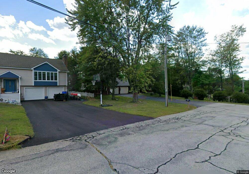
22 Mooreland St Milford, NH 03055
Estimated Value: $513,065 - $597,000
2
Beds
2
Baths
1,856
Sq Ft
$301/Sq Ft
Est. Value
About This Home
This home is located at 22 Mooreland St, Milford, NH 03055 and is currently estimated at $559,016, approximately $301 per square foot. 22 Mooreland St is a home with nearby schools including Jacques Memorial Elementary School, Heron Pond Elementary School, and Milford Middle School.
Ownership History
Date
Name
Owned For
Owner Type
Purchase Details
Closed on
May 8, 2001
Sold by
Anderson Reuben A and Anderson Mary E
Bought by
Ohare Michael F and Ohare Sandra M
Current Estimated Value
Home Financials for this Owner
Home Financials are based on the most recent Mortgage that was taken out on this home.
Original Mortgage
$107,300
Interest Rate
6.85%
Create a Home Valuation Report for This Property
The Home Valuation Report is an in-depth analysis detailing your home's value as well as a comparison with similar homes in the area
Home Values in the Area
Average Home Value in this Area
Purchase History
| Date | Buyer | Sale Price | Title Company |
|---|---|---|---|
| Ohare Michael F | $165,000 | -- |
Source: Public Records
Mortgage History
| Date | Status | Borrower | Loan Amount |
|---|---|---|---|
| Open | Ohare Michael F | $127,500 | |
| Closed | Ohare Michael F | $107,300 |
Source: Public Records
Tax History Compared to Growth
Tax History
| Year | Tax Paid | Tax Assessment Tax Assessment Total Assessment is a certain percentage of the fair market value that is determined by local assessors to be the total taxable value of land and additions on the property. | Land | Improvement |
|---|---|---|---|---|
| 2024 | $7,615 | $321,700 | $82,000 | $239,700 |
| 2023 | $7,132 | $321,700 | $82,000 | $239,700 |
| 2022 | $6,688 | $321,700 | $82,000 | $239,700 |
| 2021 | $6,482 | $321,700 | $82,000 | $239,700 |
| 2020 | $6,959 | $274,300 | $58,500 | $215,800 |
| 2019 | $7,124 | $274,300 | $58,500 | $215,800 |
| 2018 | $6,778 | $231,900 | $57,500 | $174,400 |
| 2017 | $6,816 | $231,900 | $57,500 | $174,400 |
| 2016 | $6,716 | $231,900 | $57,500 | $174,400 |
| 2015 | $6,603 | $231,200 | $57,500 | $173,700 |
| 2014 | $6,312 | $231,200 | $57,500 | $173,700 |
| 2013 | $6,235 | $231,200 | $57,500 | $173,700 |
Source: Public Records
Map
Nearby Homes
- 44 Osgood Rd
- 61 W Meadow Ct
- 26 Melendy Rd Unit 97
- 26 Melendy Rd Unit 42
- 24 Spaulding St
- 377 Nashua St
- 0 Briar Cliff Dr
- 145 Westchester Dr
- 43 Boxwood Cir
- 32 Larch Rd
- 40 North St
- 7 Fox Run Rd
- 0 Claude Rd
- 686 Route 13 S
- 36 Berkeley Place
- 00 Ruonala Rd
- 344 Elm St Unit 14
- 344 Elm St Unit 16
- 57 Patch Hill Ln
- 229 Mont Vernon Rd
- 53 David Dr
- 18 Mooreland St
- 19 Curtis Commons Cir Unit Lot 14
- 15 Curtis Commons Cir Unit Lot 13
- 23 Mooreland St
- 16 Mooreland St
- 21 Mooreland St
- 54 David Dr
- 23 Curtis Commons Cir Unit Lot 15
- 47 David Dr
- 17 Mooreland St
- 22 Curtis Commons Cir
- 22 Curtis Commons Cir Unit Lot 38
- 11 Curtis Commons Cir
- 11 Curtis Commons Cir Unit Lot 12
- 50 David Dr
- 12 Mooreland St
- 20 Oakland Dr
- 68 Curtis Commons Cir Unit Lot 27
- 41 David Dr