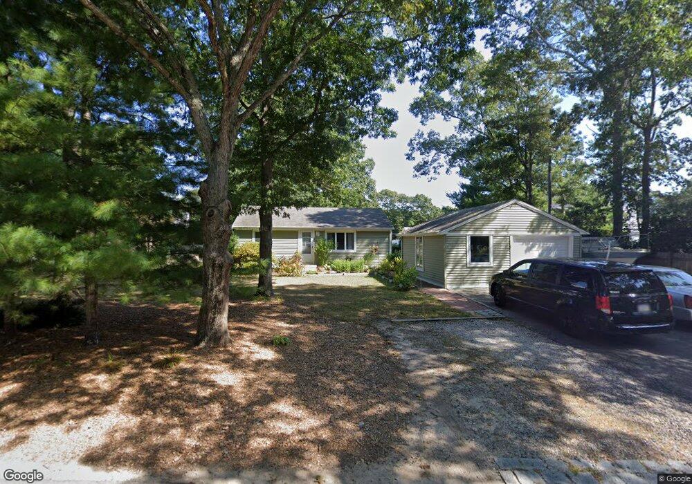
22 Musket Ln Mashpee, MA 02649
Mashpee Neck NeighborhoodEstimated Value: $443,000 - $610,000
2
Beds
1
Bath
768
Sq Ft
$664/Sq Ft
Est. Value
About This Home
This home is located at 22 Musket Ln, Mashpee, MA 02649 and is currently estimated at $510,067, approximately $664 per square foot. 22 Musket Ln is a home located in Barnstable County with nearby schools including Kenneth C. Coombs School, Quashnet School, and Mashpee Middle School.
Ownership History
Date
Name
Owned For
Owner Type
Purchase Details
Closed on
Aug 6, 2020
Sold by
Coronella Leonard and Coronella Santa
Bought by
Coronella Michael L and Shimojo Lorriann C
Current Estimated Value
Purchase Details
Closed on
Oct 26, 2011
Sold by
Fnma
Bought by
Coronella Leonard and Coronella Santa
Purchase Details
Closed on
May 10, 2011
Sold by
Murphy Richard
Bought by
Federal National Mortgage Association
Purchase Details
Closed on
Jul 30, 2003
Sold by
Dunn John D
Bought by
Murphy Richard
Home Financials for this Owner
Home Financials are based on the most recent Mortgage that was taken out on this home.
Original Mortgage
$228,000
Interest Rate
5.28%
Mortgage Type
Purchase Money Mortgage
Purchase Details
Closed on
Dec 15, 1998
Sold by
Legg Vivian F
Bought by
Dunn John D
Home Financials for this Owner
Home Financials are based on the most recent Mortgage that was taken out on this home.
Original Mortgage
$94,350
Interest Rate
6.8%
Mortgage Type
Purchase Money Mortgage
Create a Home Valuation Report for This Property
The Home Valuation Report is an in-depth analysis detailing your home's value as well as a comparison with similar homes in the area
Home Values in the Area
Average Home Value in this Area
Purchase History
| Date | Buyer | Sale Price | Title Company |
|---|---|---|---|
| Coronella Michael L | -- | None Available | |
| Coronella Leonard | $135,000 | -- | |
| Federal National Mortgage Association | $210,333 | -- | |
| Murphy Richard | $240,000 | -- | |
| Dunn John D | $92,500 | -- |
Source: Public Records
Mortgage History
| Date | Status | Borrower | Loan Amount |
|---|---|---|---|
| Previous Owner | Dunn John D | $228,000 | |
| Previous Owner | Dunn John D | $94,350 |
Source: Public Records
Tax History Compared to Growth
Tax History
| Year | Tax Paid | Tax Assessment Tax Assessment Total Assessment is a certain percentage of the fair market value that is determined by local assessors to be the total taxable value of land and additions on the property. | Land | Improvement |
|---|---|---|---|---|
| 2025 | $2,826 | $426,900 | $238,500 | $188,400 |
| 2024 | $2,549 | $396,400 | $216,800 | $179,600 |
| 2023 | $2,482 | $354,100 | $206,500 | $147,600 |
| 2022 | $2,368 | $289,900 | $167,900 | $122,000 |
| 2021 | $9,324 | $254,100 | $151,200 | $102,900 |
| 2020 | $10,257 | $244,700 | $145,400 | $99,300 |
| 2019 | $2,158 | $238,400 | $145,400 | $93,000 |
| 2018 | $10,206 | $229,100 | $145,400 | $83,700 |
| 2017 | $9,061 | $236,700 | $162,200 | $74,500 |
| 2016 | $2,143 | $231,900 | $162,200 | $69,700 |
| 2015 | $2,084 | $228,800 | $162,200 | $66,600 |
| 2014 | $2,117 | $225,400 | $159,600 | $65,800 |
Source: Public Records
Map
Nearby Homes
- 20 Mutiny Way
- 6 Heron Way
- 239 Clamshell Cove Rd
- 12 Tracey Rd
- 22 Camden Ln
- 353 Simons Narrows Rd
- 35 Spinnaker Dr W
- 140 Summersea Rd
- 160 Mashpee Neck Rd
- 11 Teal Cir
- 109 Great Pines Dr
- 10 Shadbush Cir
- 640 Poponessett Rd
- 640 Poponessett Rd
- 55 Shoestring Bay Rd
- 17 Degrass Rd
- 9 North Way
- 61 Shoestring Bay Rd