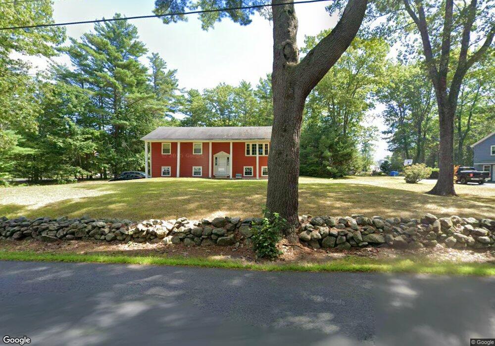
22 Newton Rd Westminster, MA 01473
Estimated Value: $471,000 - $571,000
3
Beds
2
Baths
1,500
Sq Ft
$351/Sq Ft
Est. Value
About This Home
This home is located at 22 Newton Rd, Westminster, MA 01473 and is currently estimated at $527,031, approximately $351 per square foot. 22 Newton Rd is a home located in Worcester County with nearby schools including Oakmont Regional High School.
Ownership History
Date
Name
Owned For
Owner Type
Purchase Details
Closed on
Jun 20, 2018
Sold by
Gilbreath Daniel K and Gilbreath Elise P
Bought by
Ashoryn Llc
Current Estimated Value
Purchase Details
Closed on
Jun 27, 2011
Sold by
Mass Ave Rentals Llc
Bought by
Gilbreath Daniel K and Gilbreath Elise P
Home Financials for this Owner
Home Financials are based on the most recent Mortgage that was taken out on this home.
Original Mortgage
$182,000
Interest Rate
4.63%
Mortgage Type
Purchase Money Mortgage
Purchase Details
Closed on
Sep 7, 2010
Sold by
Arch Bay Holdings Llc
Bought by
Mass Ave Rentals Llc
Purchase Details
Closed on
Aug 6, 2010
Sold by
Shackett Michael J and Arch Bay Holdings Llc
Bought by
Arch Bay Holdings Llc
Purchase Details
Closed on
Oct 25, 1996
Sold by
Westhub Rt
Bought by
Shackett Michael J and Shackett Lyndalea
Purchase Details
Closed on
Jun 3, 1987
Sold by
Whittemore Kevin D
Bought by
Westhub Rty Trust'S Tr
Create a Home Valuation Report for This Property
The Home Valuation Report is an in-depth analysis detailing your home's value as well as a comparison with similar homes in the area
Home Values in the Area
Average Home Value in this Area
Purchase History
| Date | Buyer | Sale Price | Title Company |
|---|---|---|---|
| Ashoryn Llc | -- | -- | |
| Gilbreath Daniel K | $210,000 | -- | |
| Mass Ave Rentals Llc | $128,500 | -- | |
| Arch Bay Holdings Llc | $49,000 | -- | |
| Shackett Michael J | $99,900 | -- | |
| Ashoryn Llc | -- | -- | |
| Gilbreath Daniel K | $210,000 | -- | |
| Mass Ave Rentals Llc | $128,500 | -- | |
| Arch Bay Holdings Llc | $49,000 | -- | |
| Shackett Michael J | $99,900 | -- | |
| Westhub Rty Trust'S Tr | $350,000 | -- |
Source: Public Records
Mortgage History
| Date | Status | Borrower | Loan Amount |
|---|---|---|---|
| Previous Owner | Westhub Rty Trust'S Tr | $176,000 | |
| Previous Owner | Westhub Rty Trust'S Tr | $182,000 |
Source: Public Records
Tax History Compared to Growth
Tax History
| Year | Tax Paid | Tax Assessment Tax Assessment Total Assessment is a certain percentage of the fair market value that is determined by local assessors to be the total taxable value of land and additions on the property. | Land | Improvement |
|---|---|---|---|---|
| 2025 | $4,985 | $405,300 | $124,700 | $280,600 |
| 2024 | $4,788 | $390,500 | $124,700 | $265,800 |
| 2023 | $4,533 | $347,100 | $116,600 | $230,500 |
| 2022 | $4,498 | $284,700 | $101,300 | $183,400 |
| 2021 | $4,386 | $261,700 | $88,200 | $173,500 |
| 2020 | $4,277 | $243,700 | $80,100 | $163,600 |
| 2019 | $4,170 | $228,500 | $64,900 | $163,600 |
| 2018 | $5,236 | $220,600 | $64,900 | $155,700 |
| 2017 | $3,894 | $214,100 | $64,900 | $149,200 |
| 2016 | $3,878 | $206,500 | $54,000 | $152,500 |
| 2015 | $3,818 | $201,500 | $54,000 | $147,500 |
| 2014 | $3,824 | $201,500 | $54,000 | $147,500 |
Source: Public Records
Map
Nearby Homes
- 5 Kurikka Place
- 0 Minott Rd
- 21 Plymouth St
- 334 High St
- Lot A Frog Hollow Rd
- 277 Lovewell St
- Lot 0 Old Westminster Rd
- 77 Lovewell St
- 29 Shady Ave
- 64 High St
- 73 Shady Ave
- 21 Davis Rd
- 51 Champagne Rd
- 25 Sunset Rd
- 29 Sunset Rd
- 240-Lot 2 Davis Rd
- 26 W Main St
- 4 Tandem Dr
- 207 W Princeton Rd
- 141 Sunrise Ln
- 24 Newton Rd
- Lot B Newton Rd
- 26 Newton Rd
- 18 Newton Rd
- 6 Mark Newton Rd
- 15 Newton Rd
- 3 Lighthouse Ln
- 3 Lighthouse Ln
- 3 Lighthouse Ln
- 8 Mark Newton Rd
- Lot A Mark Newton Rd
- Lot B Mark Newton Rd
- 16 Newton Rd
- 28 Newton Rd
- L-B4 Newton Rd
- L-B3 Newton Rd
- L-B Newton Rd
- 25 Newton Rd
- 5 Lighthouse Ln
- 5 Lighthouse Ln