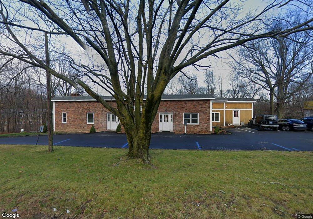
22 Newtown Rd Danbury, CT 06810
Estimated Value: $625,458
--
Bed
--
Bath
2,769
Sq Ft
$226/Sq Ft
Est. Value
About This Home
This home is located at 22 Newtown Rd, Danbury, CT 06810 and is currently estimated at $625,458, approximately $225 per square foot. 22 Newtown Rd is a home located in Fairfield County with nearby schools including Shelter Rock School, Broadview Middle School, and Danbury High School.
Ownership History
Date
Name
Owned For
Owner Type
Purchase Details
Closed on
Apr 18, 2025
Sold by
Guaragno William L
Bought by
One Step Llc
Current Estimated Value
Home Financials for this Owner
Home Financials are based on the most recent Mortgage that was taken out on this home.
Original Mortgage
$500,000
Outstanding Balance
$496,888
Interest Rate
6.67%
Mortgage Type
New Conventional
Estimated Equity
$128,570
Purchase Details
Closed on
Feb 19, 2014
Sold by
Lubin Wayne C
Bought by
Guaragno William L
Create a Home Valuation Report for This Property
The Home Valuation Report is an in-depth analysis detailing your home's value as well as a comparison with similar homes in the area
Home Values in the Area
Average Home Value in this Area
Purchase History
| Date | Buyer | Sale Price | Title Company |
|---|---|---|---|
| One Step Llc | -- | None Available | |
| One Step Llc | -- | None Available | |
| Guaragno William L | $350,000 | -- | |
| Guaragno William L | $350,000 | -- |
Source: Public Records
Mortgage History
| Date | Status | Borrower | Loan Amount |
|---|---|---|---|
| Open | One Step Llc | $500,000 |
Source: Public Records
Tax History Compared to Growth
Tax History
| Year | Tax Paid | Tax Assessment Tax Assessment Total Assessment is a certain percentage of the fair market value that is determined by local assessors to be the total taxable value of land and additions on the property. | Land | Improvement |
|---|---|---|---|---|
| 2025 | $9,175 | $367,150 | $273,910 | $93,240 |
| 2024 | $8,973 | $367,150 | $273,910 | $93,240 |
| 2023 | $8,566 | $367,150 | $273,910 | $93,240 |
| 2022 | $12,702 | $450,100 | $273,200 | $176,900 |
| 2021 | $12,423 | $450,100 | $273,200 | $176,900 |
| 2020 | $13,665 | $495,110 | $318,210 | $176,900 |
| 2019 | $13,665 | $495,110 | $318,210 | $176,900 |
| 2018 | $12,423 | $450,100 | $273,200 | $176,900 |
| 2017 | $12,402 | $428,400 | $260,300 | $168,100 |
| 2016 | $12,287 | $428,400 | $260,300 | $168,100 |
| 2015 | $12,107 | $428,400 | $260,300 | $168,100 |
| 2014 | $11,824 | $428,400 | $260,300 | $168,100 |
Source: Public Records
Map
Nearby Homes
- 5 Woodside Ave Unit 41
- 55 Cross St Unit B6
- 25 Topstone Dr
- 8 Briarwood Dr
- 156 Triangle St
- 2 Garry Knolls
- 23 Westview Dr
- 1 Skyline Dr
- 127 Triangle St
- 92 Woodcrest Ln
- 37 Faith Ln Unit 37
- 18 Meadow St
- 20 Meadow St
- 34 Morgan Ave
- 16 Springside Ave
- 51 Wildman St Unit 407
- 7 Tilden Rd
- 14 Locust Ave
- 32 Crows Nest Ln Unit 23
- 27 Crows Nest Ln Unit 8F
- 26 Newtown Rd
- 2 Old Shelter Rock Rd
- 4 Old Shelter Rock Rd
- 14 Newtown Rd Unit A9
- 14 Newtown Rd Unit A8
- 14 Newtown Rd Unit A6
- 14 Newtown Rd Unit B30
- 14 Newtown Rd Unit B29
- 14 Newtown Rd Unit B28
- 14 Newtown Rd Unit B27
- 14 Newtown Rd Unit B26
- 14 Newtown Rd Unit A5
- 14 Newtown Rd Unit B25
- 14 Newtown Rd Unit B24
- 14 Newtown Rd Unit B23
- 14 Newtown Rd Unit B22
- 14 Newtown Rd Unit B21
- 14 Newtown Rd Unit B20
- 14 Newtown Rd Unit B18
- 14 Newtown Rd Unit B17