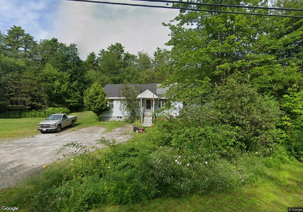
22 Ocean Point Rd East Boothbay, ME 04544
Estimated Value: $325,757 - $771,000
3
Beds
1
Bath
1,515
Sq Ft
$367/Sq Ft
Est. Value
About This Home
This home is located at 22 Ocean Point Rd, East Boothbay, ME 04544 and is currently estimated at $556,189, approximately $367 per square foot. 22 Ocean Point Rd is a home located in Lincoln County with nearby schools including Boothbay Region Elementary School and Boothbay Region High School.
Ownership History
Date
Name
Owned For
Owner Type
Purchase Details
Closed on
Sep 9, 2008
Sold by
Page Dana S and Page Lonna C
Bought by
Page Martin H and Page Kathy L
Current Estimated Value
Home Financials for this Owner
Home Financials are based on the most recent Mortgage that was taken out on this home.
Original Mortgage
$145,000
Interest Rate
6.69%
Mortgage Type
Purchase Money Mortgage
Create a Home Valuation Report for This Property
The Home Valuation Report is an in-depth analysis detailing your home's value as well as a comparison with similar homes in the area
Home Values in the Area
Average Home Value in this Area
Purchase History
| Date | Buyer | Sale Price | Title Company |
|---|---|---|---|
| Page Martin H | -- | -- |
Source: Public Records
Mortgage History
| Date | Status | Borrower | Loan Amount |
|---|---|---|---|
| Closed | Page Martin H | $145,000 |
Source: Public Records
Tax History Compared to Growth
Tax History
| Year | Tax Paid | Tax Assessment Tax Assessment Total Assessment is a certain percentage of the fair market value that is determined by local assessors to be the total taxable value of land and additions on the property. | Land | Improvement |
|---|---|---|---|---|
| 2024 | $1,859 | $163,765 | $60,384 | $103,381 |
| 2023 | $1,646 | $163,765 | $60,384 | $103,381 |
| 2022 | $1,523 | $163,765 | $60,384 | $103,381 |
| 2021 | $1,564 | $163,765 | $60,384 | $103,381 |
| 2020 | $1,572 | $163,765 | $60,384 | $103,381 |
| 2019 | $1,548 | $163,765 | $60,384 | $103,381 |
| 2018 | $1,523 | $163,765 | $60,384 | $103,381 |
| 2017 | $1,980 | $215,200 | $67,600 | $147,600 |
| 2016 | $1,894 | $215,200 | $67,600 | $147,600 |
| 2015 | $1,883 | $215,200 | $67,600 | $147,600 |
| 2014 | $1,829 | $215,200 | $67,600 | $147,600 |
Source: Public Records
Map
Nearby Homes
- 98 Meadow Cove Rd
- 5 Massachusetts Ave
- 23 Meadow Cove Rd
- 35 Rice Rd
- 210 Ocean Point Rd
- 25 Pineview Ridge Rd
- 239 Ocean Point Rd
- 127 Appalachee Rd
- 12 Westwind Dr
- 28 & 31 Will Alley Rd
- 74 & 76 Bay St
- 86 Firth Dr
- 302 Townsend Ave
- 31 Bay St
- 66 Townsend Ave
- 43 Oak St
- 66 Townsend Avenue & 43 Oak St
- 37 Townsend Ave
- 34 Townsend Ave
- 27 Townsend Ave
- 12 Ocean Point Rd
- 0 Ocean Point Unit 810150
- 0 Ocean Point Unit 583183
- 0 Ocean Point Unit 582745
- 0 Ocean Point Unit 520483
- 0 Ocean Point Unit 365109
- 0 Ocean Point Unit 468629
- 0 Ocean Point Unit 587613
- 0 Ocean Point Unit 827468
- 0 Ocean Point Unit 712622
- 0 Ocean Point Unit 516759
- 0 Ocean Point Unit 172393
- 0 Ocean Point Unit 963233
- Lot 1 Ocean Point Rd
- 109 Presley Dr
- 260 Ocean Point Rd
- Lot 53 Nichols Rd
- 0 Ocean Point Rd Unit 278396
- 0 Ocean Point Rd Unit 276749
- 0 Ocean Point Rd Unit 271524