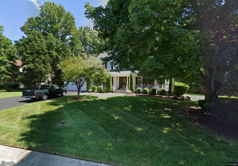
22 Pheasant Ln La Plata, MD 20646
Estimated Value: $461,028 - $574,000
Studio
3
Baths
2,608
Sq Ft
$198/Sq Ft
Est. Value
About This Home
This home is located at 22 Pheasant Ln, La Plata, MD 20646 and is currently estimated at $515,507, approximately $197 per square foot. 22 Pheasant Ln is a home located in Charles County with nearby schools including Dr. James Craik Elementary School, Milton M. Somers Middle School, and Maurice J. McDonough High School.
Ownership History
Date
Name
Owned For
Owner Type
Purchase Details
Closed on
Jun 17, 2004
Sold by
Leonard James L and Leonard Loraine L
Bought by
Leonard Loraine L Trs
Current Estimated Value
Purchase Details
Closed on
Jan 21, 1987
Sold by
Tradewind Development Inc
Bought by
Leonard James L and Leonard Loraine L
Purchase Details
Closed on
Jun 27, 1985
Sold by
Maryland Quality Homes Inc
Bought by
Tradewind Development Inc
Home Financials for this Owner
Home Financials are based on the most recent Mortgage that was taken out on this home.
Original Mortgage
$262,980
Interest Rate
12.05%
Create a Home Valuation Report for This Property
The Home Valuation Report is an in-depth analysis detailing your home's value as well as a comparison with similar homes in the area
Home Values in the Area
Average Home Value in this Area
Purchase History
| Date | Buyer | Sale Price | Title Company |
|---|---|---|---|
| Leonard Loraine L Trs | -- | -- | |
| Leonard James L | $165,900 | -- | |
| Tradewind Development Inc | $142,500 | -- |
Source: Public Records
Mortgage History
| Date | Status | Borrower | Loan Amount |
|---|---|---|---|
| Previous Owner | Tradewind Development Inc | $262,980 |
Source: Public Records
Tax History
| Year | Tax Paid | Tax Assessment Tax Assessment Total Assessment is a certain percentage of the fair market value that is determined by local assessors to be the total taxable value of land and additions on the property. | Land | Improvement |
|---|---|---|---|---|
| 2025 | -- | $421,000 | -- | -- |
| 2024 | $6,110 | $395,800 | $0 | $0 |
| 2023 | $6,482 | $370,600 | $90,600 | $280,000 |
| 2022 | $5,037 | $352,000 | $0 | $0 |
| 2021 | $4,745 | $333,400 | $0 | $0 |
| 2020 | $4,745 | $314,800 | $75,600 | $239,200 |
| 2019 | $4,763 | $314,800 | $75,600 | $239,200 |
| 2018 | $4,743 | $314,800 | $75,600 | $239,200 |
| 2017 | $4,846 | $319,900 | $0 | $0 |
| 2016 | -- | $312,633 | $0 | $0 |
| 2015 | $4,748 | $305,367 | $0 | $0 |
| 2014 | $4,748 | $298,100 | $0 | $0 |
Source: Public Records
Map
Nearby Homes
- 56 Camden Cir
- 6 Gramby Ct
- 367 Forest Edge Ave
- 549 Fawn Meadow Ln
- 19 Walnut Hill Rd
- 270 Williamsburg Cir
- 202 Williamsburg Cir
- 203 Port Tobacco Rd
- 107 Howard St
- 303 Charles St
- 505 Washington Ave
- 105 Hibiscus Ct
- 50 Hibiscus Ct
- 8802 Port Tobacco Rd
- 458 Mossy Grove Ln
- 305 Centennial St Unit K
- 0 Glen Albin Rd Unit 1002259446
- 82 Little Creek Ln
- 8715 Hill Spring Dr
- 0 Crain Hwy Unit MDCH2038304
Your Personal Tour Guide
Ask me questions while you tour the home.