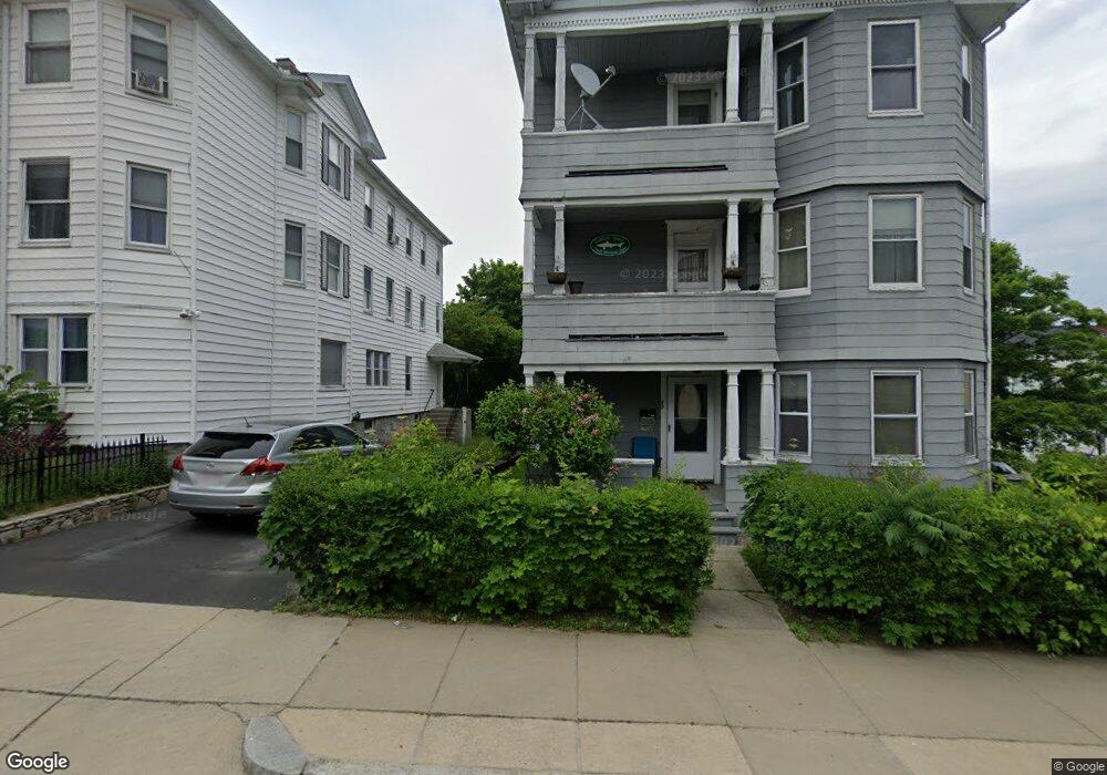
22 Plantation St Worcester, MA 01604
Grafton Hill NeighborhoodEstimated Value: $616,270 - $797,000
9
Beds
3
Baths
3,971
Sq Ft
$185/Sq Ft
Est. Value
About This Home
This home is located at 22 Plantation St, Worcester, MA 01604 and is currently estimated at $735,318, approximately $185 per square foot. 22 Plantation St is a home located in Worcester County with nearby schools including Jacob Hiatt Magnet School, Chandler Magnet, and Rice Square Elementary School.
Ownership History
Date
Name
Owned For
Owner Type
Purchase Details
Closed on
Jul 7, 2021
Sold by
Ackerman Robert V
Bought by
Alptekin Ayse
Current Estimated Value
Purchase Details
Closed on
Sep 26, 2007
Sold by
Belmonte Armand E and Belmonte Germaine T
Bought by
Ackerman Robert and Strong Kenneth R
Home Financials for this Owner
Home Financials are based on the most recent Mortgage that was taken out on this home.
Original Mortgage
$257,400
Interest Rate
6.65%
Mortgage Type
Purchase Money Mortgage
Create a Home Valuation Report for This Property
The Home Valuation Report is an in-depth analysis detailing your home's value as well as a comparison with similar homes in the area
Home Values in the Area
Average Home Value in this Area
Purchase History
We collect this data history from publicly available records. To have your information removed, we recommend requesting removal directly through your county’s website.
| Date | Buyer | Sale Price | Title Company |
|---|---|---|---|
| Alptekin Ayse | $505,000 | None Available | |
| Ackerman Robert | $286,000 | -- |
Source: Public Records
Mortgage History
We collect this data history from publicly available records. To have your information removed, we recommend requesting removal directly through your county’s website.
| Date | Status | Borrower | Loan Amount |
|---|---|---|---|
| Previous Owner | Ackerman Robert | $257,400 |
Source: Public Records
Tax History
| Year | Tax Paid | Tax Assessment Tax Assessment Total Assessment is a certain percentage of the fair market value that is determined by local assessors to be the total taxable value of land and additions on the property. | Land | Improvement |
|---|---|---|---|---|
| 2025 | $8,835 | $669,800 | $107,700 | $562,100 |
| 2024 | $8,169 | $594,100 | $107,700 | $486,400 |
| 2023 | $7,820 | $545,300 | $93,600 | $451,700 |
| 2022 | $6,813 | $447,900 | $74,900 | $373,000 |
| 2021 | $6,307 | $387,400 | $59,900 | $327,500 |
| 2020 | $5,851 | $344,200 | $59,900 | $284,300 |
| 2019 | $4,536 | $252,000 | $53,900 | $198,100 |
| 2018 | $4,459 | $235,800 | $53,900 | $181,900 |
| 2017 | $4,209 | $219,000 | $53,900 | $165,100 |
| 2016 | $4,009 | $194,500 | $40,800 | $153,700 |
| 2015 | $3,904 | $194,500 | $40,800 | $153,700 |
| 2014 | $3,801 | $194,500 | $40,800 | $153,700 |
Source: Public Records
Map
Nearby Homes
- 56 Cohasset St
- 55 Standish St
- 15 Houghton St Unit 12
- 81 Pilgrim Ave
- 80 Delmont Ave
- 133 Puritan Ave
- 34 Dartmouth St
- 64 Park Terrace Rd
- 25 Almont Ave
- 43 Orient St
- 9-11 Barclay St
- 24 Dell Ave
- 30 Rice Ln Unit 5
- 20 Mott St
- 1 Brightwood Ave
- 43 Robin Rd
- 128 Derby St
- 25 Shannon St
- 20 Kenberma Rd
- 23 Suffolk St
- 30 Plantation St
- 30 Plantation St Unit 2
- 30 Plantation St Unit 3
- 7 Leon St
- 18 Plantation St
- 26 Village St
- 28 Village St
- 2 Village St
- 30 Village St
- 34 Plantation St
- 32 Village St
- 34 Village St
- 36 Village St
- 11 Leon St
- 6 Leon St
- 6 Leon St
- 6 Leon St Unit 3
- 6 Leon St Unit 2
- 4 Village St
- 16 Plantation St
Your Personal Tour Guide
Ask me questions while you tour the home.