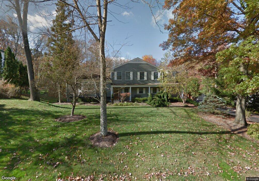
22 Rickland Dr Randolph, NJ 07869
Estimated Value: $830,000 - $958,000
Studio
--
Bath
2,877
Sq Ft
$316/Sq Ft
Est. Value
About This Home
This home is located at 22 Rickland Dr, Randolph, NJ 07869 and is currently estimated at $908,463, approximately $315 per square foot. 22 Rickland Dr is a home located in Morris County with nearby schools including Randolph High School, Randolph Middle School, and Apple Montessori Schools and Camps - Randolph.
Ownership History
Date
Name
Owned For
Owner Type
Purchase Details
Closed on
Oct 21, 2024
Sold by
Schwartz Daniel J and Schwartz Norma J
Bought by
Schwartz Daniel J and Schwartz Norma J
Current Estimated Value
Purchase Details
Closed on
Aug 12, 2004
Sold by
Achwartz Daniel
Bought by
Schwartz Daniel and Schwartz Norma
Purchase Details
Closed on
Apr 15, 2003
Sold by
Schwartz Daniel
Bought by
Schwartz Daniel and Schwartz Norma
Create a Home Valuation Report for This Property
The Home Valuation Report is an in-depth analysis detailing your home's value as well as a comparison with similar homes in the area
Home Values in the Area
Average Home Value in this Area
Purchase History
| Date | Buyer | Sale Price | Title Company |
|---|---|---|---|
| Schwartz Daniel J | -- | None Listed On Document | |
| Schwartz Daniel J | -- | None Listed On Document | |
| Schwartz Daniel | -- | -- | |
| Schwartz Daniel | -- | -- |
Source: Public Records
Tax History
| Year | Tax Paid | Tax Assessment Tax Assessment Total Assessment is a certain percentage of the fair market value that is determined by local assessors to be the total taxable value of land and additions on the property. | Land | Improvement |
|---|---|---|---|---|
| 2025 | $16,176 | $571,400 | $246,700 | $324,700 |
| 2024 | $15,771 | $571,400 | $246,700 | $324,700 |
| 2023 | $15,771 | $571,400 | $246,700 | $324,700 |
| 2022 | $14,904 | $571,400 | $246,700 | $324,700 |
| 2021 | $14,904 | $571,400 | $246,700 | $324,700 |
| 2020 | $14,999 | $571,400 | $246,700 | $324,700 |
| 2019 | $14,828 | $571,400 | $246,700 | $324,700 |
| 2018 | $14,639 | $571,400 | $246,700 | $324,700 |
| 2017 | $14,456 | $571,400 | $246,700 | $324,700 |
| 2016 | $14,688 | $401,300 | $158,600 | $242,700 |
| 2015 | $14,261 | $401,300 | $158,600 | $242,700 |
| 2014 | $14,036 | $401,300 | $158,600 | $242,700 |
Source: Public Records
Map
Nearby Homes
- 10 Bayberry Ln
- 46 W Hanover Ave
- 3 Springhill Rd
- 10 Forrest Rd
- 5 Elaine Ct
- 14 Fieldstone Ct
- 8 Cherry Ln
- 3 Woodmont Dr
- 267 Washington Valley Rd
- 4A Southview Rd
- 33 Albert Ct
- 15 Southview Rd
- 138 Shady Ln
- 384 Millbrook Ave
- 20 Mount Pleasant Rd
- 20 Mount Pleasant Rd
- 33 Shongum Rd
- 24 Raynor Rd
- 4 Ascot Ln
- 34 Starlight Dr
Your Personal Tour Guide
Ask me questions while you tour the home.