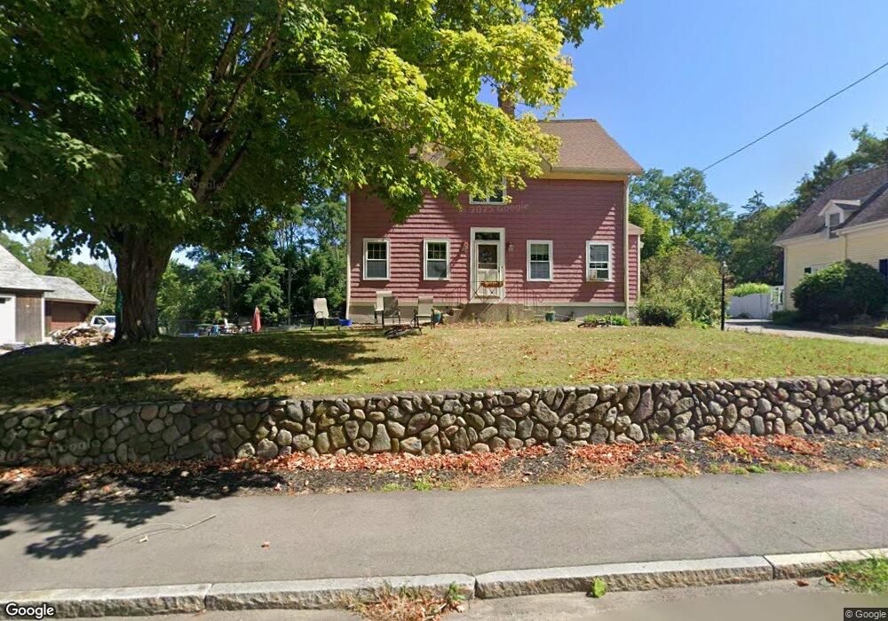
22 S Worcester St Norton, MA 02766
Estimated Value: $646,885 - $705,000
3
Beds
2
Baths
2,610
Sq Ft
$262/Sq Ft
Est. Value
About This Home
This home is located at 22 S Worcester St, Norton, MA 02766 and is currently estimated at $684,721, approximately $262 per square foot. 22 S Worcester St is a home located in Bristol County with nearby schools including J.C. Solmonese Elementary School, Henri A. Yelle Elementary School, and Norton Middle School.
Ownership History
Date
Name
Owned For
Owner Type
Purchase Details
Closed on
Aug 5, 1996
Sold by
Angus Robert D and Angus Bruce C
Bought by
Chancey Robert A
Current Estimated Value
Home Financials for this Owner
Home Financials are based on the most recent Mortgage that was taken out on this home.
Original Mortgage
$104,000
Outstanding Balance
$6,808
Interest Rate
8.27%
Mortgage Type
Purchase Money Mortgage
Estimated Equity
$677,913
Create a Home Valuation Report for This Property
The Home Valuation Report is an in-depth analysis detailing your home's value as well as a comparison with similar homes in the area
Home Values in the Area
Average Home Value in this Area
Purchase History
| Date | Buyer | Sale Price | Title Company |
|---|---|---|---|
| Chancey Robert A | $130,000 | -- |
Source: Public Records
Mortgage History
| Date | Status | Borrower | Loan Amount |
|---|---|---|---|
| Open | Chancey Robert A | $104,000 |
Source: Public Records
Tax History
| Year | Tax Paid | Tax Assessment Tax Assessment Total Assessment is a certain percentage of the fair market value that is determined by local assessors to be the total taxable value of land and additions on the property. | Land | Improvement |
|---|---|---|---|---|
| 2025 | $77 | $590,000 | $183,900 | $406,100 |
| 2024 | $7,288 | $562,800 | $175,200 | $387,600 |
| 2023 | $6,907 | $531,700 | $165,200 | $366,500 |
| 2022 | $6,530 | $457,900 | $150,200 | $307,700 |
| 2021 | $44 | $413,500 | $143,100 | $270,400 |
| 2020 | $5,950 | $402,000 | $138,900 | $263,100 |
| 2019 | $46 | $387,300 | $133,600 | $253,700 |
| 2018 | $5,577 | $367,900 | $133,600 | $234,300 |
| 2017 | $47 | $351,800 | $133,600 | $218,200 |
| 2016 | $5,206 | $333,500 | $133,600 | $199,900 |
| 2015 | $5,019 | $326,100 | $131,000 | $195,100 |
| 2014 | $4,597 | $299,100 | $112,200 | $186,900 |
Source: Public Records
Map
Nearby Homes
- 55 Sturdy St
- 108 S Worcester St
- 170 S Worcester St Unit 3
- 214 Pike Ave
- 0 Pike Ave
- 4 Village Way Unit F
- 123 Pike Ave
- 933 Pleasant St
- 11 Cherry Tree Ln
- 26 Barrows Ct
- 366 & 0 Pike Ave
- 19 Cherry Tree Ln
- 143 Oak St Unit 10
- 127 John Scott Blvd
- 10 Walter St
- 14 Country Club Way
- 125 John Scott Blvd
- 8 Kasmira Way
- 827 Pike Ave
- 1 Robin Cir Unit 2
- 24 S Worcester St
- 26 S Worcester St
- 53 Sturdy St
- 1 S Worcester St Unit 1
- 1 S Worcester St
- 28 S Worcester St
- 13 S Worcester St
- 2 S Worcester St
- 0 S
- 30 S Worcester St
- 5 Union Rd
- 7 Union Rd
- 320 W Main St Unit 1
- 320 W Main St
- 316 W Main St
- 34 S Worcester St Unit B
- 34 S Worcester St Unit 2
- 34 S Worcester St
- 9 Union Rd
- 2 Union Rd Unit 7