Estimated Value: $532,000 - $659,000
3
Beds
2
Baths
1,666
Sq Ft
$346/Sq Ft
Est. Value
About This Home
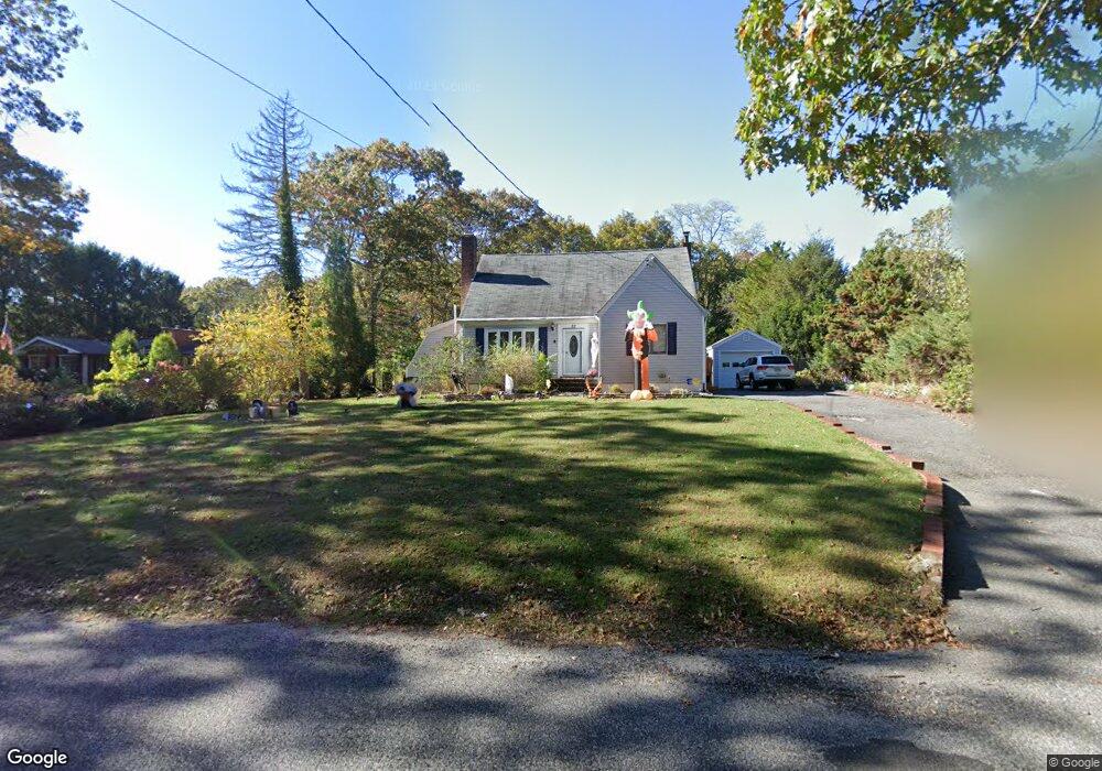
This home is located at 22 Sally Ln, Ridge, NY 11961 and is currently estimated at $577,253, approximately $346 per square foot. 22 Sally Ln is a home located in Suffolk County with nearby schools including Longwood Junior High School, Longwood Middle School, and Longwood Senior High School.
Ownership History
Date
Name
Owned For
Owner Type
Purchase Details
Closed on
Apr 7, 2021
Sold by
Lagrasse Jeffrey and Lagrasse Shannon D
Bought by
Lagrasse Jeffrey
Current Estimated Value
Home Financials for this Owner
Home Financials are based on the most recent Mortgage that was taken out on this home.
Original Mortgage
$321,021
Interest Rate
3.1%
Mortgage Type
FHA
Purchase Details
Closed on
Oct 23, 2008
Sold by
Quinones Daryl
Bought by
Lagrasse Shannon D
Home Financials for this Owner
Home Financials are based on the most recent Mortgage that was taken out on this home.
Original Mortgage
$289,726
Interest Rate
6.08%
Purchase Details
Closed on
May 30, 1996
Sold by
Kneisel Gerard K and Kneisel Lisa
Bought by
Quinones Daryl
Create a Home Valuation Report for This Property
The Home Valuation Report is an in-depth analysis detailing your home's value as well as a comparison with similar homes in the area
Home Values in the Area
Average Home Value in this Area
Purchase History
| Date | Buyer | Sale Price | Title Company |
|---|---|---|---|
| Lagrasse Jeffrey | -- | None Available | |
| Lagrasse Shannon D | $295,000 | Michael Croston | |
| Quinones Daryl | $142,000 | Safe Harbor Title Agency Ltd |
Source: Public Records
Mortgage History
| Date | Status | Borrower | Loan Amount |
|---|---|---|---|
| Previous Owner | Lagrasse Jeffrey | $321,021 | |
| Previous Owner | Lagrasse Shannon D | $289,726 |
Source: Public Records
Tax History Compared to Growth
Tax History
| Year | Tax Paid | Tax Assessment Tax Assessment Total Assessment is a certain percentage of the fair market value that is determined by local assessors to be the total taxable value of land and additions on the property. | Land | Improvement |
|---|---|---|---|---|
| 2024 | $8,572 | $2,150 | $100 | $2,050 |
| 2023 | $8,572 | $2,150 | $100 | $2,050 |
| 2022 | $7,717 | $2,150 | $100 | $2,050 |
| 2021 | $7,717 | $2,150 | $100 | $2,050 |
| 2020 | $7,901 | $2,150 | $100 | $2,050 |
| 2019 | $7,901 | $0 | $0 | $0 |
| 2018 | $7,380 | $2,150 | $100 | $2,050 |
| 2017 | $7,380 | $2,150 | $100 | $2,050 |
| 2016 | $7,304 | $2,150 | $100 | $2,050 |
| 2015 | -- | $2,150 | $100 | $2,050 |
| 2014 | -- | $2,150 | $100 | $2,050 |
Source: Public Records
Map
Nearby Homes
- 10 Sally Ln
- 37 Pond Ln
- 20 Ruth Ln
- Lot #6 Cardinal Ct
- Lot 39 Fox Run Ct
- 0 Elizabeth Way Unit KEY803253
- 28 Francis Mooney Dr
- 64 Sally Ln
- 2405 (Lot 5) Brickyard Rd
- 8 Marc Dr
- 30 Elizabeth Way
- 3 Farmhouse Dr
- 11 Patrick Ln
- 33 Highview Ln
- 70 Gull Dip Rd
- 202 Belfast Ln
- 41 Woodbrook Dr
- 323 Brownfield Dr
- 349 Randall Rd
- 407 Belfast Ln