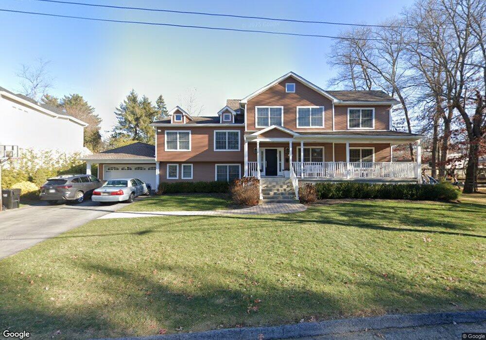
22 Sands Point Rd Monsey, NY 10952
Estimated Value: $541,320 - $2,223,000
3
Beds
3
Baths
1,740
Sq Ft
$818/Sq Ft
Est. Value
About This Home
This home is located at 22 Sands Point Rd, Monsey, NY 10952 and is currently estimated at $1,423,080, approximately $817 per square foot. 22 Sands Point Rd is a home located in Rockland County with nearby schools including Grandview Elementary School, Pomona Middle School, and Ramapo High School.
Ownership History
Date
Name
Owned For
Owner Type
Purchase Details
Closed on
Oct 24, 2008
Sold by
Meiselman Nathan I and Meiselman Leonie S
Bought by
Weiss Joel and Weiss Rachel Eve
Current Estimated Value
Home Financials for this Owner
Home Financials are based on the most recent Mortgage that was taken out on this home.
Original Mortgage
$417,000
Outstanding Balance
$270,325
Interest Rate
5.83%
Mortgage Type
Purchase Money Mortgage
Estimated Equity
$1,152,755
Create a Home Valuation Report for This Property
The Home Valuation Report is an in-depth analysis detailing your home's value as well as a comparison with similar homes in the area
Home Values in the Area
Average Home Value in this Area
Purchase History
| Date | Buyer | Sale Price | Title Company |
|---|---|---|---|
| Weiss Joel | $535,600 | Commonwealth Land Title Insu |
Source: Public Records
Mortgage History
| Date | Status | Borrower | Loan Amount |
|---|---|---|---|
| Open | Weiss Joel | $417,000 |
Source: Public Records
Tax History Compared to Growth
Tax History
| Year | Tax Paid | Tax Assessment Tax Assessment Total Assessment is a certain percentage of the fair market value that is determined by local assessors to be the total taxable value of land and additions on the property. | Land | Improvement |
|---|---|---|---|---|
| 2024 | $23,470 | $100,200 | $15,800 | $84,400 |
| 2023 | $23,470 | $100,200 | $15,800 | $84,400 |
| 2022 | $23,288 | $100,200 | $15,800 | $84,400 |
| 2021 | $23,288 | $100,200 | $15,800 | $84,400 |
| 2020 | $22,702 | $100,200 | $15,800 | $84,400 |
| 2019 | $24,202 | $100,200 | $15,800 | $84,400 |
| 2018 | $24,202 | $100,200 | $15,800 | $84,400 |
| 2017 | $23,866 | $100,200 | $15,800 | $84,400 |
| 2016 | $23,664 | $100,200 | $15,800 | $84,400 |
| 2015 | -- | $100,200 | $15,800 | $84,400 |
| 2014 | -- | $92,700 | $15,800 | $76,900 |
Source: Public Records
Map
Nearby Homes
- 24 Waverly Place
- 14 Calvert Dr Unit 102
- 12 Cloverdale Ln
- 33 Briarcliff Dr
- 29 Calvert Dr Unit 115
- 25 Smolley Dr
- 352 Blauvelt Rd Unit 202
- 151 Blauvelt Rd Unit 116
- 141 Blauvelt Rd Unit 103
- 169 Route 306 Unit 101
- 21 Briarcliff Dr
- 1 Manor Dr Unit 102
- 1 Manor Dr Unit 201
- 1 Manor Dr Unit 112
- 1 Manor Dr Unit 202
- 40 Calvert Dr
- 244 Blauvelt Rd Unit 213
- 242 Blauvelt Rd Unit 201
- 2 Wiener Dr Unit 101
- 27 Highview Rd
- 20 Sands Point Rd
- 34 Carlton Rd
- 15 Dover Terrace
- 32 Carlton Rd
- 21 Sands Point Rd
- 38 Carlton Rd
- 11 Dover Terrace
- 18 Sands Point Rd
- 30 Carlton Rd
- 17 Dover Terrace
- 19 Sands Point Rd
- 40 Carlton Rd
- 55 Briarcliff Dr
- 9 Dover Terrace
- 17 Sands Point Rd
- 16 Sands Point Rd
- 12 Dover Terrace
- 28 Carlton Rd
- 39 Carlton Rd
- 19 Dover Terrace