Estimated Value: $130,000 - $211,000
4
Beds
2
Baths
1,800
Sq Ft
$93/Sq Ft
Est. Value
About This Home
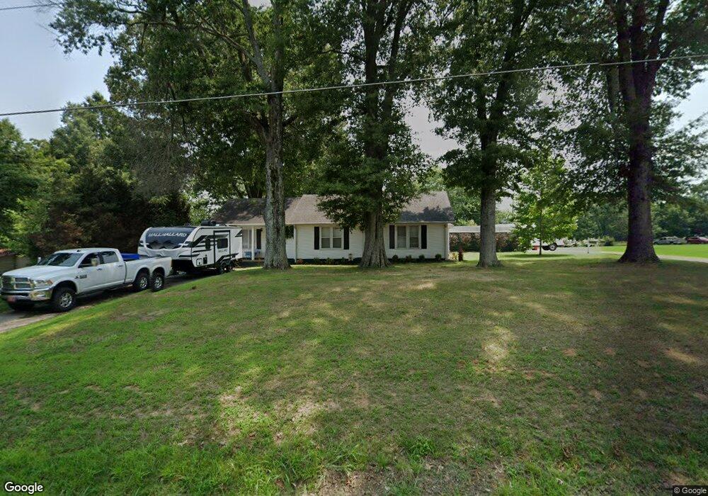
This home is located at 22 State Route 185 Unit 22, Dyer, TN 38330 and is currently estimated at $167,541, approximately $93 per square foot. 22 State Route 185 Unit 22 is a home located in Gibson County with nearby schools including Dyer Elementary School and Gibson County High School.
Ownership History
Date
Name
Owned For
Owner Type
Purchase Details
Closed on
Aug 5, 2021
Sold by
Spellings Joseph A and Spellings Blake
Bought by
Bradshaw Kayla A
Current Estimated Value
Home Financials for this Owner
Home Financials are based on the most recent Mortgage that was taken out on this home.
Original Mortgage
$133,000
Outstanding Balance
$121,119
Interest Rate
3%
Mortgage Type
New Conventional
Estimated Equity
$46,422
Purchase Details
Closed on
Jun 11, 2021
Sold by
Cole William Jeremy
Bought by
Spellings Joseph A and Spellings Blake
Home Financials for this Owner
Home Financials are based on the most recent Mortgage that was taken out on this home.
Original Mortgage
$133,000
Outstanding Balance
$121,119
Interest Rate
3%
Mortgage Type
New Conventional
Estimated Equity
$46,422
Purchase Details
Closed on
Oct 20, 2020
Sold by
Yergin Macie Lynn and Estate Of Rita June Cole
Bought by
Cole William Jeremy
Purchase Details
Closed on
Jul 30, 2013
Sold by
Wells Fargo Bank National
Bought by
Cole Rita and Cole Charlie
Purchase Details
Closed on
Apr 23, 2013
Sold by
Oliver Thomas
Bought by
Wells Fargo Bank National Asso and Option One Mtg Loan Trust
Purchase Details
Closed on
Oct 17, 2006
Sold by
Barron Billy Raymond
Bought by
Oliver Carol
Purchase Details
Closed on
May 20, 2006
Sold by
Campbell Martha C
Bought by
Barron Billy Raymond
Home Financials for this Owner
Home Financials are based on the most recent Mortgage that was taken out on this home.
Original Mortgage
$45,000
Interest Rate
6.44%
Purchase Details
Closed on
Mar 21, 2006
Sold by
Campbell Robert Lynn
Bought by
Campbell Martha C
Home Financials for this Owner
Home Financials are based on the most recent Mortgage that was taken out on this home.
Original Mortgage
$45,000
Interest Rate
6.44%
Purchase Details
Closed on
Oct 5, 2005
Sold by
Campbell Noel C
Bought by
Campbell Robert Lynn
Purchase Details
Closed on
Mar 7, 1958
Bought by
Campbell Noel C and Campbell Martha
Create a Home Valuation Report for This Property
The Home Valuation Report is an in-depth analysis detailing your home's value as well as a comparison with similar homes in the area
Home Values in the Area
Average Home Value in this Area
Purchase History
| Date | Buyer | Sale Price | Title Company |
|---|---|---|---|
| Bradshaw Kayla A | $140,000 | None Available | |
| Spellings Joseph A | $73,000 | None Available | |
| Cole William Jeremy | $1,000 | None Available | |
| Cole Rita | $53,554 | -- | |
| Wells Fargo Bank National Asso | $53,000 | -- | |
| Oliver Carol | $100,000 | -- | |
| Barron Billy Raymond | $45,000 | -- | |
| Campbell Martha C | -- | -- | |
| Campbell Robert Lynn | -- | -- | |
| Campbell Noel C | -- | -- |
Source: Public Records
Mortgage History
| Date | Status | Borrower | Loan Amount |
|---|---|---|---|
| Open | Bradshaw Kayla A | $133,000 | |
| Previous Owner | Campbell Noel C | $45,000 |
Source: Public Records
Tax History Compared to Growth
Tax History
| Year | Tax Paid | Tax Assessment Tax Assessment Total Assessment is a certain percentage of the fair market value that is determined by local assessors to be the total taxable value of land and additions on the property. | Land | Improvement |
|---|---|---|---|---|
| 2024 | $607 | $28,275 | $2,450 | $25,825 |
| 2023 | $780 | $25,050 | $2,125 | $22,925 |
| 2022 | $763 | $25,050 | $2,125 | $22,925 |
| 2021 | $763 | $25,050 | $2,125 | $22,925 |
| 2020 | $386 | $12,700 | $2,125 | $10,575 |
| 2019 | $386 | $12,700 | $2,125 | $10,575 |
| 2018 | $385 | $12,200 | $2,125 | $10,075 |
| 2017 | $379 | $12,200 | $2,125 | $10,075 |
| 2016 | $379 | $12,200 | $2,125 | $10,075 |
| 2015 | -- | $12,200 | $2,125 | $10,075 |
| 2014 | -- | $12,200 | $2,125 | $10,075 |
Source: Public Records
Map
Nearby Homes
- 217 Central St
- 299 E Walnut St
- 354 E Maple St
- 163 Monroe St
- 139 Peach St
- 142 S Poplar St
- 137 W South St
- 548 E College St
- 246 Thomas St
- 148 Scattered Acres Loop
- 153 New Hope St
- 205 Division St
- 106 Scattered Acres Dr
- 0 Royal St
- 0 Reed Rd
- 208 & 210 Lee St
- 117 Washington St
- 288 W Broad St
- 173 Orr Rd
- 0 Ernest Paschall Rd Unit RRA45339
- 21 Tennessee 185
- 21 State Route 185
- 63 Iron Mountain Rd
- 58 Iron Mountain Rd
- 30 State Route 185 Unit 30
- 32 State Route 185 Unit 32
- 55 Iron Mountain Rd
- 9 State Route 185 Unit 9
- 23 State Route 185 Unit 23
- 23 Tennessee 185
- 34 State Route 185 Unit 34
- 34 State Route 185 Unit 48
- 5 State Route 185
- 50 Iron Mountain Rd
- 46 Iron Mountain Rd
- 45 Iron Mountain Rd
- 41 Iron Mountain Rd
- 34 Iron Mountain Rd
- 31 Sand Rd
- 823 S Main St