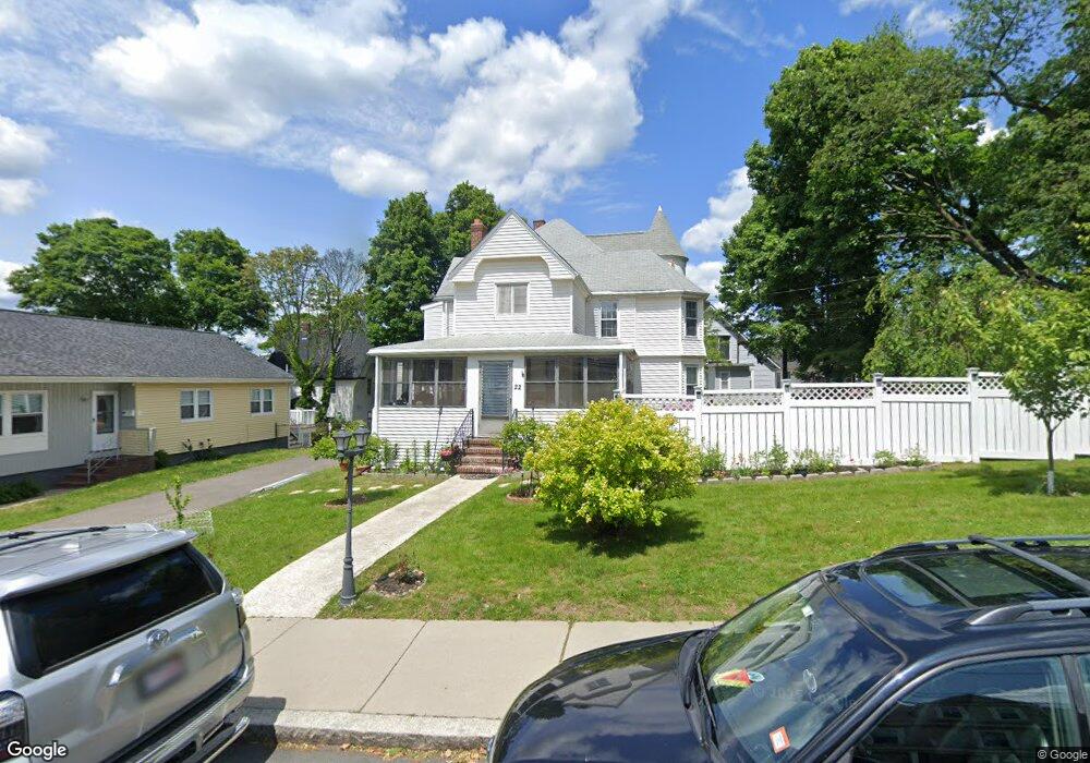
22 Summit Ave Unit R Winthrop, MA 02152
Downtown Winthrop NeighborhoodEstimated Value: $840,000 - $1,062,000
1
Bed
1
Bath
650
Sq Ft
$1,491/Sq Ft
Est. Value
About This Home
This home is located at 22 Summit Ave Unit R, Winthrop, MA 02152 and is currently estimated at $969,127, approximately $1,490 per square foot. 22 Summit Ave Unit R is a home located in Suffolk County with nearby schools including William P. Gorman/Fort Banks Elementary School, Arthur T. Cummings Elementary School, and Winthrop Middle School.
Ownership History
Date
Name
Owned For
Owner Type
Purchase Details
Closed on
Mar 28, 2014
Sold by
Figler Burton D and Figler Clare E
Bought by
Freed David A and Gao Wei
Current Estimated Value
Home Financials for this Owner
Home Financials are based on the most recent Mortgage that was taken out on this home.
Original Mortgage
$382,250
Outstanding Balance
$289,813
Interest Rate
4.27%
Mortgage Type
New Conventional
Estimated Equity
$679,314
Create a Home Valuation Report for This Property
The Home Valuation Report is an in-depth analysis detailing your home's value as well as a comparison with similar homes in the area
Home Values in the Area
Average Home Value in this Area
Purchase History
| Date | Buyer | Sale Price | Title Company |
|---|---|---|---|
| Freed David A | $449,750 | -- |
Source: Public Records
Mortgage History
| Date | Status | Borrower | Loan Amount |
|---|---|---|---|
| Open | Freed David A | $382,250 |
Source: Public Records
Tax History
| Year | Tax Paid | Tax Assessment Tax Assessment Total Assessment is a certain percentage of the fair market value that is determined by local assessors to be the total taxable value of land and additions on the property. | Land | Improvement |
|---|---|---|---|---|
| 2025 | $8,577 | $831,100 | $369,000 | $462,100 |
| 2024 | $7,864 | $754,700 | $354,600 | $400,100 |
| 2023 | $8,351 | $780,500 | $324,600 | $455,900 |
| 2022 | $8,220 | $699,000 | $289,700 | $409,300 |
| 2021 | $7,992 | $630,300 | $258,700 | $371,600 |
| 2020 | $7,792 | $617,400 | $258,700 | $358,700 |
| 2019 | $7,664 | $581,500 | $238,400 | $343,100 |
| 2018 | $7,462 | $527,000 | $204,600 | $322,400 |
| 2017 | $6,807 | $472,400 | $181,100 | $291,300 |
| 2016 | $6,462 | $420,400 | $157,500 | $262,900 |
| 2015 | $5,350 | $373,100 | $152,900 | $220,200 |
| 2014 | $5,180 | $332,500 | $142,200 | $190,300 |
Source: Public Records
Map
Nearby Homes
- 80 Shirley St
- 800 Governors Dr Unit 6
- 100 Governors Dr Unit 118
- 140 Shirley St Unit 201
- 140 Shirley St Unit 310
- 140 Shirley St Unit 204
- 144 Quincy Ave
- 2 Deane Ave
- 22 Upland Rd
- 441 Winthrop St
- 426 Winthrop St
- 12 Sewall Ave Unit 3
- 201 Cliff Ave
- 53 Trident Ave Unit 204
- 37 Trident Ave
- 279 Shirley St Unit 2
- 3 Seal Harbor Rd Unit 137
- 1 Seal Harbor Rd Unit 415
- 1 Seal Harbor Rd Unit 210
- 1 Seal Harbor Rd Unit 701
- 22 Summit Ave
- 16 Summit Ave
- 25 Summit Ave
- 19 Summit Ave Unit 21
- 15 Summit Ave
- 19 Sagamore Ave
- 36 Summit Ave Unit 3
- 36 Summit Ave Unit 1
- 36-38 Summit Ave
- 5 Sagamore Ave
- 11 Summit Ave
- 11 Summit Ave Unit 1
- 31 Summit Ave
- 31 Summit Ave Unit B
- 31 Summit Ave Unit 1
- 35 Summit Ave
- 171 Revere St
- 181 Revere St
- 5 Summit Ave
- 23 Sagamore Ave
Your Personal Tour Guide
Ask me questions while you tour the home.