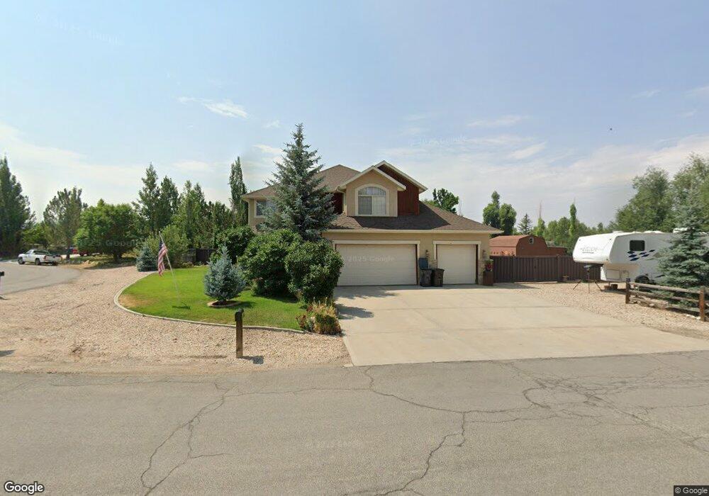
22 Tils Way Unit 11 Francis, UT 84036
Kamas Valley NeighborhoodEstimated Value: $874,151 - $1,128,000
--
Bed
--
Bath
2,331
Sq Ft
$408/Sq Ft
Est. Value
About This Home
This home is located at 22 Tils Way Unit 11, Francis, UT 84036 and is currently estimated at $952,038, approximately $408 per square foot. 22 Tils Way Unit 11 is a home located in Summit County with nearby schools including South Summit Elementary School and South Summit High School.
Ownership History
Date
Name
Owned For
Owner Type
Purchase Details
Closed on
Aug 10, 2022
Sold by
Harrop Roland L and Harrop Terrie L
Bought by
Harrop/Armstrong Family Living Trust
Current Estimated Value
Purchase Details
Closed on
Jan 2, 2012
Sold by
Swisher Peter and Swisher Cortni
Bought by
Harrop Ronald L and Armstrong Terrie L
Home Financials for this Owner
Home Financials are based on the most recent Mortgage that was taken out on this home.
Original Mortgage
$299,950
Interest Rate
3.27%
Mortgage Type
VA
Purchase Details
Closed on
Apr 3, 2009
Sold by
Swisher Peter S and Swisher Cortni W
Bought by
Swisher Peter and Swisher Cortni
Home Financials for this Owner
Home Financials are based on the most recent Mortgage that was taken out on this home.
Original Mortgage
$260,400
Interest Rate
5.06%
Mortgage Type
New Conventional
Purchase Details
Closed on
Nov 9, 2005
Sold by
Collyer Kim
Bought by
Swisher Peter S and Swisher Cortni W
Home Financials for this Owner
Home Financials are based on the most recent Mortgage that was taken out on this home.
Original Mortgage
$249,600
Interest Rate
5.75%
Mortgage Type
Adjustable Rate Mortgage/ARM
Purchase Details
Closed on
Aug 19, 2005
Sold by
Louder James Elgin and Louder Patricia Mae
Bought by
Collyer James B
Purchase Details
Closed on
May 27, 2005
Sold by
Collyer James B
Bought by
Collyer Kim
Create a Home Valuation Report for This Property
The Home Valuation Report is an in-depth analysis detailing your home's value as well as a comparison with similar homes in the area
Home Values in the Area
Average Home Value in this Area
Purchase History
| Date | Buyer | Sale Price | Title Company |
|---|---|---|---|
| Harrop/Armstrong Family Living Trust | -- | None Listed On Document | |
| Harrop Ronald L | -- | First American Title Company | |
| Swisher Peter | -- | -- | |
| Swisher Peter S | -- | Park City Title Co | |
| Collyer James B | -- | Century Title Co | |
| Collyer Kim | -- | Founders Title Company |
Source: Public Records
Mortgage History
| Date | Status | Borrower | Loan Amount |
|---|---|---|---|
| Previous Owner | Harrop Ronald L | $299,950 | |
| Previous Owner | Swisher Peter | $260,400 | |
| Previous Owner | Swisher Peter S | $249,600 |
Source: Public Records
Tax History Compared to Growth
Tax History
| Year | Tax Paid | Tax Assessment Tax Assessment Total Assessment is a certain percentage of the fair market value that is determined by local assessors to be the total taxable value of land and additions on the property. | Land | Improvement |
|---|---|---|---|---|
| 2024 | $2,812 | $456,235 | $132,000 | $324,235 |
| 2023 | $2,812 | $456,235 | $132,000 | $324,235 |
| 2022 | $3,079 | $440,621 | $121,000 | $319,621 |
| 2021 | $2,744 | $306,260 | $66,000 | $240,260 |
| 2020 | $2,730 | $298,251 | $66,000 | $232,251 |
| 2019 | $2,394 | $234,318 | $46,200 | $188,118 |
| 2018 | $2,038 | $207,271 | $39,600 | $167,671 |
| 2017 | $1,918 | $199,092 | $39,600 | $159,492 |
| 2016 | $1,912 | $186,823 | $39,600 | $147,223 |
| 2015 | $1,726 | $164,842 | $0 | $0 |
| 2013 | $1,859 | $164,842 | $0 | $0 |
Source: Public Records
Map
Nearby Homes
- 52 Scenic Heights Rd
- 52 Scenic Heights Rd Unit 207
- 56 Scenic Heights Rd
- 56 Scenic Heights Rd Unit 206
- 68 Scenic Heights Rd
- 68 Scenic Heights Rd Unit 203
- 1775 S State Road 32
- 145 Scenic Heights Rd Unit 508
- 145 Scenic Heights Rd
- 133 Scenic Heights Rd Unit 509
- 133 Scenic Heights Rd
- 153 Scenic Heights Rd
- 153 Scenic Heights Rd Unit 506
- 157 Scenic Heights Rd Unit 505
- 157 Scenic Heights Rd
- 169 Scenic Heights Rd Unit 504
- 169 Scenic Heights Rd
- 187 Scenic Heights Rd
- 187 Scenic Heights Rd Unit 501
- 1181 Big Sky Trail - Lot 39 Unit 39
- 22 Tils Way
- 22 E Til''S Way
- 21 Til's Way
- 22 Til's Way
- 1945 S State Road 32
- 1945 Utah 32
- 1955 Parleys Loop
- 1955 Parleys Loop Unit 10
- 1955 Parley's Loop
- 21 Tils Way
- 1950 Parleys Loop
- 1950 Parleys Loop Unit 13
- 21 E Til''S Way
- 1880 Parleys Loop
- 1880 S Parley's Loop
- 1914 S State Road 32
- 1926 S State Road 32
- 1983 S State Road 32
- 1930 S Parley's Loop
- 1930 Parleys Loop