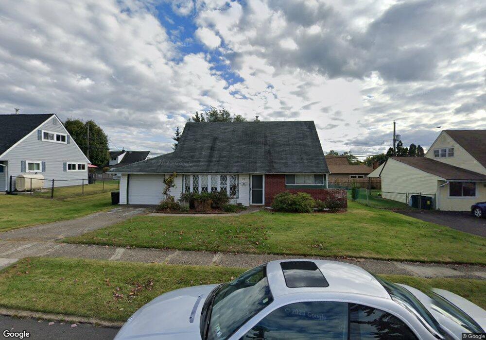
22 Tinder Rd Levittown, PA 19056
Estimated Value: $398,064 - $430,000
4
Beds
2
Baths
1,275
Sq Ft
$322/Sq Ft
Est. Value
About This Home
This home is located at 22 Tinder Rd, Levittown, PA 19056 and is currently estimated at $410,266, approximately $321 per square foot. 22 Tinder Rd is a home located in Bucks County with nearby schools including Pearl S. Buck Elementary School, Maple Point Middle School, and Neshaminy High School.
Ownership History
Date
Name
Owned For
Owner Type
Purchase Details
Closed on
Nov 24, 2020
Sold by
Meskers Donald A and Estate Of Doris A Meskers
Bought by
Meskers Donald A
Current Estimated Value
Purchase Details
Closed on
Apr 28, 1958
Bought by
Meskers Donald A and Meskers Doris A
Create a Home Valuation Report for This Property
The Home Valuation Report is an in-depth analysis detailing your home's value as well as a comparison with similar homes in the area
Home Values in the Area
Average Home Value in this Area
Purchase History
| Date | Buyer | Sale Price | Title Company |
|---|---|---|---|
| Meskers Donald A | -- | None Available | |
| Meskers Donald A | -- | -- |
Source: Public Records
Tax History Compared to Growth
Tax History
| Year | Tax Paid | Tax Assessment Tax Assessment Total Assessment is a certain percentage of the fair market value that is determined by local assessors to be the total taxable value of land and additions on the property. | Land | Improvement |
|---|---|---|---|---|
| 2025 | $4,093 | $18,800 | $4,320 | $14,480 |
| 2024 | $4,093 | $18,800 | $4,320 | $14,480 |
| 2023 | $4,028 | $18,800 | $4,320 | $14,480 |
| 2022 | $3,922 | $18,800 | $4,320 | $14,480 |
| 2021 | $3,922 | $18,800 | $4,320 | $14,480 |
| 2020 | $3,875 | $18,800 | $4,320 | $14,480 |
| 2019 | $3,789 | $18,800 | $4,320 | $14,480 |
| 2018 | $3,719 | $18,800 | $4,320 | $14,480 |
| 2017 | $3,624 | $18,800 | $4,320 | $14,480 |
| 2016 | $3,624 | $18,800 | $4,320 | $14,480 |
| 2015 | $3,813 | $18,800 | $4,320 | $14,480 |
| 2014 | $3,813 | $18,800 | $4,320 | $14,480 |
Source: Public Records
Map
Nearby Homes
- 20 Trellis Rd
- 01 Kyle Ln
- 000 Kyle Ln
- 212 Apple St
- 59 Liberty Dr
- 6 Handy Rd
- 1977 4th St
- 180 Andover Rd Unit A
- 107 Hollow Rd
- 114 Nursery Ave
- 208 Suffolk Rd
- 8 Haven Rd
- 245 Trenton Rd
- 225 Yorkshire Rd Unit HIII
- 75 Flamehill Rd
- 134 Lincoln Hwy Unit 11
- 88 Forsythia Dr N
- 331 Doone Place
- 18 Harvest Rd
- 14 Harp Rd