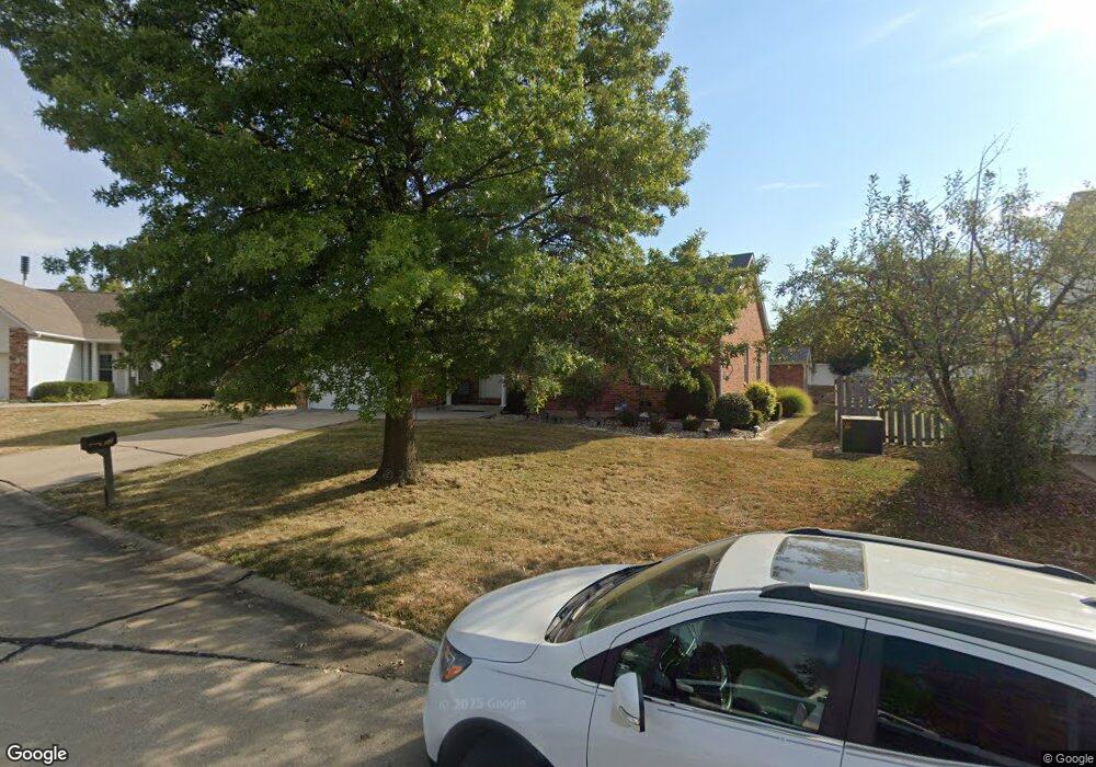
22 Tinsmith Ct O Fallon, MO 63366
Estimated Value: $325,165 - $371,000
3
Beds
2
Baths
1,571
Sq Ft
$226/Sq Ft
Est. Value
About This Home
This home is located at 22 Tinsmith Ct, O Fallon, MO 63366 and is currently estimated at $354,291, approximately $225 per square foot. 22 Tinsmith Ct is a home located in St. Charles County with nearby schools including Rock Creek Elementary School, Fort Zumwalt West Middle School, and Fort Zumwalt West High School.
Ownership History
Date
Name
Owned For
Owner Type
Purchase Details
Closed on
Jul 25, 2013
Sold by
Sellini Timothy M and Sellini Kimberly A
Bought by
Sellini Timothy M
Current Estimated Value
Purchase Details
Closed on
Oct 30, 1998
Sold by
Cozy Homes Inc
Bought by
Sellini Timothy M and Sellini Kimberly A
Home Financials for this Owner
Home Financials are based on the most recent Mortgage that was taken out on this home.
Original Mortgage
$100,000
Outstanding Balance
$21,347
Interest Rate
6.61%
Mortgage Type
FHA
Estimated Equity
$332,944
Create a Home Valuation Report for This Property
The Home Valuation Report is an in-depth analysis detailing your home's value as well as a comparison with similar homes in the area
Home Values in the Area
Average Home Value in this Area
Purchase History
| Date | Buyer | Sale Price | Title Company |
|---|---|---|---|
| Sellini Timothy M | -- | None Available | |
| Sellini Timothy M | -- | -- |
Source: Public Records
Mortgage History
| Date | Status | Borrower | Loan Amount |
|---|---|---|---|
| Open | Sellini Timothy M | $100,000 |
Source: Public Records
Tax History
| Year | Tax Paid | Tax Assessment Tax Assessment Total Assessment is a certain percentage of the fair market value that is determined by local assessors to be the total taxable value of land and additions on the property. | Land | Improvement |
|---|---|---|---|---|
| 2025 | $3,671 | $60,360 | -- | -- |
| 2023 | $3,673 | $55,456 | -- | -- |
| 2022 | $3,113 | $43,672 | $0 | $0 |
| 2021 | $3,115 | $43,672 | $0 | $0 |
| 2020 | $2,949 | $40,061 | $0 | $0 |
| 2019 | $2,956 | $40,061 | $0 | $0 |
| 2018 | $2,773 | $35,859 | $0 | $0 |
| 2017 | $2,735 | $35,859 | $0 | $0 |
| 2016 | $2,563 | $33,471 | $0 | $0 |
| 2015 | $2,383 | $33,471 | $0 | $0 |
| 2014 | $2,217 | $30,625 | $0 | $0 |
Source: Public Records
Map
Nearby Homes
- 3 Pinehurst Forest Ct
- 1234 Pinehurst Club Ct
- 8 Winter Forest Ct
- 14 Spangle Way Dr
- 159 Weatherby Landing Dr Unit 53
- 140 Weatherby Landing Dr
- 217 Roaring River Dr
- 962 Midpoint Dr
- 10 Southern Hills Ct
- 20 Cherokee Sunset Ct Ct
- 11 Southern Hills Ct
- 1117 Turtle Creek Dr
- 151 N Wellington St
- 2325 Sundance Dr
- 109 Sterling Crossing Dr
- 532 Bramblett Hills
- 5 Challenger Ct
- 105 Columbia Meadows Ln
- 116 Columbia Meadows Ln
- 4 Challenger Ct
- 20 Tinsmith Ct
- 24 Tinsmith Ct
- 18 Tinsmith Ct
- 25 Tinsmith Ct
- 19 Tinsmith Ct
- 21 Tinsmith Ct
- 23 Tinsmith Ct
- 16 Tinsmith Ct
- 17 Tinsmith Ct
- 15 Tinsmith Ct
- 14 Tinsmith Ct
- 1326 Franklins Kite Dr
- 1320 Franklins Kite Dr
- 506 Pinehurst Woods Ct
- 1314 Franklins Kite Dr
- 510 Pinehurst Woods Ct
- 1295 Pinehurst View Dr
- 1310 Franklins Kite Dr
- 514 Pinehurst Woods Ct
- 1332 Franklins Kite Dr
Your Personal Tour Guide
Ask me questions while you tour the home.