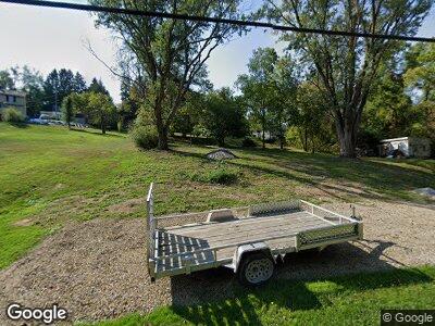
22 Watt Rd Jeannette, PA 15644
Penn Township NeighborhoodEstimated Value: $91,000 - $402,000
--
Bed
--
Bath
--
Sq Ft
1.02
Acres
About This Home
This home is located at 22 Watt Rd, Jeannette, PA 15644 and is currently estimated at $195,220. 22 Watt Rd is a home located in Westmoreland County with nearby schools including Penn Trafford High School.
Ownership History
Date
Name
Owned For
Owner Type
Purchase Details
Closed on
Jul 7, 2023
Sold by
Lonero Samuel P
Bought by
Lonero Samuel P and Lonero Darlene A
Current Estimated Value
Purchase Details
Closed on
Jul 18, 2022
Sold by
Slagy Joshua M and Slagy Erik D
Bought by
Lonero Samuel P
Purchase Details
Closed on
Oct 19, 2021
Sold by
Voron Vincent J and Estate Of John Voron
Bought by
Slagy Joshua M and Voron Erik D
Purchase Details
Closed on
Jun 29, 2017
Sold by
Voron Mark T
Bought by
Voron Jahn Thomas
Purchase Details
Closed on
May 26, 2010
Sold by
Kelleher Linda S
Bought by
Voron Mark T
Home Financials for this Owner
Home Financials are based on the most recent Mortgage that was taken out on this home.
Original Mortgage
$32,000
Interest Rate
5.12%
Mortgage Type
New Conventional
Create a Home Valuation Report for This Property
The Home Valuation Report is an in-depth analysis detailing your home's value as well as a comparison with similar homes in the area
Home Values in the Area
Average Home Value in this Area
Purchase History
| Date | Buyer | Sale Price | Title Company |
|---|---|---|---|
| Lonero Samuel P | -- | None Listed On Document | |
| Lonero Samuel P | $25,000 | None Listed On Document | |
| Slagy Joshua M | $65,934 | None Available | |
| Voron Jahn Thomas | -- | None Available | |
| Voron Mark T | $40,000 | None Available |
Source: Public Records
Mortgage History
| Date | Status | Borrower | Loan Amount |
|---|---|---|---|
| Previous Owner | Voron Mark T | $32,000 |
Source: Public Records
Tax History Compared to Growth
Tax History
| Year | Tax Paid | Tax Assessment Tax Assessment Total Assessment is a certain percentage of the fair market value that is determined by local assessors to be the total taxable value of land and additions on the property. | Land | Improvement |
|---|---|---|---|---|
| 2025 | $500 | $1,380 | $1,380 | $0 |
| 2024 | $1,102 | $8,110 | $1,380 | $6,730 |
| 2023 | $157 | $8,110 | $1,380 | $6,730 |
| 2022 | $1,034 | $8,110 | $1,380 | $6,730 |
| 2021 | $1,025 | $8,110 | $1,380 | $6,730 |
| 2020 | $1,017 | $8,110 | $1,380 | $6,730 |
| 2019 | $993 | $8,110 | $1,380 | $6,730 |
| 2018 | $965 | $8,110 | $1,380 | $6,730 |
| 2017 | $940 | $8,110 | $1,380 | $6,730 |
| 2016 | $913 | $8,110 | $1,380 | $6,730 |
| 2015 | $913 | $8,110 | $1,380 | $6,730 |
| 2014 | $896 | $8,110 | $1,380 | $6,730 |
Source: Public Records
Map
Nearby Homes
- 93 Koter Dr
- 1024 Gombach Rd
- 106 Seslar St
- 1004 Deveron Ct
- 1058 Moria Ct
- 2003 Rivendell Dr
- 2207 Church St
- 30 Martha Ave
- 52 Nancy Dr
- 20 Brooklane Dr
- 114 Adella Ct
- 101 Fieldstone Ct
- 3 Sunbirch Dr
- 2094 Route 130
- 1006 Sweetgum Ct
- 1016 Seneca Ln
- 3004 Bushy Run Rd
- 224 Waugaman Rd
- 1189 Claridge Elliott Rd
- 000 Harrold St
