Estimated Value: $1,002,000 - $1,235,000
Studio
--
Bath
3,911
Sq Ft
$277/Sq Ft
Est. Value
About This Home
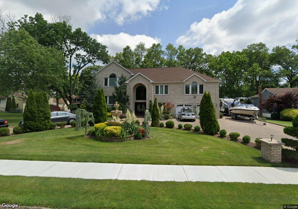
This home is located at 22 Wheatsheaf Rd, Clark, NJ 07066 and is currently estimated at $1,082,343, approximately $276 per square foot. 22 Wheatsheaf Rd is a home located in Union County with nearby schools including Frank K. Hehnly Elementary School, Carl H. Kumpf Middle School, and Arthur L. Johnson High School.
Ownership History
Date
Name
Owned For
Owner Type
Purchase Details
Closed on
Jun 13, 2008
Sold by
Gyimesi Rosetta and Ferrigno Lou
Bought by
Twardowski Wojciech S and Konopko Iwona
Current Estimated Value
Home Financials for this Owner
Home Financials are based on the most recent Mortgage that was taken out on this home.
Original Mortgage
$250,000
Outstanding Balance
$160,588
Interest Rate
6.07%
Mortgage Type
Purchase Money Mortgage
Estimated Equity
$921,755
Purchase Details
Closed on
Dec 28, 2001
Sold by
Ferrigno Nicole
Bought by
Ferrigno Filippo and Lou Ferrigno
Home Financials for this Owner
Home Financials are based on the most recent Mortgage that was taken out on this home.
Original Mortgage
$250,000
Interest Rate
7%
Mortgage Type
Purchase Money Mortgage
Create a Home Valuation Report for This Property
The Home Valuation Report is an in-depth analysis detailing your home's value as well as a comparison with similar homes in the area
Home Values in the Area
Average Home Value in this Area
Purchase History
| Date | Buyer | Sale Price | Title Company |
|---|---|---|---|
| Twardowski Wojciech S | $575,000 | Consolidated Title Group Llc | |
| Ferrigno Filippo | $400,000 | -- |
Source: Public Records
Mortgage History
| Date | Status | Borrower | Loan Amount |
|---|---|---|---|
| Open | Twardowski Wojciech S | $250,000 | |
| Previous Owner | Ferrigno Filippo | $250,000 |
Source: Public Records
Tax History
| Year | Tax Paid | Tax Assessment Tax Assessment Total Assessment is a certain percentage of the fair market value that is determined by local assessors to be the total taxable value of land and additions on the property. | Land | Improvement |
|---|---|---|---|---|
| 2025 | $17,099 | $772,300 | $264,000 | $508,300 |
| 2024 | $16,844 | $772,300 | $264,000 | $508,300 |
| 2023 | $16,844 | $772,300 | $264,000 | $508,300 |
| 2022 | $16,357 | $772,300 | $264,000 | $508,300 |
| 2021 | $18,598 | $209,200 | $55,500 | $153,700 |
| 2020 | $18,295 | $209,200 | $55,500 | $153,700 |
| 2019 | $18,110 | $209,200 | $55,500 | $153,700 |
| 2018 | $17,893 | $209,200 | $55,500 | $153,700 |
| 2017 | $17,606 | $209,200 | $55,500 | $153,700 |
| 2016 | $16,958 | $209,200 | $55,500 | $153,700 |
| 2015 | $16,786 | $209,200 | $55,500 | $153,700 |
| 2014 | $16,433 | $209,200 | $55,500 | $153,700 |
Source: Public Records
Map
Nearby Homes
- 372 Willow Way
- 24 Woodland Rd
- 172 Briarheath Ln
- 64 William St
- 8 Normandy Rd
- 34 E Prescott Ave
- 131 Morningside Rd
- 1033 Cellar Ave Unit 1033
- 125 Kimberly Rd
- 265 W Prescott Ave
- 973 Ellis Pkwy
- 8 Maddaket
- 17 Thelma Ct
- 868 Inman Ave
- 155 Meadow Rd
- 53 Jordan Rd
- 6 Tulip Ct
- 675 Raritan Rd Unit 12
- 1995 Winding Brook Way
- 27 Stemmer Dr
- 28 Wheatsheaf Rd
- 299 Oak Ridge Rd
- 36 Wheatsheaf Rd
- 309 Oak Ridge Rd
- 27 Brookside Terrace
- 21 Brookside Terrace
- 33 Brookside Terrace
- 15 Brookside Terrace
- 39 Brookside Terrace
- 21 Wheatsheaf Rd
- 244 Laurel Ln
- 317 Oak Ridge Rd
- 44 Wheatsheaf Rd
- 45 Brookside Terrace
- 250 Laurel Ln
- 273 Oak Ridge Rd
- 325 Oak Ridge Rd
- 51 Brookside Terrace
- 52 Wheatsheaf Rd
- 258 Laurel Ln
Your Personal Tour Guide
Ask me questions while you tour the home.