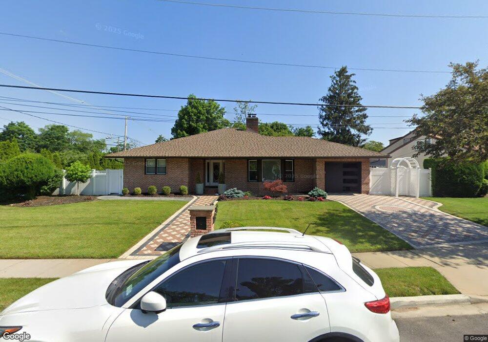
22 Willowbrook Ln Freeport, NY 11520
Estimated Value: $665,593 - $798,000
Studio
2
Baths
1,908
Sq Ft
$384/Sq Ft
Est. Value
About This Home
This home is located at 22 Willowbrook Ln, Freeport, NY 11520 and is currently estimated at $731,797, approximately $383 per square foot. 22 Willowbrook Ln is a home located in Nassau County with nearby schools including Baldwin Senior High School.
Ownership History
Date
Name
Owned For
Owner Type
Purchase Details
Closed on
Dec 21, 2020
Sold by
Millet Mari G and Millet Marylynn
Bought by
Miller Holding Llc
Current Estimated Value
Purchase Details
Closed on
Feb 2, 2015
Sold by
Millet Mari G and Millet Marylynn
Bought by
Millet Mari G and Millet Marylynn
Purchase Details
Closed on
Oct 18, 2013
Sold by
Millet Raymond P
Bought by
Millet Rodly J and Millet Mari G
Purchase Details
Closed on
Sep 19, 2008
Sold by
Millet Mari
Bought by
Millet Raymonde P
Purchase Details
Closed on
Dec 28, 2007
Sold by
Mitwell Harriet
Bought by
Mitwell Mari
Create a Home Valuation Report for This Property
The Home Valuation Report is an in-depth analysis detailing your home's value as well as a comparison with similar homes in the area
Home Values in the Area
Average Home Value in this Area
Purchase History
| Date | Buyer | Sale Price | Title Company |
|---|---|---|---|
| Miller Holding Llc | -- | Judicial Title | |
| Millet Mari G | -- | The Judicial Title Insurance | |
| Millet Rodly J | -- | River Edge Land Services Inc | |
| Millet Raymonde P | -- | Judicial Title Insurance | |
| Mitwell Mari | $378,000 | -- |
Source: Public Records
Tax History
| Year | Tax Paid | Tax Assessment Tax Assessment Total Assessment is a certain percentage of the fair market value that is determined by local assessors to be the total taxable value of land and additions on the property. | Land | Improvement |
|---|---|---|---|---|
| 2025 | $10,478 | $420 | $157 | $263 |
| 2024 | $935 | $423 | $159 | $264 |
Source: Public Records
Map
Nearby Homes
- 215 N Brookside Ave
- 1 Willowbrook Ln
- 89 Delaware Ave
- 1850 Voshage St
- 139 New York Ave
- 200 Evans Ave
- 858 Seaman Ave E
- 980 Wallace Ave
- 883 Mckenna Ave
- 315 Maryland Ave
- 938 Wallace Ave
- 60 Connecticut Ave
- 15 Mckenna Ave
- 1878 Lake Dr W
- 915 Wallace Ave
- 365 Wallace St
- 2098 Felix Ct
- 156 Brookside Ave
- 1690 Grand Ave Unit A15
- 1690 Grand Ave Unit A16
- 304 N Brookside Ave
- 20 Willowbrook Ln
- 21 Willowbrook Ln
- 19 Willowbrook Ln
- 312 N Brookside Ave
- 26 Willowbrook Ln
- 3 Tanglewood Ln
- 18 Willowbrook Ln
- 303 N Brookside Ave
- 320 N Brookside Ave
- 28 Willowbrook Ln
- 15 Willowbrook Ln
- 5 Tanglewood Ln
- 176 California Ave
- 261 N Brookside Ave
- 182 California Ave
- 172 California Ave
- 321 N Brookside Ave
- 33 Willowbrook Ln
- 311 N Brookside Ave
Your Personal Tour Guide
Ask me questions while you tour the home.