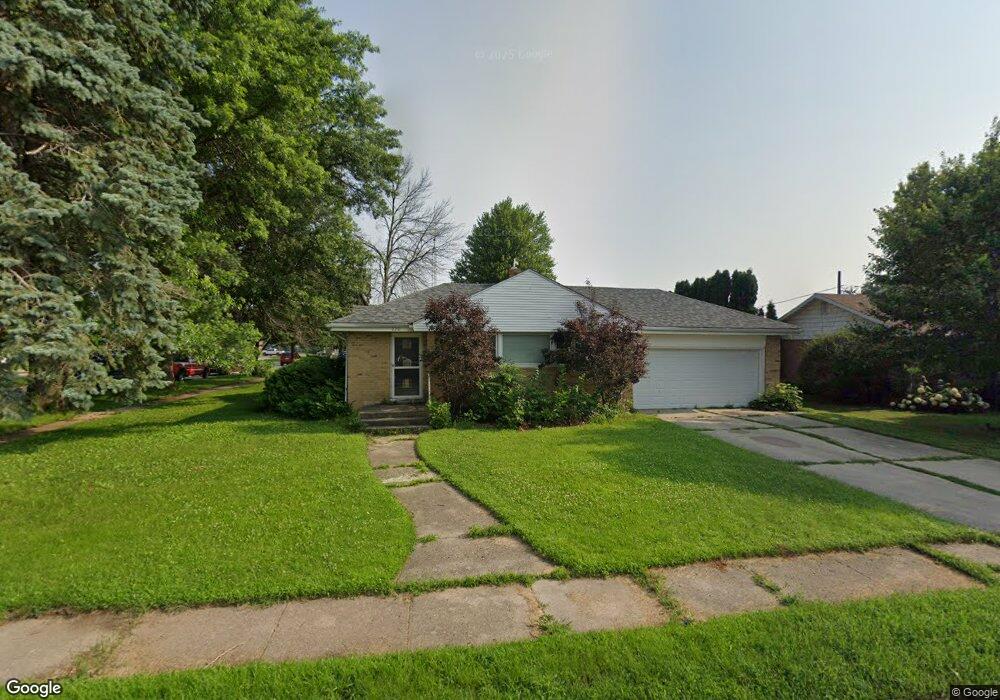
220 11th Ave NE Hampton, IA 50441
Estimated Value: $110,338 - $139,000
2
Beds
1
Bath
1,166
Sq Ft
$110/Sq Ft
Est. Value
About This Home
This home is located at 220 11th Ave NE, Hampton, IA 50441 and is currently estimated at $128,085, approximately $109 per square foot. 220 11th Ave NE is a home located in Franklin County with nearby schools including North Side Elementary School, South Side Elementary School, and Hampton-Dumont Middle School.
Ownership History
Date
Name
Owned For
Owner Type
Purchase Details
Closed on
Oct 28, 2008
Sold by
Walton Heath Lee and Walton Jennifer Kae
Bought by
Folkerds Eric D
Current Estimated Value
Home Financials for this Owner
Home Financials are based on the most recent Mortgage that was taken out on this home.
Original Mortgage
$75,500
Outstanding Balance
$48,488
Interest Rate
5.73%
Mortgage Type
New Conventional
Estimated Equity
$79,597
Create a Home Valuation Report for This Property
The Home Valuation Report is an in-depth analysis detailing your home's value as well as a comparison with similar homes in the area
Home Values in the Area
Average Home Value in this Area
Purchase History
| Date | Buyer | Sale Price | Title Company |
|---|---|---|---|
| Folkerds Eric D | $75,000 | None Available |
Source: Public Records
Mortgage History
| Date | Status | Borrower | Loan Amount |
|---|---|---|---|
| Open | Folkerds Eric D | $75,500 |
Source: Public Records
Tax History Compared to Growth
Tax History
| Year | Tax Paid | Tax Assessment Tax Assessment Total Assessment is a certain percentage of the fair market value that is determined by local assessors to be the total taxable value of land and additions on the property. | Land | Improvement |
|---|---|---|---|---|
| 2025 | $1,598 | $111,900 | $15,300 | $96,600 |
| 2024 | $1,598 | $90,700 | $15,300 | $75,400 |
| 2023 | $2,082 | $90,700 | $15,300 | $75,400 |
| 2022 | $1,838 | $97,900 | $15,300 | $82,600 |
| 2021 | $1,838 | $84,800 | $15,300 | $69,500 |
| 2020 | $1,616 | $82,100 | $15,300 | $66,800 |
| 2019 | $1,522 | $72,500 | $0 | $0 |
| 2018 | $1,526 | $72,500 | $0 | $0 |
| 2017 | $1,526 | $65,500 | $0 | $0 |
| 2016 | $1,382 | $65,500 | $0 | $0 |
| 2015 | $1,382 | $71,000 | $0 | $0 |
| 2014 | $1,512 | $71,000 | $0 | $0 |
Source: Public Records
Map
Nearby Homes
- 1403 3rd St NE
- 1427 4th St NE
- 322 16th Ave NE
- 220 12th Ave NW
- 5 Armory Ln
- 814 3rd St NW
- 1706 N Federal St
- 302 1st St NW
- 716 1st Ave NE
- 518 Central Ave E
- 999 Glendale Park Dr
- 602 Central Ave E
- TBD Iowa 3
- 1/2 2nd Ave NW
- 705 Central Ave E
- 114 4th St SE
- 1318 Sunset Dr
- 114 7th St SE
- 1330 Sunset Dr
- 319 3rd Ave SW
- 304 11th Ave NE
- 219 11th Ave NE
- 1117 Val Kay Ct
- 310 11th Ave NE
- 303 11th Ave NE
- 1123 Val Kay Ct
- 1106 Val Kay Ct
- 1020 Val Kay Ct
- 1100 Val Kay Ct
- 1118 Val Kay Ct
- 1009 Val Kay Ct
- 1108 4th St NE
- 1129 Val Kay Ct
- 1014 Val Kay Ct
- 1102 4th St NE
- 1124 Val Kay Ct
- 1008 Val Kay Ct
- 1000 3rd St NE
- 1130 Val Kay Ct
- 307 12th Ave NE