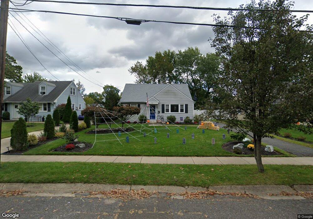
220 Albertson Ave Barrington, NJ 08007
Estimated Value: $224,771 - $307,000
--
Bed
--
Bath
1,220
Sq Ft
$234/Sq Ft
Est. Value
About This Home
This home is located at 220 Albertson Ave, Barrington, NJ 08007 and is currently estimated at $285,443, approximately $233 per square foot. 220 Albertson Ave is a home located in Camden County with nearby schools including Avon Elementary School, Woodland Elementary School, and Saint Rose of Lima Catholic School.
Ownership History
Date
Name
Owned For
Owner Type
Purchase Details
Closed on
Oct 20, 2008
Sold by
Gamm Sarah and Estate Of Michael J Kehoe
Bought by
Long Michele
Current Estimated Value
Purchase Details
Closed on
Jun 18, 1999
Sold by
Woodland Michael
Bought by
Kehoe Michael J and Long Michelle
Home Financials for this Owner
Home Financials are based on the most recent Mortgage that was taken out on this home.
Original Mortgage
$84,300
Interest Rate
7.39%
Mortgage Type
FHA
Create a Home Valuation Report for This Property
The Home Valuation Report is an in-depth analysis detailing your home's value as well as a comparison with similar homes in the area
Home Values in the Area
Average Home Value in this Area
Purchase History
| Date | Buyer | Sale Price | Title Company |
|---|---|---|---|
| Long Michele | -- | -- | |
| Kehoe Michael J | $85,000 | -- |
Source: Public Records
Mortgage History
| Date | Status | Borrower | Loan Amount |
|---|---|---|---|
| Previous Owner | Kehoe Michael J | $84,300 |
Source: Public Records
Tax History Compared to Growth
Tax History
| Year | Tax Paid | Tax Assessment Tax Assessment Total Assessment is a certain percentage of the fair market value that is determined by local assessors to be the total taxable value of land and additions on the property. | Land | Improvement |
|---|---|---|---|---|
| 2025 | $6,780 | $141,600 | $55,300 | $86,300 |
| 2024 | $6,546 | $141,600 | $55,300 | $86,300 |
| 2023 | $6,546 | $141,600 | $55,300 | $86,300 |
| 2022 | $6,406 | $141,600 | $55,300 | $86,300 |
| 2021 | $6,335 | $141,600 | $55,300 | $86,300 |
| 2020 | $6,230 | $141,600 | $55,300 | $86,300 |
| 2019 | $6,204 | $141,600 | $55,300 | $86,300 |
| 2018 | $6,083 | $141,600 | $55,300 | $86,300 |
| 2017 | $5,932 | $141,600 | $55,300 | $86,300 |
| 2016 | $6,077 | $162,000 | $84,800 | $77,200 |
| 2015 | $5,877 | $162,000 | $84,800 | $77,200 |
| 2014 | $5,630 | $162,000 | $84,800 | $77,200 |
Source: Public Records
Map
Nearby Homes
- 143 W Gloucester Pike
- 219 S Moore Ave
- 305 W 4th Ave
- 499 Austin Ave
- 204 Adams Ave
- 406 Austin Ave
- 226 Adams Ave
- 325 Reading Ave
- 330 Haines Ave
- 325 Albany Ave
- 300 Austin Ave
- 309 Oakland Ave
- 233 Haines Ave
- 913 Lenton Ave
- 2 Clark Dr
- 115 Woodland Ave
- 118 Woodland Ave
- 5 Trinity Place
- 139 Albany Ave
- 208 Chester Ave
- 222 Albertson Ave
- 218 Albertson Ave
- 224 Albertson Ave
- 216 Albertson Ave
- 213 W Gloucester Pike
- 211 W Gloucester Pike
- 215 W Gloucester Pike
- 209 W Gloucester Pike
- 532 Dubois Ave
- 226 Albertson Ave
- 217 W Gloucester Pike
- 217 Albertson Ave
- 207 W Gloucester Pike
- 215 Albertson Ave
- 533 Dubois Ave
- 219 W Gloucester Pike
- 205 W Gloucester Pike
- 228 Albertson Ave
- 530 Dubois Ave
- 213 Albertson Ave