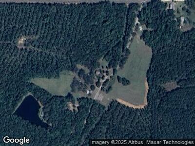
220 Drane - Mathews Rd Talbotton, GA 31827
Estimated Value: $346,000 - $658,000
5
Beds
5
Baths
4,882
Sq Ft
$100/Sq Ft
Est. Value
About This Home
This home is located at 220 Drane - Mathews Rd, Talbotton, GA 31827 and is currently estimated at $487,666, approximately $99 per square foot. 220 Drane - Mathews Rd is a home located in Talbot County with nearby schools including Central School.
Ownership History
Date
Name
Owned For
Owner Type
Purchase Details
Closed on
Apr 23, 2018
Sold by
Tyrell James E
Bought by
Geraci Carol and Foster Emily
Current Estimated Value
Home Financials for this Owner
Home Financials are based on the most recent Mortgage that was taken out on this home.
Original Mortgage
$247,500
Interest Rate
5%
Mortgage Type
New Conventional
Create a Home Valuation Report for This Property
The Home Valuation Report is an in-depth analysis detailing your home's value as well as a comparison with similar homes in the area
Home Values in the Area
Average Home Value in this Area
Purchase History
| Date | Buyer | Sale Price | Title Company |
|---|---|---|---|
| Geraci Carol | $337,500 | -- |
Source: Public Records
Mortgage History
| Date | Status | Borrower | Loan Amount |
|---|---|---|---|
| Open | Geraci Carol | $236,000 | |
| Closed | Geraci Carol | $247,500 | |
| Previous Owner | Tyrell James | $200,000 | |
| Previous Owner | Tyrell Patricia | $200,000 | |
| Previous Owner | Tyrell Patricia | $150,000 |
Source: Public Records
Tax History Compared to Growth
Tax History
| Year | Tax Paid | Tax Assessment Tax Assessment Total Assessment is a certain percentage of the fair market value that is determined by local assessors to be the total taxable value of land and additions on the property. | Land | Improvement |
|---|---|---|---|---|
| 2024 | $1,537 | $136,854 | $2,391 | $134,463 |
| 2023 | $1,518 | $112,058 | $2,321 | $109,737 |
| 2022 | $3,561 | $115,640 | $2,321 | $113,319 |
| 2021 | $1,555 | $114,034 | $2,210 | $111,824 |
| 2020 | $1,579 | $92,423 | $2,210 | $90,213 |
| 2019 | $1,579 | $92,975 | $2,210 | $90,765 |
| 2018 | $2,800 | $92,975 | $2,210 | $90,765 |
| 2017 | $1,584 | $109,894 | $2,210 | $107,684 |
| 2016 | $1,581 | $50,048 | $2,210 | $47,838 |
| 2015 | -- | $36,690 | $2,000 | $34,690 |
| 2013 | -- | $54,383 | $3,400 | $50,983 |
Source: Public Records
Map
Nearby Homes
- 98 ACRES +/- George Smith Rd
- 160.29 ACRES Carl Mathis Rd
- 650+/- Highway 80
- 650+/- AC Talbotton Hwy
- 1083 Talbotton Hwy
- 1077 W Wire Rd
- 0 Hwy 80 Unit 10484991
- 0 Hwy 80 Unit 7546340
- 86 Carl Mathis Rd Unit 160.29 ACRES
- 0 Bickley Rd Unit 176112
- 0 Bickley Rd Unit 244685
- 0 Bickley Rd Unit 10345732
- 1942 Wesley Church Rd
- 3046 Sunrise Rd
- 0 Green Oak Cir Unit 10506664
- 0 U S Highway 19
- 1096 Buckner Rd
- 538 Us Highway 80
- 1181 Kelly Rd
- 0 None Unit 10431111
- 220 Drane Mathews Rd
- 220 Drane - Mathews Rd
- 220 Drane Matthews Rd
- 288 Drane Mathews Rd
- 67 Drane Mathews Rd
- 36 Clayton Matthews Rd
- 62 Clayton Matthews Rd
- 160 Clayton Matthews Rd
- 191 George Smith Rd
- 694 Drane Mathews Rd
- 183 Clayton Matthews Rd
- 290 George Smith Rd
- 10897 Macon Hwy
- 200 Clayton Matthews Rd
- 609 George Smith Rd
- 10484 Macon Hwy
- 916 Drane Mathews Rd
- 0 Clayton Matthews Rd
