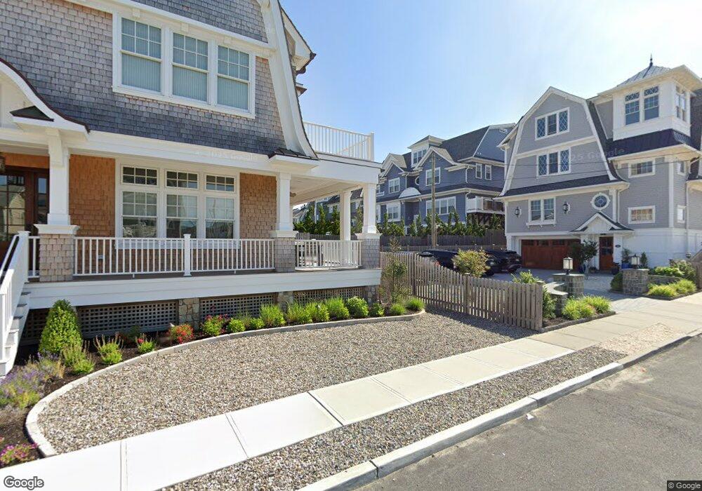
220 Dune Ave Mantoloking, NJ 08738
Estimated Value: $4,614,517 - $5,661,000
6
Beds
7
Baths
4,890
Sq Ft
$1,023/Sq Ft
Est. Value
About This Home
This home is located at 220 Dune Ave, Mantoloking, NJ 08738 and is currently estimated at $5,002,506, approximately $1,023 per square foot. 220 Dune Ave is a home with nearby schools including Emma Havens Young Elementary School, Lake Riviera Middle School, and Brick Township High School.
Ownership History
Date
Name
Owned For
Owner Type
Purchase Details
Closed on
Jan 2, 2002
Sold by
Williams Betty
Bought by
Bahash Robert and Bahash Carol
Current Estimated Value
Home Financials for this Owner
Home Financials are based on the most recent Mortgage that was taken out on this home.
Original Mortgage
$1,300,000
Outstanding Balance
$531,241
Interest Rate
7.04%
Estimated Equity
$4,471,265
Create a Home Valuation Report for This Property
The Home Valuation Report is an in-depth analysis detailing your home's value as well as a comparison with similar homes in the area
Home Values in the Area
Average Home Value in this Area
Purchase History
| Date | Buyer | Sale Price | Title Company |
|---|---|---|---|
| Bahash Robert | $2,200,000 | -- |
Source: Public Records
Mortgage History
| Date | Status | Borrower | Loan Amount |
|---|---|---|---|
| Open | Bahash Robert | $1,300,000 |
Source: Public Records
Tax History Compared to Growth
Tax History
| Year | Tax Paid | Tax Assessment Tax Assessment Total Assessment is a certain percentage of the fair market value that is determined by local assessors to be the total taxable value of land and additions on the property. | Land | Improvement |
|---|---|---|---|---|
| 2025 | $62,015 | $2,400,900 | $1,590,100 | $810,800 |
| 2024 | $58,942 | $2,400,900 | $1,590,100 | $810,800 |
| 2023 | $58,174 | $2,400,900 | $1,590,100 | $810,800 |
| 2022 | $58,174 | $2,400,900 | $1,590,100 | $810,800 |
| 2021 | $56,902 | $2,398,900 | $1,590,100 | $808,800 |
| 2020 | $49,976 | $2,133,900 | $1,325,100 | $808,800 |
| 2019 | $49,144 | $2,133,900 | $1,325,100 | $808,800 |
| 2018 | $48,013 | $2,133,900 | $1,325,100 | $808,800 |
| 2017 | $52,630 | $2,404,300 | $1,325,100 | $1,079,200 |
| 2016 | $52,366 | $2,404,300 | $1,325,100 | $1,079,200 |
| 2015 | $50,995 | $2,404,300 | $1,325,100 | $1,079,200 |
| 2014 | $50,586 | $2,404,300 | $1,325,100 | $1,079,200 |
Source: Public Records
Map
Nearby Homes
- 304 Schooner Ln
- 150 Sunset Ln
- 122 Squan Beach Dr
- 308 Cove Dr
- 233 Curtis Point Dr
- 275 Curtis Point Dr
- 366 Highway 35 N
- 1519 Runyon Ln
- 438 Highway 35 N Unit 1304
- 12 Shell Rd
- 1318 Ocean Ave
- 515 New Jersey 35
- 1207 Ocean Ave
- 545 Route 35
- 1201 Ocean Ave
- 254 Harbor Ct
- 1097 Barnegat Ln
- 64 W Granada Dr
- 108 Rochester Dr
- 77 Rochester Dr
- 214 Dune Ave
- 224 Dune Ave
- 219 Dune Ave
- 221 Dune Ave
- 215 Dune Ave
- 210 Dune Ave
- 225 Dune Ave
- 226 Dune Ave
- 99 Oceanview Ave
- 211 Dune Ave
- 0 Sunset Ln Unit 22115578
- 218 Highway 35 N
- 230 Dune Ave
- 206 Dune Ave
- 224 Highway 35 N
- 214 Highway 35 N
- 232 Dune Ave
- 99 Oceanview Terrace
- 210 Highway 35 N
- 228 Highway 35 N