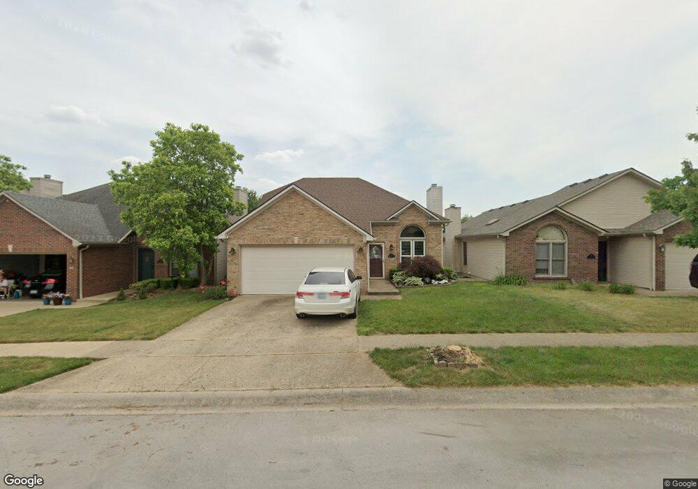
220 Gateway Park Cir Lexington, KY 40511
Masterson Station NeighborhoodEstimated Value: $268,331 - $322,000
--
Bed
2
Baths
1,307
Sq Ft
$225/Sq Ft
Est. Value
About This Home
This home is located at 220 Gateway Park Cir, Lexington, KY 40511 and is currently estimated at $294,583, approximately $225 per square foot. 220 Gateway Park Cir is a home located in Fayette County with nearby schools including Sandersville Elementary School, Leestown Middle School, and Bryan Station High School.
Ownership History
Date
Name
Owned For
Owner Type
Purchase Details
Closed on
Jul 14, 2025
Sold by
Goodwin Angela M and Watts Angela M
Bought by
Cochran Angela Watts and Cochran Gary W
Current Estimated Value
Purchase Details
Closed on
Jun 13, 2011
Sold by
Goodwin Curt D
Bought by
Goodwin Angela M and Watts Angela M
Home Financials for this Owner
Home Financials are based on the most recent Mortgage that was taken out on this home.
Original Mortgage
$104,800
Interest Rate
4.79%
Mortgage Type
Purchase Money Mortgage
Create a Home Valuation Report for This Property
The Home Valuation Report is an in-depth analysis detailing your home's value as well as a comparison with similar homes in the area
Home Values in the Area
Average Home Value in this Area
Purchase History
| Date | Buyer | Sale Price | Title Company |
|---|---|---|---|
| Cochran Angela Watts | -- | None Listed On Document | |
| Cochran Angela Watts | -- | None Listed On Document | |
| Goodwin Angela M | -- | -- |
Source: Public Records
Mortgage History
| Date | Status | Borrower | Loan Amount |
|---|---|---|---|
| Previous Owner | Goodwin Angela M | $86,400 | |
| Previous Owner | Goodwin Angela M | $104,800 |
Source: Public Records
Tax History Compared to Growth
Tax History
| Year | Tax Paid | Tax Assessment Tax Assessment Total Assessment is a certain percentage of the fair market value that is determined by local assessors to be the total taxable value of land and additions on the property. | Land | Improvement |
|---|---|---|---|---|
| 2024 | $2,244 | $181,500 | $0 | $0 |
| 2023 | $2,244 | $181,500 | $0 | $0 |
| 2022 | $2,318 | $181,500 | $0 | $0 |
| 2021 | $2,318 | $181,500 | $0 | $0 |
| 2020 | $1,823 | $142,700 | $0 | $0 |
| 2019 | $1,823 | $142,700 | $0 | $0 |
| 2018 | $1,823 | $142,700 | $0 | $0 |
| 2017 | $1,737 | $142,700 | $0 | $0 |
| 2015 | $1,287 | $115,000 | $0 | $0 |
| 2014 | $1,287 | $115,000 | $0 | $0 |
| 2012 | $1,287 | $115,000 | $0 | $0 |
Source: Public Records
Map
Nearby Homes
- 192 Masterson Station Dr
- 297 Lucille Dr
- 188 Lucille Dr
- 2617 Buck Ln
- 261 Ferndale Pass
- 2761 Woodlawn Way
- 2752 Jacquelyn Ln
- 2705 Michelle Park
- 2649 Michelle Park
- 349 Silver Creek Way
- 2625 Mable Ln
- 121 Chestnut Ridge Dr
- 2833 Burnt Mill Rd
- 2748 Candytuft Ln
- 2749 Whiteberry Dr
- 2773 Burnt Mill Rd
- 2805 Morsen Point
- 220 White Oak Trace
- 3065 Caddis Ln
- 3069 Caddis Ln
- 224 Gateway Park Cir
- 216 Gateway Park Cir
- 212 Gateway Park Cir
- 2841 Gateway Park Ln
- 2837 Gateway Park Ln
- 2845 Gateway Park Ln
- 232 Gateway Park Cir
- 208 Gateway Park Cir
- 2833 Gateway Park Ln
- 201 Meadow Valley Rd
- 236 Gateway Park Cir
- 200 Meadow Valley Rd
- 204 Gateway Park Cir
- 2825 Gateway Park Ln
- 2857 Gateway Park Ln
- 205 Meadow Valley Rd
- 240 Gateway Park Cir
- 229 Gateway Park Cir
- 233 Gateway Park Cir
- 204 Meadow Valley Rd