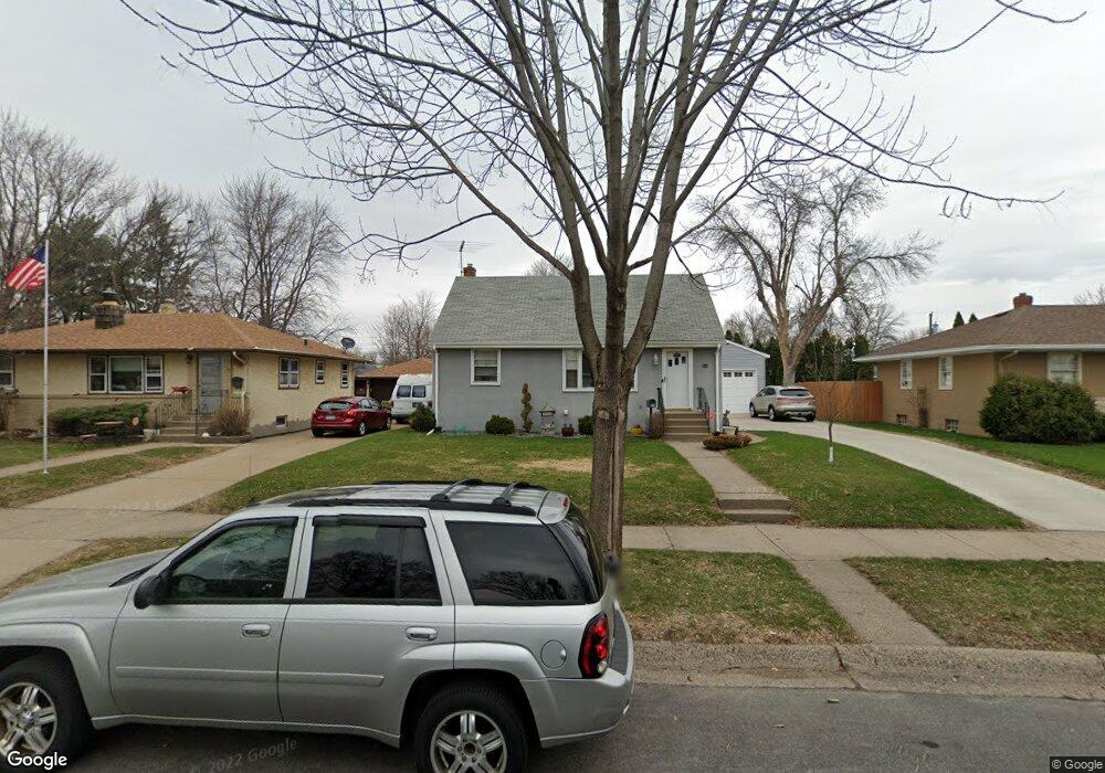
220 Macarthur St W South Saint Paul, MN 55075
Estimated Value: $269,000 - $287,021
3
Beds
2
Baths
960
Sq Ft
$288/Sq Ft
Est. Value
About This Home
This home is located at 220 Macarthur St W, South Saint Paul, MN 55075 and is currently estimated at $276,505, approximately $288 per square foot. 220 Macarthur St W is a home located in Dakota County with nearby schools including Kaposia Education Center Elementary, South St. Paul Secondary, and Discovery Charter School.
Ownership History
Date
Name
Owned For
Owner Type
Purchase Details
Closed on
Jul 17, 2015
Sold by
Jacobs Rose A
Bought by
Gobely Gordon
Current Estimated Value
Home Financials for this Owner
Home Financials are based on the most recent Mortgage that was taken out on this home.
Original Mortgage
$111,600
Outstanding Balance
$87,593
Interest Rate
4.05%
Mortgage Type
New Conventional
Estimated Equity
$188,912
Create a Home Valuation Report for This Property
The Home Valuation Report is an in-depth analysis detailing your home's value as well as a comparison with similar homes in the area
Home Values in the Area
Average Home Value in this Area
Purchase History
| Date | Buyer | Sale Price | Title Company |
|---|---|---|---|
| Gobely Gordon | $139,500 | Home Title |
Source: Public Records
Mortgage History
| Date | Status | Borrower | Loan Amount |
|---|---|---|---|
| Open | Gobely Gordon | $111,600 |
Source: Public Records
Tax History Compared to Growth
Tax History
| Year | Tax Paid | Tax Assessment Tax Assessment Total Assessment is a certain percentage of the fair market value that is determined by local assessors to be the total taxable value of land and additions on the property. | Land | Improvement |
|---|---|---|---|---|
| 2024 | $3,346 | $254,600 | $77,800 | $176,800 |
| 2023 | $3,346 | $250,900 | $78,300 | $172,600 |
| 2022 | $2,922 | $254,500 | $78,200 | $176,300 |
| 2021 | $2,972 | $224,700 | $68,000 | $156,700 |
| 2020 | $2,764 | $211,600 | $64,800 | $146,800 |
| 2019 | $2,484 | $201,700 | $61,700 | $140,000 |
| 2018 | $2,395 | $175,500 | $56,100 | $119,400 |
| 2017 | $1,861 | $163,100 | $53,400 | $109,700 |
| 2016 | $1,589 | $132,200 | $48,600 | $83,600 |
| 2015 | $1,467 | $99,119 | $36,684 | $62,435 |
| 2014 | -- | $97,048 | $36,472 | $60,576 |
| 2013 | -- | $85,821 | $30,938 | $54,883 |
Source: Public Records
Map
Nearby Homes
- 1436 5th Ave S
- 101 Frost St W
- 1456 6th Ave S
- 233 Richmond St W
- 137 South St E
- 1215 8th Ave S
- 1434 8th Ave S
- 100 W Warburton St
- 1127 9th Ave S
- 5472 Bryce Ave
- 151 Park St W
- 6050 Cahill Ave
- 5938 Burke Trail
- 928 8th Ave S
- 5903 Bryant Ln
- 1403 Concord St S Unit 1
- 5870 Blackberry Bridge Path
- 4970 Boyd Ave
- TBD 65th St E
- 6051 Concord Blvd
- 226 Macarthur St W
- 214 Macarthur St W
- 232 Macarthur St W
- 208 Macarthur St W
- 221 221 Spruce-Street-w
- 221 221 Spruce St W
- 221 Spruce St W
- 227 Spruce St W
- 215 Spruce St W
- 209 Spruce St W
- 202 Macarthur St W
- 238 Macarthur St W
- 221 Macarthur St W
- 233 233 Spruce-Street-w
- 215 Macarthur St W
- 227 Macarthur St W
- 239 Spruce St W
- 203 Spruce St W
- 209 Macarthur St W
- 233 Macarthur St W