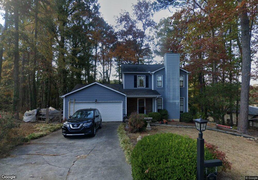
220 Melea Ln Calhoun, GA 30701
Estimated Value: $222,000 - $271,000
3
Beds
3
Baths
1,525
Sq Ft
$164/Sq Ft
Est. Value
About This Home
This home is located at 220 Melea Ln, Calhoun, GA 30701 and is currently estimated at $250,300, approximately $164 per square foot. 220 Melea Ln is a home located in Gordon County with nearby schools including Belwood Elementary School and Philadelphia Christian School.
Ownership History
Date
Name
Owned For
Owner Type
Purchase Details
Closed on
Jun 5, 2018
Sold by
Scott Robert L
Bought by
Gosa Weston L
Current Estimated Value
Home Financials for this Owner
Home Financials are based on the most recent Mortgage that was taken out on this home.
Original Mortgage
$141,313
Outstanding Balance
$122,212
Interest Rate
4.5%
Mortgage Type
New Conventional
Estimated Equity
$128,088
Purchase Details
Closed on
Apr 11, 2014
Sold by
Elrod Yvonne Q
Bought by
Scott Robert L
Home Financials for this Owner
Home Financials are based on the most recent Mortgage that was taken out on this home.
Original Mortgage
$115,306
Interest Rate
4.43%
Mortgage Type
New Conventional
Purchase Details
Closed on
Apr 23, 1993
Bought by
Elrod Yvonne Q and Elrod Marvin R
Create a Home Valuation Report for This Property
The Home Valuation Report is an in-depth analysis detailing your home's value as well as a comparison with similar homes in the area
Home Values in the Area
Average Home Value in this Area
Purchase History
| Date | Buyer | Sale Price | Title Company |
|---|---|---|---|
| Gosa Weston L | $139,900 | -- | |
| Scott Robert L | $113,000 | -- | |
| Elrod Yvonne Q | $65,800 | -- |
Source: Public Records
Mortgage History
| Date | Status | Borrower | Loan Amount |
|---|---|---|---|
| Open | Gosa Weston L | $141,313 | |
| Previous Owner | Scott Robert L | $115,306 |
Source: Public Records
Tax History Compared to Growth
Tax History
| Year | Tax Paid | Tax Assessment Tax Assessment Total Assessment is a certain percentage of the fair market value that is determined by local assessors to be the total taxable value of land and additions on the property. | Land | Improvement |
|---|---|---|---|---|
| 2024 | $1,943 | $69,120 | $5,600 | $63,520 |
| 2023 | $1,826 | $64,960 | $5,600 | $59,360 |
| 2022 | $577 | $60,640 | $5,600 | $55,040 |
| 2021 | $1,481 | $49,760 | $5,600 | $44,160 |
| 2020 | $1,478 | $49,240 | $5,600 | $43,640 |
| 2019 | $1,475 | $49,240 | $5,600 | $43,640 |
| 2018 | $444 | $46,080 | $5,600 | $40,480 |
| 2017 | $431 | $43,840 | $5,600 | $38,240 |
| 2016 | $432 | $43,840 | $5,600 | $38,240 |
| 2015 | $430 | $43,120 | $5,600 | $37,520 |
| 2014 | $393 | $42,279 | $5,600 | $36,679 |
Source: Public Records
Map
Nearby Homes
- 111 Lewis Dr SE
- 306 E Belmont Dr
- 102 Sylvania Cir
- 1311 Us Highway 41
- 199 Cherry St SE
- 00 Curtis Cir
- 0 W Belmont Dr Unit 10489910
- 1401 U S 41
- 201 Porch Loop SE
- 220 Porch Loop SE
- 119 Deer Park Ln
- 0 Lovers Lane Rd SE Unit 10509663
- 0 Richardson Rd SE Unit 10474273
- 0 Richardson Rd SE Unit 7537183
- 0 Curtis Cir SE Unit 10611011
- 0 Curtis Cir SE Unit 7654260
- 402 Linda Ln
- The Alston Plan at Salacoa - The Overlook at Salacoa
- The Hartwell Plan at Salacoa - The Overlook at Salacoa
- The Perry Plan at Salacoa - The Overlook at Salacoa