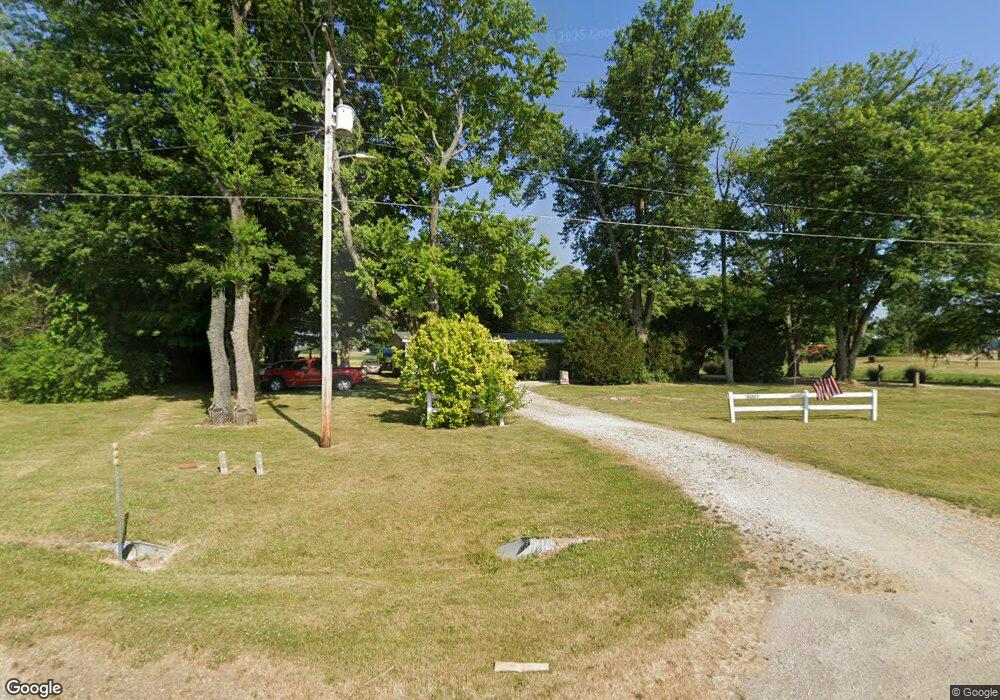
220 N State Highway 1 West Union, IL 62477
Estimated Value: $53,704 - $120,000
--
Bed
--
Bath
1,344
Sq Ft
$61/Sq Ft
Est. Value
About This Home
This home is located at 220 N State Highway 1, West Union, IL 62477 and is currently estimated at $81,926, approximately $60 per square foot. 220 N State Highway 1 is a home located in Clark County with nearby schools including Hutsonville Elementary/Junior High School and Hutsonville High School.
Ownership History
Date
Name
Owned For
Owner Type
Purchase Details
Closed on
Aug 25, 2010
Sold by
Isbell Debra
Bought by
Reynolds Ross E and Reynolds Brenda K
Current Estimated Value
Home Financials for this Owner
Home Financials are based on the most recent Mortgage that was taken out on this home.
Original Mortgage
$28,000
Interest Rate
4.36%
Mortgage Type
New Conventional
Create a Home Valuation Report for This Property
The Home Valuation Report is an in-depth analysis detailing your home's value as well as a comparison with similar homes in the area
Home Values in the Area
Average Home Value in this Area
Purchase History
| Date | Buyer | Sale Price | Title Company |
|---|---|---|---|
| Reynolds Ross E | -- | None Available |
Source: Public Records
Mortgage History
| Date | Status | Borrower | Loan Amount |
|---|---|---|---|
| Previous Owner | Reynolds Ross E | $28,000 |
Source: Public Records
Tax History Compared to Growth
Tax History
| Year | Tax Paid | Tax Assessment Tax Assessment Total Assessment is a certain percentage of the fair market value that is determined by local assessors to be the total taxable value of land and additions on the property. | Land | Improvement |
|---|---|---|---|---|
| 2024 | $314 | $9,988 | $2,136 | $7,852 |
| 2023 | $292 | $9,988 | $2,136 | $7,852 |
| 2022 | $234 | $8,918 | $1,907 | $7,011 |
| 2021 | $29 | $10,826 | $3,815 | $7,011 |
| 2020 | $966 | $17,730 | $2,070 | $15,660 |
| 2019 | $966 | $17,730 | $2,070 | $15,660 |
| 2018 | $589 | $17,730 | $2,070 | $15,660 |
| 2017 | $597 | $18,132 | $2,117 | $16,015 |
| 2016 | $638 | $17,730 | $2,070 | $15,660 |
| 2015 | $589 | $17,600 | $2,055 | $15,545 |
| 2014 | $668 | $17,130 | $2,000 | $15,130 |
| 2013 | $668 | $17,130 | $2,000 | $15,130 |
Source: Public Records
Map
Nearby Homes
- E 450th Rd Lot Unit WP001
- E 2025th Ave
- 20392 N Lake Walton Rd
- 20301 County Road 920 N
- 0 N River Rd
- 407 N Main St
- 100 N 2nd St
- 301 S Pleasant St
- 600 S Pleasant St
- 208 Wood Ln
- 6823 W Gobin Dr
- 14752 S Battlerow Place
- 14709 S Battlerow Place
- 7157 E 2000th Ave
- 6198 W French Dr
- 2001-2615 N 900th St
- 104 Thomas Dr
- 0 County Road 300 N
- 14298 N 1650th St
- 0 N 925th St
- 3975 Illinois 1
- 3975 Illinois 1
- 111 N Walnut St
- 104 N Walnut St
- 114 N Walnut St
- 125 Po Box
- 108 N Walnut St
- 210 W Union St
- 313 W Union St
- 304 W Union St
- 113 E Union St
- 105 S State Highway 1
- 106 E Union St
- 110 E Union St
- 109 S Walnut St
- 103 Harrison St
- 205 E Union St
- 115 S State Highway 1
- 209 E Union St
- 203 S State Highway 1
