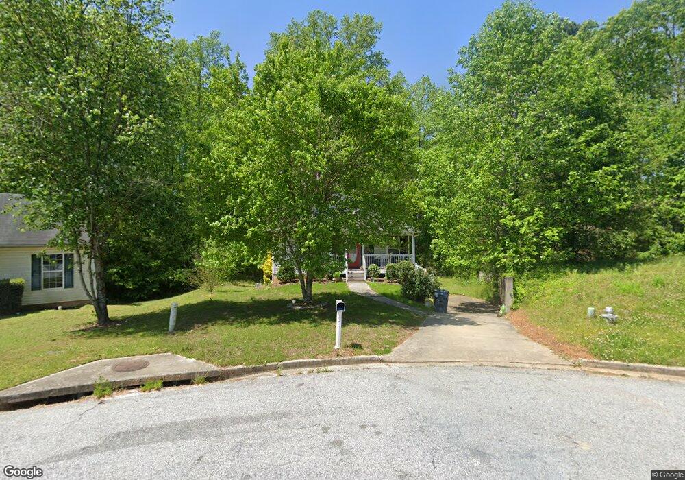
220 Railside Dr Covington, GA 30014
Estimated Value: $267,000 - $301,000
Studio
2
Baths
1,410
Sq Ft
$202/Sq Ft
Est. Value
About This Home
This home is located at 220 Railside Dr, Covington, GA 30014 and is currently estimated at $285,171, approximately $202 per square foot. 220 Railside Dr is a home located in Newton County with nearby schools including Heard-Mixon Elementary School, Cousins Middle School, and Eastside High School.
Ownership History
Date
Name
Owned For
Owner Type
Purchase Details
Closed on
Jan 31, 2007
Sold by
R & B Const Inc
Bought by
Walcott Marvin E
Current Estimated Value
Home Financials for this Owner
Home Financials are based on the most recent Mortgage that was taken out on this home.
Original Mortgage
$127,499
Outstanding Balance
$75,119
Interest Rate
6.14%
Mortgage Type
New Conventional
Estimated Equity
$210,052
Create a Home Valuation Report for This Property
The Home Valuation Report is an in-depth analysis detailing your home's value as well as a comparison with similar homes in the area
Home Values in the Area
Average Home Value in this Area
Purchase History
| Date | Buyer | Sale Price | Title Company |
|---|---|---|---|
| Walcott Marvin E | $150,000 | -- |
Source: Public Records
Mortgage History
| Date | Status | Borrower | Loan Amount |
|---|---|---|---|
| Open | Walcott Marvin E | $127,499 |
Source: Public Records
Tax History
| Year | Tax Paid | Tax Assessment Tax Assessment Total Assessment is a certain percentage of the fair market value that is determined by local assessors to be the total taxable value of land and additions on the property. | Land | Improvement |
|---|---|---|---|---|
| 2025 | $3,442 | $135,400 | $15,200 | $120,200 |
| 2024 | $3,279 | $126,600 | $15,200 | $111,400 |
| 2023 | $3,292 | $118,680 | $6,400 | $112,280 |
| 2022 | $2,472 | $88,440 | $6,400 | $82,040 |
| 2021 | $2,384 | $76,240 | $6,400 | $69,840 |
| 2020 | $2,172 | $62,560 | $6,400 | $56,160 |
| 2019 | $1,875 | $52,920 | $6,400 | $46,520 |
| 2018 | $1,467 | $40,680 | $5,000 | $35,680 |
| 2017 | $1,405 | $38,880 | $3,800 | $35,080 |
| 2016 | $1,431 | $39,640 | $3,800 | $35,840 |
| 2015 | $1,400 | $38,760 | $3,200 | $35,560 |
| 2014 | $1,395 | $38,760 | $0 | $0 |
Source: Public Records
Map
Nearby Homes
- 25 Scarlett Ct
- 10717 Highway 36
- 324 Piper Rd
- 13268 Tolstoy Ln
- 0 Piper Rd Unit 7693971
- 0 Piper Rd Unit 10659921
- 20 Kestrel Cir
- 370 Granary Walk
- 18 River Walk Farm Pkwy
- 85 Bellerive Ln SE
- 10184 Malcolm Dr
- 60 Laurie Ln
- 7713 Fawn Cir
- 7713 Fawn Cir Unit 51
- 7703 Fawn Cir
- 200 Hidden Pines Dr
- 10110 Malcolm Ct
- 25 Lena Ct
- 35 Crossbill Trail
- 170 Hidden Pines Dr
- 225 Railside Dr
- 210 Railside Dr
- 200 Railside Dr
- 215 Railside Dr
- 190 Railside Dr
- 35 Sunbelt Pkwy
- 45 Boxcar Ln
- 105 Cedar Creek Dr
- 110 Cedar Creek Dr
- 195 Railside Dr
- 180 Railside Dr
- 95 Cedar Creek Dr Unit 1
- 35 Boxcar Ln
- 30 Boxcar Ln
- 100 Cedar Creek Dr Unit 1
- 170 Railside Dr
- 25 Sunbelt Pkwy Unit 25B, C; 35 B
- 25 Sunbelt Pkwy
- 175 Railside Dr
- 85 Cedar Creek Dr Unit 1
Your Personal Tour Guide
Ask me questions while you tour the home.